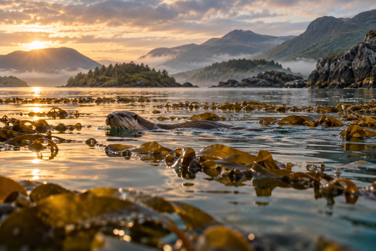
The Firth of Clyde is the reach of Atlantic water that folds itself into Scotland's industrial heartland: Glasgow's old shipbuilding river widening past Greenock and Helensburgh into a broad, island-dotted estuary, then opening toward Arran and the Kintyre peninsula. It is simultaneously one of Britain's most historically overworked seas and one of its most quietly hopeful. Kelp still wraps the firth's rocky margins — tangle and oarweed on the outer headlands, sugar kelp and furbelows in the lochs — and the country's first community-led no-take zone, at Lamlash Bay on Arran, has become a national reference point for what protection actually does. This guide covers where the kelp grows, what happened to the Clyde, and how to see the coast at its best.
Where the kelp grows
The Clyde is not one habitat but a staircase of them. The outer firth — the open water between Ailsa Craig, Arran's exposed west side and the Kintyre shore — is Atlantic in character: clear, well-mixed, wave-washed. The inner firth, north of the narrows at Cloch Point, is an estuarine basin with deep holes, softer seabed and heavier freshwater influence. And branching north out of it run the sea lochs — Loch Fyne, Loch Long, Loch Goil, Gare Loch, Holy Loch — glacier-cut arms where salinity, shelter and depth change the whole algal community.
The outer firth: tangle country
On the exposed western shores and around Ailsa Craig's famous granite dome, the dominant kelp is tangle, or cuvie — Laminaria hyperborea, the stiff, rough-stiped forest-former of Europe's wave-beaten reefs. It stands in waist-deep to twenty-metre water, its epiphyte-furred stipes holding miniature forests of their own. Alongside it on the more moderate shores grows oarweed, Laminaria digitata, the hand-shaped kelp of the low intertidal and shallow subtidal. Where the wave energy falls away, especially on Arran's east coast and the Cumbraes, the classic Clyde mix appears: sugar kelp (Saccharina latissima) on the shallow sublittoral, dabberlocks (Alaria esculenta) on exposed ledges, and the fast-growing annual furbelows (Saccorhiza polyschides) filling gaps through summer.
Ailsa Craig deserves its own sentence. The island's volcanic-plug cliffs, ringed by kelp and topped by one of the great gannet colonies of Europe, sit at the geographic hinge of the firth — the point where the Clyde stops behaving like an estuary and starts behaving like the Irish Sea.
The sea lochs: drowned valleys, layered water
Loch Fyne — famous for herring long before it was famous for oysters — holds some of the firth's most intact kelp habitat, partly because its steep rock shores offered little for mobile fishing gear to work. In the lochs, kelp zonation is tightened by a fresh, brackish surface layer that sits over saltier deep water; intertidal seaweeds thin out toward the loch heads, and the subtidal kelp line deepens. The sheltered basins also hold maerl beds and seagrass — species-poor neighbours of the kelp that matter just as much for juvenile fish. For a renowned example of this habitat mosaic elsewhere on the west coast, see the dive guide to Loch Carron, whose kelp-and-maerl maze was protected after flame shell beds made headlines.
A century of pressure
To understand the Clyde's kelp, you have to understand what was taken out from around it. In the 19th century the firth was ringed by trawling bans — Parliament closed the whole loch system and much of the Clyde to trawls in 1889, treating the inshore grounds as a nursery worth defending. For most of a century, the inshore Clyde was a net-and-line sea: herring drifters out of Loch Fyne, small line boats, the famous Fyne kippers.
In 1984 the inshore trawl ban was repealed, and mobile gear — trawls and later scallop dredges — was readmitted to grounds it had not worked for generations. The outcomes are debated in detail, but the broad pattern is not in serious dispute: finfish landings from the Clyde collapsed through the 1990s and 2000s, the herring never returned to their old abundance, and the fishery narrowed to prawns and scallops. Repeated dredging of inshore grounds flattens three-dimensional habitat — the hydroid turf, sponges, maerl and kelp edges that give young fish somewhere to be — and a simpler seabed supports a simpler sea.
Kelp on rock survived better than the soft-bottom habitats did, because dredges cannot work hard reef. But the forest lost the neighbourhood around it. What swam among the stipes — the cod and whiting, the herring shoals that once darkened the lochs, the huge common skates old anglers remember — largely went elsewhere or nowhere.
Signs of recovery
The Clyde is now one of the UK's most interesting recovery experiments, for two reasons standing barely an hour's sail apart.
The first is Lamlash Bay. In 2008, after a decade of campaigning by the Community of Arran Seabed Trust, Scotland designated a small no-take zone in the bay — the country's first community-driven marine reserve of its kind. Surveys inside the zone have since reported scallops growing older, bigger and more numerous, and lobster densities improving: the kind of straightforward, see-it-yourself evidence that protection of even a few square kilometres allows life-history stages that fishing removes to accumulate again. Lamlash is not a kelp story alone — much of the bay is maerl and soft sediment — but its rocky margins carry healthy kelp, and the principle it proved travels: recover the grazers' predators and the structure-builders, and the reef reorganises.
The second is the wider shift in policy. A fisheries management pilot in the Clyde has trialled seasonal closures of spawning grounds, and Scotland's broader marine protected area network now wraps several Clyde features. For how protection is designed and what it can and cannot deliver, see our explainer on marine protected areas.
Two cautions belong in any honest account. The Clyde's waters are warming with the rest of the northeast Atlantic, and marine heat waves now reach into Scottish seas — our marine heatwaves primer explains what that does to kelp physiology. And recovery of a system simplified over a century is slow and non-linear. Nobody who knows the Clyde promises the herring year of 1913 will come again. What is being rebuilt is something newer: a resilient, well-watched inshore sea.
Seeing the Clyde's kelp yourself
The firth is one of the most accessible kelp coasts in this atlas — ninety minutes from Glasgow puts you in cold, clear water over a kelp bed.
Shore snorkelling and diving. Arran's east-coast bays, the Cumbraes' rocky shores outside Millport, and the outer Loch Fyne shore offer shallow kelp in reasonable shelter. Water temperature runs from about 7°C in late winter to 14°C or so in a warm August — a drysuit or thick wetsuit water, with a hood for comfort. Visibility is best with settled high pressure and offshore winds; after heavy rain, loch water can go milky-brown within a day.
From the surface. The Waverley — the world's last sea-going paddle steamer — still sails the firth in summer, and the regular CalMac ferries to Arran, Bute and the Cowal peninsula double as wildlife platforms: porpoises and seals are routine, and basking sharks turn up in the outer firth in warm summers, feeding along plankton fronts over the kelp-line reefs. Otters work the kelp along quieter shores at first and last light.
Kayaking the Loch Fyne shore or around the Kyles of Bute gives the best low-altitude view of the kelp zonation — the oarweed fringe, the sugar-kelp band below it, the dark band of tangle beyond — all readable from a cockpit seat in calm weather. If Scotland's west coast kelp forests are on your list, the Clyde is the natural southern starting point.
Key takeaways
- The Firth of Clyde is a staircase of habitats — exposed Atlantic outer firth, estuarine inner basin, and glacial sea lochs — each with its own kelp community.
- Tangle (Laminaria hyperborea) and oarweed dominate the wave-exposed reefs; sugar kelp, dabberlocks and summer furbelows fill the sheltered ground.
- A century of protection for inshore grounds was reversed in 1984; the Clyde's finfish fisheries never recovered their former shape, and kelp reefs lost much of the life around them.
- Lamlash Bay's community-led no-take zone — Scotland's first — has shown measurable recovery of scallops and lobsters, and remains the national proof-of-concept for small-scale protection.
- The coast is unusually accessible: shore dives, ferries, a paddle steamer and kayak-friendly lochs all put the kelp forest within a day trip of Glasgow.
FAQ
Does kelp still grow in the Firth of Clyde?
Yes — and in places, well. Kelp needs hard substrate and light, so it survived on the firth's rocky reefs even where the soft seabed was heavily worked. Tangle, oarweed and sugar kelp beds persist along Arran, the Cumbraes, Kintyre and the Loch Fyne shore, and kelp in the deeper lochs has had centuries of shelter from mobile gear.
What is the Lamlash Bay no-take zone?
A small marine reserve off Arran's east coast, designated in 2008 after a long community campaign. No fishing of any kind is allowed inside it. Follow-up surveys have found larger, older and more abundant scallops and improved lobster populations — evidence that even compact protected areas let heavily fished species rebuild their size and age structure.
Why did the Clyde's fisheries decline?
Several pressures ran together, but the pivotal change was the 1984 repeal of the inshore trawl ban, which let mobile gear back onto grounds fished only by nets and lines for most of a century. Repeated dredging and trawling simplified the seabed habitats young fish depend on, and landings of cod, haddock, whiting and herring fell steeply through the 1990s and 2000s.
Can you snorkel with kelp in the Clyde without a boat?
Yes. The rocky shores of Arran's east coast, Great Cumbrae outside Millport, and parts of the outer Loch Fyne shore all have shallow kelp reachable from the beach. Choose settled weather, expect 7–14°C water depending on season, and bring a wetsuit or drysuit with appropriate exposure protection.
What larger wildlife might I see?
Otters patrol many quiet shores; harbour and grey seals are common; harbour porpoises are a near-daily sighting from ferries in settled weather. In warm summers, basking sharks feed in the outer firth, and minke whales pass through regularly enough that ferry crews keep an eye out for them.