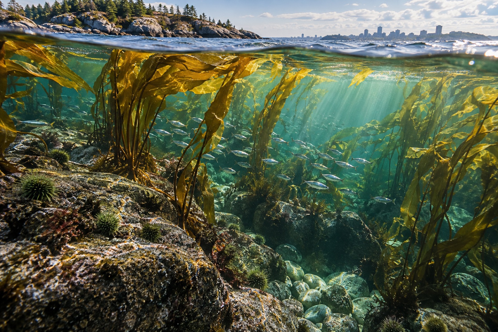
Half an hour by ferry from downtown Boston, you can stand on a granite headland and look down into green water where a forest of kelp sways over cobbled ledges — with the skyline of a major American city shimmering on the horizon behind you. That this sentence is true at all is one of the great environmental plot twists of the last half-century. Boston Harbor was once famously, comically dirty. Today the Boston Harbor Islands National and State Park protects more than thirty islands and peninsulas surrounded by some of the cleanest urban water on the Atlantic seaboard, and the kelp beds that ring their rocky shores are a quiet measure of how far the cleanup has come.
Where Is This Place?
The Boston Harbor Islands scatter across roughly 50 square miles of the southern Gulf of Maine, between the granite of Hull to the south and Deer Island — now connected to the mainland by a causeway and crowned by the egg-shaped digesters of the wastewater treatment plant that saved the harbor's reputation. Georges Island and its Civil War-era Fort Warren anchor the outer group; Spectacle, Long, Peddocks and Thompson islands fill the inner harbor; tiny Rainsford and the Brewster islands — Great, Middle, Outer and Little — hold the seaward edge where the swells come in off Massachusetts Bay.
This is classic glaciated New England coast. The islands are drumlins — streamlined hills bulldozed out of glacial till by the ice sheet that covered the region, their seaward flanks eroded into cliffs, boulder fields and gravel beaches. Because the Atlantic reworked the till as sea level rose, the underwater landscape is wonderfully varied: smooth cobble pavements, jumbled granite ribs, and kelp-friendly ledges running from the low-tide line down past ten metres.
Water here runs cold by most of the world's standards and very cold by Iberian or Mediterranean standards: roughly 1–4°C in late winter, 15–19°C in the warmest weeks of August and September. That seasonality is the engine of the local kelp story.
The Kelp Forest: What Grows Here
Boston's underwater forests are made of boreal North Atlantic species — the same kelp clan that stretches from Cape Cod north through the Gulf of Maine, Nova Scotia, and across the ocean to Iceland and Norway.
Sugar kelp and its companions
The star of the shallow subtidal is sugar kelp (Saccharina latissima), whose crinkled, strap-like blades can reach two to three metres by late summer. On more exposed outer ledges, oarweed (Laminaria digitata) grips the rock with its characteristic flexing holdfast, while shotgun kelp (Agarum clathratum) — the sieve kelp with its riddled blades — occupies deeper, dimmer water. Along the low intertidal you'll find sea cabbage, bladderwrack and knotted wrack, with Irish moss forming a red understory in the shallows.
Sugar kelp here is an opportunist of the growing season: it puts on most of its length through the long spring days when nutrients are plentiful and warming water has not yet stressed it. Come the heat of late summer, blades erode from the tips, and winter storms strip the fronds down — an annual rhythm familiar to anyone who reads the phenology of northern kelp.
The grazer in the room
No account of Gulf of Maine kelp is complete without the green sea urchin (Strongylocentrotus droebachiensis). Urchin fronts can mow shallow kelp down to the coralline pavement, and for much of the twentieth century barrens were common around New England. The harbor isles today carry a patchwork: healthy kelp on exposed, current-flushed ledges, and grazed areas in calmer shallows where urchins concentrate. Lobsters, crabs and a recovering cod population are the region's urchin predators of note, and their abundance is one of the levers on how much forest Boston's islands carry in any given year.
From "Harbor of Shame" to Recovery Story
The arc of Boston Harbor's water quality deserves to be famous. For most of the twentieth century, sewage flowed into the harbor barely treated, and nutrients, pathogens and organic matter fouled the water, stripped the light and smothered benthic life. Eutrophication is poison to kelp in non-obvious ways: not by the nutrients themselves, which kelp loves, but by fogging the water with phytoplankton and coating rock with turf algae that outcompete young kelp.
The turnaround came through the Boston Harbor Project — court-ordered, federally funded, and hardly glamorous: primary and secondary treatment consolidated at Deer Island, and in 2000 an effluent outfall extended 15 kilometres offshore into the deeper, better-flushed waters of Massachusetts Bay. Fecal bacteria counts crashed. Dissolved oxygen climbed. Water clarity improved enough that eelgrass crept back into coves where it had vanished, and within years monitor surveys showed luxuriant kelp on ledges that old-timers remembered as slime.
A few lessons the harbor offers any coastal city:
- Light is currency. Kelp doesn't need pristine romance, it needs photons and clean rock. Remove the nutrient fog and engineering does the rest.
- Recovery is fast. Kelp is a weedy genius; give it clear water and within two or three growing seasons a bare ledge can be a forest, thanks to the spore lottery that lets kelp recolonise quickly.
- Cleanup is the foundation, not the finish. Restoration work by groups like the state's eelgrass and shellfish programs succeeded because the water-quality groundwork was already done.
The Warming Test
The Gulf of Maine has warmed faster than most of the world's oceans over recent decades — a headline any reader of our Gulf of Maine atlas will have seen — and Boston's kelp lives near the warm edge of the sugar kelp range. That doesn't make the comeback fragile, exactly; it makes it watched. Marine heatwaves now visit New England summers regularly, and a hot, still August can tip shallow beds into partial die-back. Deep-water kelp below the thermocline, and kelp on the cooler outer islands, appear to be natural refuges — the sort of thermal refugia scientists are mapping coast-wide. Boston Harbor is effectively a field laboratory for how an urban kelp system handles a fever-wracked future: heavily instrumented, heavily visited, and full of citizens who kayak, swim and dive in what their grandparents were warned never to touch.
Visiting: What You Can Actually Do
- Ferries run seasonally from Long Wharf to Georges and Spectacle islands, with connections onward. Inter-island ferries and smaller services reach Peddocks, Bumpkin, Grape and Lovells.
- Snorkeling is best July through September at slack high tide on the calmer island lees (a wetsuit isn't optional — 5 mm minimum, plus hood). Lovells and Rainsford have sheltered, clear gravel-and-rock shallows.
- Diving by charter goes to the Brewsters and Graves edges, where kelp grows denser, lobsters and cunner prowl the boulders, and wrecks mix with reef. Visibility runs 3–8 metres on a good day; outgoing tide carries cleaner offshore water into the island group.
- Kelp watching from shore is genuinely good: at low tide, headland lookouts show dark kelp lanes against pale sand, and wrack lines after storms are full of Atlantic seaweeds waiting to be identified.
For a deeper, quieter version of this coast, drive an hour north to the granite ledges of Cape Ann, where the same species grow over older, wilder rock.
Key Takeaways
- The Boston Harbor Islands sit on the doorstep of a major city yet support genuine boreal kelp forests — sugar kelp first, with oarweed and sieve kelp behind.
- The harbor's transformation from sewage-tainted to swimmable is one of the world's leading urban coastal recoveries, and kelp is its most visible beneficiary.
- Green sea urchins, lobsters and kelp remain locked in a shifting balance on the islands' ledges.
- The Gulf of Maine's rapid warming makes Boston a closely watched test case for kelp at its southern range edge.
- Ferries make much of the island group easy to visit; snorkeling and diving are real options July–September with proper thermal protection.
FAQ
Can you really swim and snorkel in Boston Harbor now?
Yes. Water quality around the islands is generally excellent, swimming beaches are patrolled at Spectacle Island, and snorkelers regularly freedive the kelp edges in summer. Cold water, not cleanliness, is your main constraint — bring a thick wetsuit.
What kelp species will I actually see?
Mostly sugar kelp (Saccharina latissima) in the shallows, joined by oarweed on exposed ledges and sieve kelp in deeper water. Intertidally, expect the classic New England wracks and Irish moss.
When is the best season to see the kelp forest?
July through early September, when blades are longest and water is warmest. Spring offers greener, clearer water but briefer, colder sessions; winter storms reduce the annual kelp beds considerably.
Is the recovery permanent?
The treatment infrastructure is designed to last, but warming is a moving threat. Hot summers can thin shallow kelp locally; deeper and outer-island beds appear more resilient. Scientists monitor continuously, and the bed-by-bed picture shifts every few years.
How does Boston compare to other urban kelp coasts?
It's among the world's best proof-of-concept stories — Sydney's crayweed comebacks and Monterey's recovery after wastewater upgrades are the other canonical urban examples, cities that stopped denying what flowed offshore and rebuilt trust with their own seas.
At Tidewright, urban coastlines like Boston remind us why restoration at scale is worth building: when the groundwork of clean water is laid, the forest is ready to come home. See how we measure canopy recovery on our Impact dashboard.