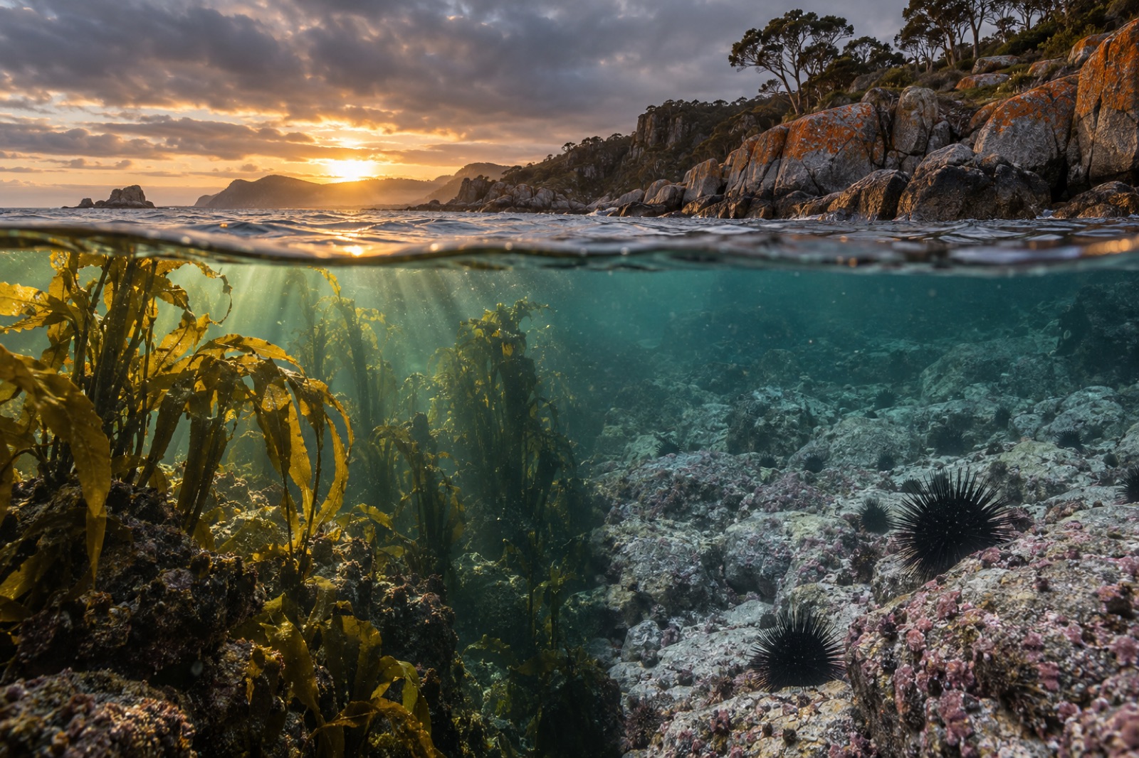
Jervis Bay is where Australians go to be reminded what protected water looks like. Three hours south of Sydney, the bay bends a deep, almost perfectly sheltered arc behind two sandstone headlands — and inside that arc sit reefs of golden kelp, meadows of seagrass, turquoise shallows over sand so white it squeaks, and a resident pod of dolphins. Much of it has been a marine park since the 1990s, and it shows. Whether you dive, snorkel, swim or walk, Jervis Bay is the most rewarding temperate bay on the New South Wales coast.
Getting your bearings
The bay sits where two jurisdictions meet in an unusual way. The northern shore around Hyams Beach and Huskisson is New South Wales; Booderee National Park on the southern shore is Commonwealth land, co-managed with the Wreck Bay Aboriginal Community, whose Country this has been for thousands of years. The village names tell the story: Booderee means "bay of plenty" in the local Dhurga language. A small naval enclave, HMAS Creswell, occupies the Jervis Bay Territory on the northern headland.
Beneath it all, the Jervis Bay Marine Park — declared in 1998, covering roughly 215 square kilometres — zones the bay for protection. No-take sanctuary zones hold some of the best reef in the region, and the results are visible on any clear-water day.
What's under the water
Jervis Bay is an estuary-bay hybrid: a drowned river valley with oceanic exchange strong enough to keep the water clear and temperate. That mix supports an unusual richness.
Common kelp and the rocky reefs
The bay's shallow rocky reefs carry forests of common kelp (Ecklonia radiata) — the workhorse forest-builder of the Great Southern Reef. In 4–12 metres of water the fronds form a swaying canopy over boulder fields packed with abalone, lobster, wrasse and jewfish. At the deeper outer reefs and headlands, kelp gives way to sponge gardens in shades of purple and gold.
Seagrass meadows
In the sheltered arms of the bay and the Currambene Creek estuary, meadows of strapweed and eelgrass do quiet, vital work: nursery habitat for juvenile fish, sediment stabilisation, and serious carbon storage. Seagrass is among the most carbon-dense habitat on Earth per hectare — a reminder that blue carbon isn't only a kelp story, and that mapping it is exactly what platforms like Canopy Ledger are built to do.
The residents
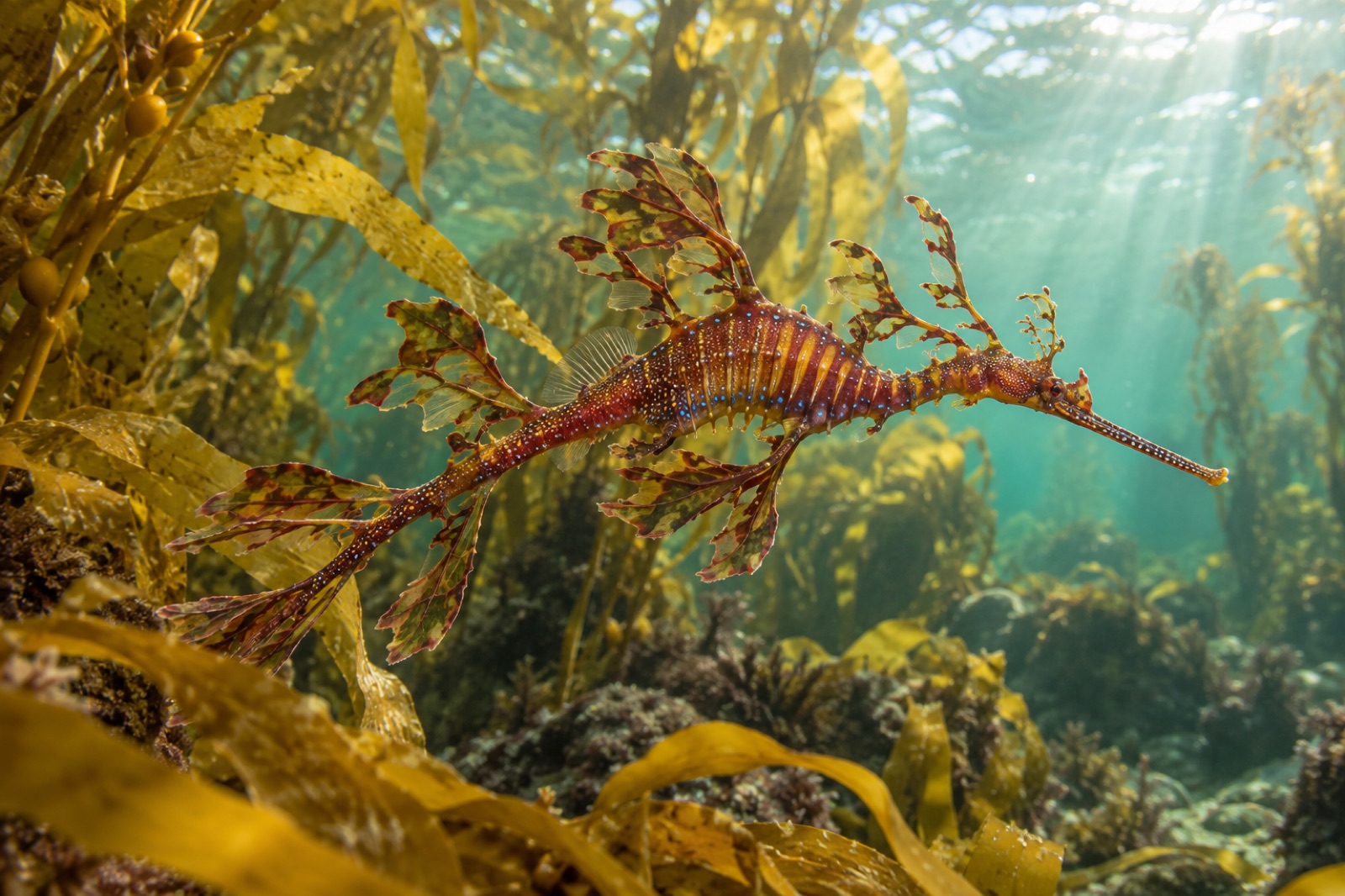
Bottlenose dolphins commute through the bay daily. Humpbacks and occasional southern right whales cruise the entrance during the May-to-November migration. Wobbegongs carpet the ledges, giant cuttlefish appear in winter, and at famous shore-dive sites like The Docks on the northern shore, weedy seadragons hover over the kelp edge — one of the most reliable seadragon sites anywhere.
The best of the bay: dive and snorkel sites
- The Docks (northern headland): giant stride entry off a rock platform, kelp forest to 12 m, seadragons, wobbegongs and blue gropers. The benchmark Jervis Bay dive.
- Murrays Beach (Booderee): the gentlest ocean snorkel in the park — a forested walk to a white-sand cove with reef edges, stingrays and baitfish schools. Go midweek outside holidays.
- Green Patch (Booderee): family-perfect — white sand, picnic facilities, calm shallows, and resident eastern water dragons sunning on the lawn.
- The outer reefs (boat): drama for certified divers — sponge gardens, grey nurse sharks seasonally at deeper bommies, and big-school fish life.
- Huskisson wreck and bay dives: shallow SCUBA for new divers, with resident rays and octopus.
Water temperature runs roughly 15–22 °C across the year; visibility peaks in winter and early spring after southerly clear-outs.
Above the water: beach etiquette and bush
The beaches need little selling — Hyams, Chinamans, Murrays — but live by three rules: arrive early (car parks fill by 9 am in summer), walk on marked tracks (the dune vegetation holds that famous sand in place), and leave the wildlife alone. Booderee's walking trails, like the circuit to Cape St George Lighthouse, deliver cliff-top views over the bay mouth and, in season, whales passing close enough to hear breathe.
Jervis Bay in the bigger picture
Jervis Bay is proof of concept. Zone the water, leave fish and abalone unfished in sanctuary pockets, manage the boat traffic — and within years the reef stands taller, the fish get bolder, and the whole system gets more resilient to shocks like marine heatwaves. It's a model Tidewright borrows from constantly: protect first, restore second, measure always. For temperate diving beyond Jervis, our Dive & Explore hub and the rest of the Coastal Atlas trace the kelp coast from here to Tasmania and beyond.
Key takeaways
- Jervis Bay combines NSW coastline, the Commonwealth's Booderee National Park (co-managed with the Wreck Bay Aboriginal Community) and a ~215 km² marine park.
- Common kelp forests and sponge gardens fringe the rocky reefs; seagrass meadows anchor the sheltered bays and store serious carbon.
- The Docks is one of Australia's premier shore dives — kelp forest, wobbegongs and weedy seadragons in 12 m.
- Murrays Beach and Green Patch are the mainland-standard family snorkels: white sand, calm water, easy reef.
- Summer crowds are intense; winter brings the clearest water, migrating whales and empty trails.
FAQ
Is Jervis Bay in NSW or the ACT?
Mostly New South Wales — but a small area on the northern headland is the Commonwealth's Jervis Bay Territory, set aside in 1915 to give the federal capital coastal access for its naval college. Visitors needn't worry about it; borders are invisible from the beach.
When is the best time to visit Jervis Bay?
For diving and snorkelling, winter to early spring offers the clearest water and whale migration. For beach-going, late spring through autumn has the warmest water. Avoid summer weekends unless you arrive before 9 am.
Do I need a national park pass for Booderee?
Yes — Booderee charges a vehicle entry fee, which directly supports the park and its co-management with the Wreck Bay Aboriginal Community. Buy passes online in advance during peak season.
Is the famous Jervis Bay sand really the whitest in the world?
Hyams Beach was long promoted as holding that record title. Whether or not the superlative survives scrutiny, the sand is extraordinary — near-pure quartz rounded into powder — and the contrast with the turquoise water is why the photos look unreal.
Can beginners dive at Jervis Bay?
Yes — the bay is a training ground for Sydney dive schools precisely because conditions are forgiving inside the heads. The Docks suits divers with shore-entry confidence; guided boat dives in the bay are the easiest start.