Atlas6 min read
Maria Island: Tasmania's Island Kelp Sanctuary
Maria Island pairs a World Heritage convict site with one of Tasmania's pioneering marine reserves. A diver and walker's guide to its reefs, wildlife and kelp.
Tom Okafor ·
Tasmania's east coast has lost the vast majority of its giant kelp forests to warming seas and urchins. Explore what happened here, and what's coming back.
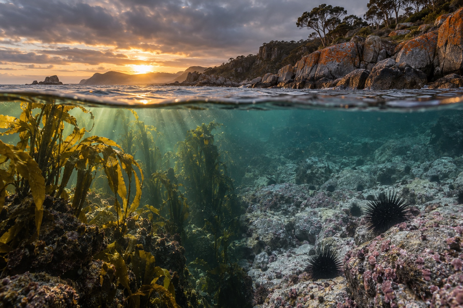
Tasmania's east coast is one of the most instructive stretches of coastline on Earth. Between the granite headlands of Freycinet and the kelp-dark reefs off St Helens, the island's giant kelp forests collapsed over a few decades — among the fastest and most complete losses of a marine ecosystem ever documented. The same coast is now a proving ground for how kelp comes back. If you want to understand the global kelp crisis in one place, start here.
Tasmania sits at the edge of the Great Southern Reef, the 8,000-kilometre ribbon of temperate kelp habitat that arcs across the bottom third of Australia. Its east coast runs some 300 kilometres from the Furneaux Group past St Helens and Binalong Bay, the orange-lichen boulders of the Bay of Fires, the pink-granite ranges of Freycinet Peninsula and the sea cliffs of the Tasman Peninsula. Offshore lies Maria Island, a marine-reserve refuge we cover in its own guide.
The water here is part of the Tasman Sea's western boundary current system — and that framing matters, because it is the oceanography that changed first, and the kelp that followed.
Fifty years ago, giant kelp (Macrocystis pyrifera) grew in dense, surface-canopied forests along eastern Tasmania — the southern hemisphere mirror of California's famous beds. Beginning in the late twentieth century, those forests thinned, patch by patch. Surveys comparing historical records with modern reef condition have estimated that Tasmania has lost on the order of 95 percent of its giant kelp cover, concentrated along the east coast. It remains one of the starkest regional collapses of a habitat-forming species documented anywhere.
The collapse was not caused by a single insult. It was a cascade, and understanding the cascade is the key to understanding kelp loss everywhere.
The East Australian Current (EAC) is a fast, warm western boundary current that sweeps tropical water down Australia's east coast. Over the past half-century its southward extension has strengthened, pushing ever-warmer water into eastern Tasmanian seas. Waters off the east coast have been warming at several times the global ocean average — making this region one of the most rapidly warming temperate marine regions on the planet.
Giant kelp degrades above roughly 20 °C, and warm EAC water arrives nutrient-poor: buoyant, stratified and starved of the nitrate kelp needs. Marine heatwaves, increasingly frequent in the Tasman Sea, deliver the acute blows; the background warming means forests never fully recover between them.
Warm water is a highway. The long-spined sea urchin (Centrostephanus rodgersii) — originally a mainland New South Wales species — rode the strengthening current south, established in Tasmanian waters, and multiplied. Tasmania's other signature urchin pressure mirrors what purple sea urchins have done in California: when kelp weakens and predators of urchins are scarce, grazing urchins shift from eating drift kelp to mowing down living forest, leaving behind "urchin barrens" — low, pink-encrusted reef where a forest stood.
The natural control on Centrostephanus is predation, above all by large southern rock lobster. Decades of heavy fishing left few lobsters big enough to crack an adult long-spined urchin, removing the brake precisely when the accelerator was pressed. Barrens now occupy a substantial share of the east coast's shallow rocky reef — surveys have documented barren formation spreading reef by reef.
A kelp forest lost to urchins doesn't regrow when a cool year returns. Lobster recovery is slow; warming continues; and microscopic kelp stages, while resilient, cannot outgrow an urchin army. This self-reinforcing "barren state" — ecologists call it a regime shift — is the central problem of modern kelp restoration.
The same coast that lost its forests first is now where return strategies are most advanced:
Even where the giant kelp thinned, this is a magnificent coastline, and the remaining temperate reefs — dominated by common kelp (Ecklonia radiata), crayweed and dense understorey algae — teem with life.
Water temperatures run roughly 12–18 °C across the year; a 7 mm wetsuit and good boots are the reliable kit. Autumn offers the calmest seas and longest visibility windows.
Eastern Tasmania is not an anomaly. It is an early chapter of a story now repeating in northern Japan, northern California, Norway and New Zealand — warming water, arriving urchins, missing predators, flipping reefs. What is learned here about barren reversal, predator recovery and heat-tolerant seeding becomes the operating manual for every temperate coast in the Atlas. That is why Tidewright treats Tasmania not as a wound to grieve but as a workshop: the place where restoring kelp forest at scale stops being a hope and becomes engineering.
Yes, but rarely on the east coast. Remaining giant kelp stands persist in cooler southern and western waters and around some offshore islands. East coast reefs are now dominated by common kelp and other temperate algae, with giant kelp restoration programs working to re-establish it.
A rocky reef stripped of kelp by sea urchin grazing, leaving low pink coralline algae and dense urchin populations but little three-dimensional habitat. Barrens are stable — the urchins keep their own food source from returning — which is why active intervention is usually required to reverse them.
No. It is native to mainland New South Wales and established in Tasmania as the East Australian Current carried its planktonic larvae south over recent decades — a classic case of climate-driven range extension.
Autumn (March to May) typically brings the calmest seas and best visibility, with water around 15–17 °C. Winter is colder but often glassy-clear; summer is warmest and most comfortable for long shore dives.
Tidewright is a fictional company, but its depicted program follows credible practice: partnering on urchin control, seeding cleared reef with heat-screened kelp lines from our Holdfast nurseries, and verifying regrowth with Canopy Ledger monitoring — all presented on this site as illustrative demonstration content.
Maria Island pairs a World Heritage convict site with one of Tasmania's pioneering marine reserves. A diver and walker's guide to its reefs, wildlife and kelp.
Tom Okafor ·
Marine heatwaves are weeks of anomalously hot ocean that can deforest entire coastlines. Here's the science behind them and what restoration can do.
Dr. Lena Fischer ·
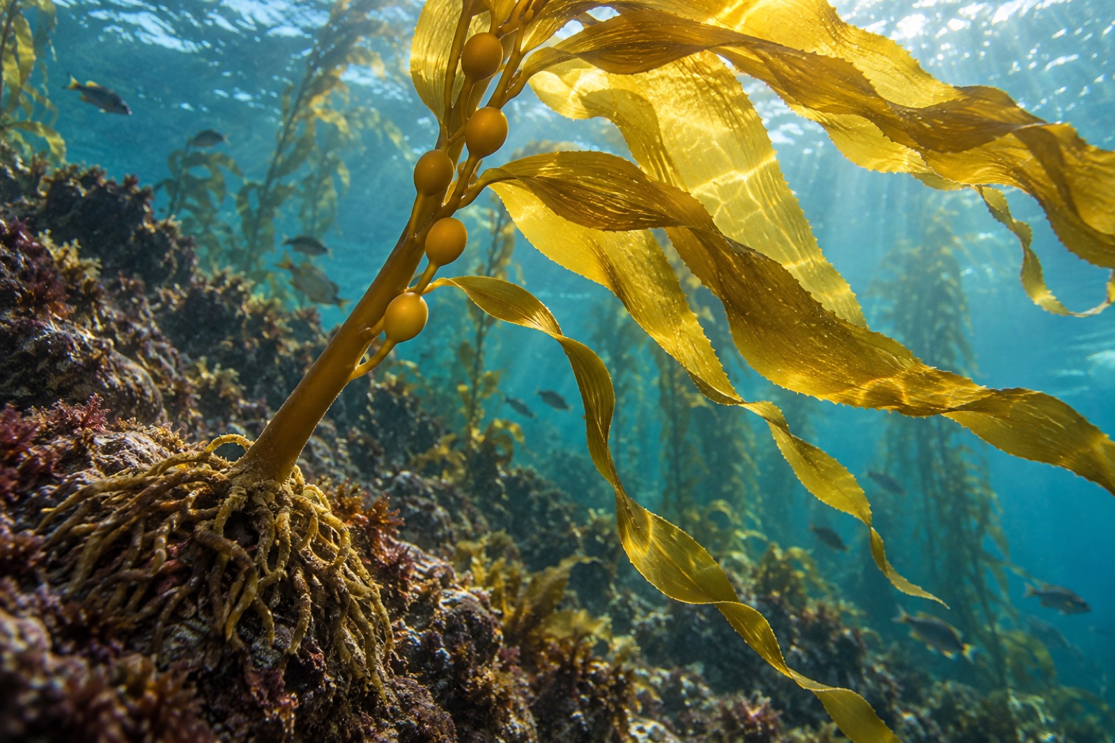
Giant kelp is the fastest-growing organism on Earth and the architect of undersea forests. Learn its biology, life cycle, range and why it matters.
Dr. Theo Nakamura ·