Atlas7 min read
Puget Sound: Bull Kelp in the Inland Sea
Washington's inland sea shelters floating bull kelp beds that shelter salmon in return. A Coastal Atlas guide to its patchwork beds and citizen science.
Tom Okafor ·
Between Vancouver Island and mainland Washington, the San Juans thread bull kelp beds through tidal rapids. A Coastal Atlas guide to the archipelago.
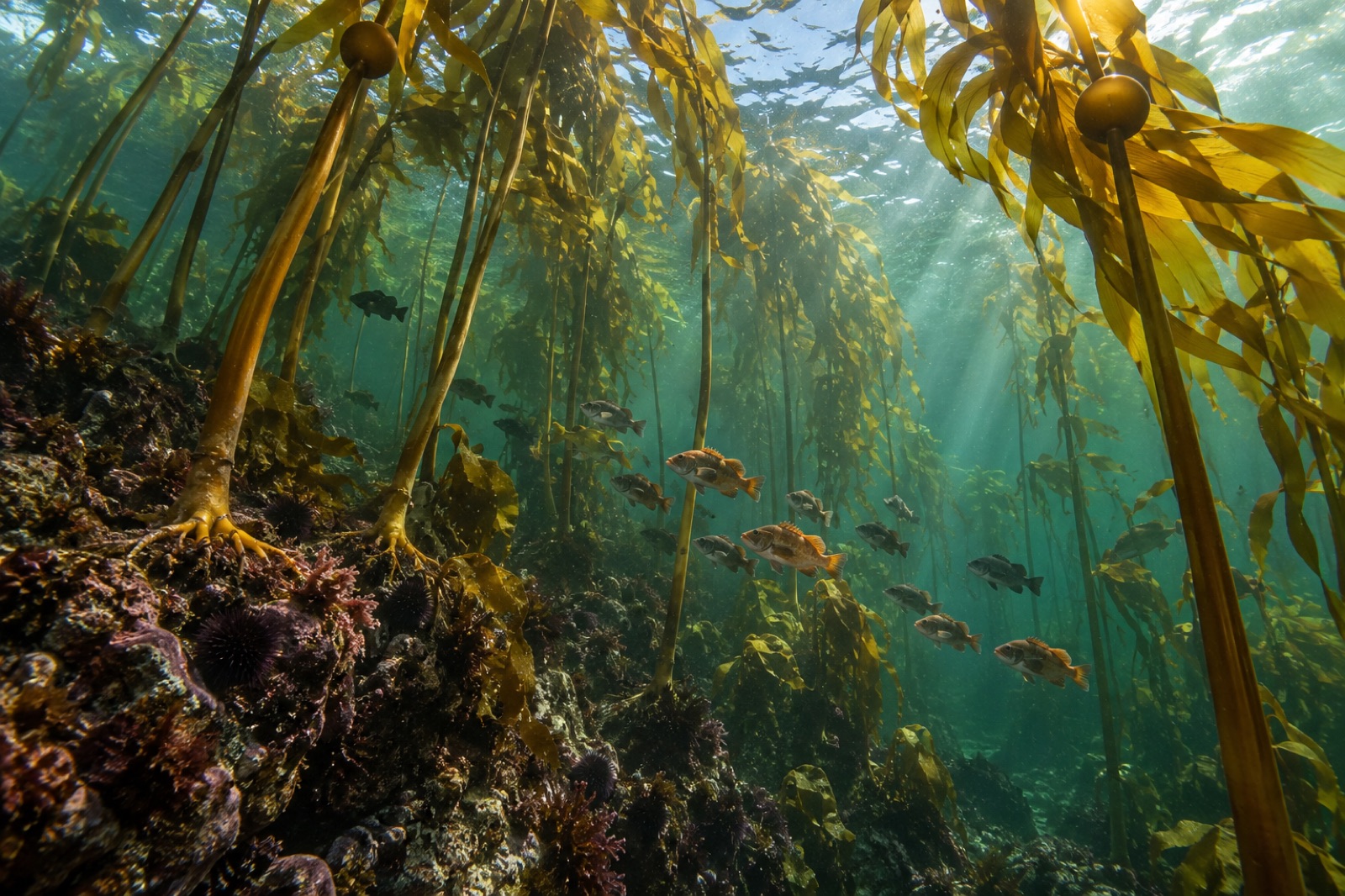
Stand on a headland anywhere in the San Juan Islands in late summer and look down. Below, where the clear green water accelerates along the rocky shore, are strung lines of golden-brown rafts — bull kelp, Nereocystis luetkeana, anchored to the subtidal reef and laying its blades out flat along the current like hair in wind. Between Vancouver Island and mainland Washington, this archipelago of roughly 450 islands and rocks at high tide holds some of the most vigorous kelp habitat in the Salish Sea — and some of the most carefully watched. This is the Coastal Atlas entry for the San Juans: the currents that make the kelp, and the county-scale community that keeps count of it.
The San Juan archipelago occupies the chokepoint of the inland sea. All the water that fills Puget Sound to the south and the Strait of Georgia to the north squeezes through these channels on every tide, past the south end of Vancouver Island and in from the Pacific through the Strait of Juan de Fuca. The result is a tide-swept maze: deep basins behind shallow sills, channels that boil at several knots at peak flow, and narrow passes like Cattle Pass where the surface of the ocean runs visibly downhill.
For a kelp, this could hardly be better. Constant flow brings cold, salty, nutrient-bearing Pacific water across every bed, shuffles the fronds so each blade gets its turn in the light, and does much of the mixing that a calmer basin has to achieve the hard way. Bull kelp in these channels grows to visible maturity fast enough to outrun the worst summer warming: a sprint before the storm, the classic annual survival strategy we cover in our bull kelp species profile.
San Juan kelp is arranged by geography. On the outer-rock shores of the west side — San Juan Island's Strait-facing fringe, and the wilder, wave-washed northern and western islands — beds form persistent ribbons of floating canopy a hundred metres or more along a shoreline. In the lee-end bays, beds shrink to patches. Local observers classify them lovingly: some beds have been there, persistent, for all living memory; others wax and wane with heat and urchin pressure.
What the surfers of the canopy ride above is the region's underwater suburbia. Juvenile rockfish shelter in the fronds. Herring spawn on the blades. Pigeon guillemots dive straight through them from the surface. And below the kelp, the shallow rocky bottom carries one of the region's rarer residents: the pinto abalone, the small, endangered snail whose recovery through hatchery rearing and diver outplanting proceeds slowly in these same islands — a reminder that what fringes are aerially pretty from a kayak can also be, at the scale of a crevice, a nursery of a recovering species.
One of the San Juans' quiet ecological facts is that there are barely any sea otters here. The furry keystone of the outer coast — which eats the kelp-grazing sea urchins and keeps them from forming barrens, as our trophic cascade explainer lays out — has not returned to the inland sea in meaningful numbers. Human effort fills that role instead: urchin removals and urchin-density monitoring around key beds, and the steady eye of community and governmental monitoring, stand in where the otters aren't.
This matters because it shapes what the kelp has to survive. With no otters to check urchin numbers, the balance between kelp bed and urchin barren is set by everything else: substrate type, current speed, juvenile kelp recruitment, water temperature, and the small armies of grazer-eating fish that patrol above. The San Juans are not kelp heaven. They are kelp managed — carefully, deliberately, and at arm's length from the ecosystems the outer coast takes for granted.
What distinguishes San Juan kelp work from anywhere else is how seriously it is local. An active county marine resources committee, and a network of volunteer and scientific monitoring, treat the beds as infrastructure: mapped annually, compared year to year, discussed at public meetings. Because the kelp is shallow, nearshore and surface-floating, the mapping is done from boats and kayaks — the same citizen-science practice that makes Puget Sound's kelp datasets so good, running here in its most thorough form.
That matters for restoration, and Tidewright's work on this coast is structured around the same logic: monitoring before intervention, community-held data as the steady baseline, and only then nursery or outplant steps where the numbers say they matter. The inland sea's volunteers have built the world's cheapest long-term kelp records; the San Juans are where that work is most sophisticated.
For divers, the San Juans are a study in strict schedule. Dives are planned around slack water — the window at the turn of the tide when the current eases — and the price of slack-water discipline is steep: visibilities in summer of five to fifteen metres, water hovers at 8–11 °C year-round, and the sites are entirely about the reef. There are no wrecks here; there are kelp fringes, walls, and the quiet of a channel that will restart whether you are back on shore or not.
For tides that run this hard, the system publishes itself: read a local tide table, arrive patient, and dive on it. For cold-water gear and technique, our explore section has the detail.
San Juan kelp stands at the front edge of the Salish Sea's warming. Summer sea-surface temperatures in the inland sea have pushed repeatedly past the thresholds bull kelp juveniles tolerate, and beds in the warmest, most sheltered reaches are visibly thinner than the historical record says they were. Shoreline arms — docks, bulkheads, breakwaters — bite into the narrow subtidal strip the kelp needs to grow. And the sea urchins, without otters to trim them, sit at densities close enough to flip a bed in a couple of bad years.
The trajectory is neither inevitable nor simple. These are beds in the front yards of people who watch them every summer, monitored as a matter of civic habit. That is the San Juans' most profitable export to the rest of kelp country: the model of what happens when a forest is counted, talked about and treated as community infrastructure. Our bull kelp species profile covers the organism itself; the archipelago supplies the way to keep faith with it.
Because all the water filling the inland basins each tide must pass through the same constricted channels around the islands. Tidal volumes are enormous, the channels are narrow, and the surface can run several knots during peak flow. That flow is why the kelp here is healthy — and why divers and kayakers must plan around slack water.
The picture is mixed. Thermal pressure from repeated warm summers has thinned or erased some beds, especially in more sheltered water, while cool, current-fed shorelines remain more stable. Local monitoring tracks each bed annually, so the answer depends on exactly which bed you mean.
Yes — in fact the annual kelp surveys are largely kayak-based. Stay to the fringes of floating canopy if the current is running, know the tide, and keep well clear of haul-out wildlife. Kayaks drifting over the canopy go largely unnoticed by the kelp crabs below; harbour seal pups resting on the kelp should be given a wide quiet berth.
The west side of San Juan Island is one of the most famous orca-watching coasts in the world, where transient and fish-eating groups pass at close range. Lime Kiln Point is the classic land-based viewing spot. Whale-watching boats work under strict distance rules; shore-watching is free and unregulated.
The archipelago is in the Salish Sea's heart, fed directly by Pacific exchange through the Strait of Juan de Fuca, while the southern Sound's beds are more enclosed, urbanised and warm. Both are bull kelp communities, but the San Juans generally hold cooler, faster water and more stable beds — and their monitoring is the region's most thorough.
Washington's inland sea shelters floating bull kelp beds that shelter salmon in return. A Coastal Atlas guide to its patchwork beds and citizen science.
Tom Okafor ·
Barkley Sound, Clayoquot Sound and the full weight of the open Pacific: how Vancouver Island's west coast became Canada's kelp laboratory and its best cold-water wild coast.
Tom Okafor ·
Meet bull kelp, the fast-growing annual giant of North America's Pacific coast — its biology, Indigenous heritage, dramatic decline and the race to restore it.
Dr. Mara Ellison ·