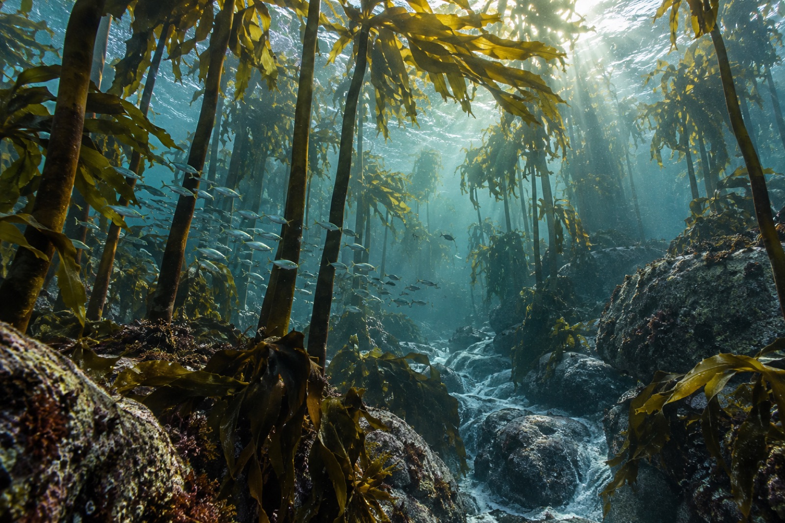
Every kelp forest on Earth ends somewhere. For South Africa's great western kelp coast — the cold, fog-bound forests that run from Namibia's desert edge around the Cape of Good Hope — the ending happens gradually across the Eastern Cape, and it happens mostly in Algoa Bay. Here the warm Agulhas Current, sliding down from the Indian Ocean, begins to dominate the shelf water, and the kelp thins from a canopy to a fringe to isolated pockets of deep-water forest that fishers know as faint marks on a sounder rather than a place you can dive. It is an oceanographic boundary made visible in habitat — and it makes Algoa Bay one of the most revealing places on the planet to watch what a warming edge does to a living coast.
Where Algoa Bay sits — and why it is different
Algoa Bay stretches between Cape Recife, at the port city of Gqeberha (until 2020 named Port Elizabeth), and Cape Padrone some 70 kilometres east. The city — one of South Africa's largest — gives the bay a working waterfront identity: a deep harbour, the newer deep-water port of Ngqura at Coega, wind farms leaning inland, an anchovy fleet.
But the water is what matters. South Africa's coast is a hinge between two currents described in our Southern Africa atlas region: the cold, nutrient-rich Benguela upwelling system that drives the west coast kelp forests and the desert-coast ecosystems of Namibia, and the warm Agulhas Current sweeping the east coast toward Durban and the tropics. The boundary is mobile — El Niño years and La Niña years shift it along the coast — but on average it sits right here. Sea surface temperature in Algoa Bay runs several degrees warmer than the West Coast, typically 16–22 °C depending on season and current position, and the difference expresses itself biologically.
The last of the kelp
The iconic South African forest-former is sea bamboo (Ecklonia maxima), the big stripe-stiped kelp that grows to 15 metres and gives the west coast its characteristic architecture. Ecklonia maxima does not reach Algoa Bay in meaningful numbers — its range fades toward the warmer east. What kelp remains here tells a subtler story:
- Split-fan kelp (Laminaria pallida) holds on in deeper water where the bottom stays cool even when the surface warms. These are forests you visit by sonar and camera, not by snorkel, and their presence explains why the benthic reef ecosystem here still carries a kelp-forest character despite the absence of an obvious canopy.
- Patchy kelp on reef tops near Cape Recife and along the Garden Route inflection support reef fish and custard the rocky platform habitat that much of the bay's fishing depends on.
- The Agulhas front — the broad gradient zone where warm and cold water mix — creates one of the richest foraging grounds in the region for fur seals, penguins, dolphins and sharks. Productivity here is not about kelp biomass. It is about the front itself.
That last point shapes everything about how Algoa Bay works as an ecosystem. This is not a coast whose wildlife depends on submerged forest. It is a coast whose wildlife depends on the boundary where the forest gives way.
The penguins of St Croix
The St Croix Island group — St Croix, Brenton and Jahleel islands — sits a few kilometres offshore from the port of Ngqura, on top of the reef system. St Croix has historically held one of the largest African penguin (Spheniscus demersus) breeding colonies on Earth: tens of thousands of pairs at its peak, a dark-capped rookery audible across the anchorage. African penguins prefer cool water and the anchovy and sardine schools that the Benguela-Agulhas boundary delivers. For most of the twentieth century, the St Croix colony hammered along on the productivity of the front.
The colony has declined steeply since the 1990s — not from local mismanagement alone, but from a difficult stack of pressures: sardine distributions shifting eastward away from the west coast colonies where most African penguins concentrate; noise and disturbance from the industrial port at Ngqura, which brought shipping and machinery to within a few kilometres of the island after 2009; competition with the purse-seine fishery for the forage fish both depend on; and the larger thermal restructuring of the southeast Atlantic. South Africa has run experimental fishing closures around the island since 2008 to test whether reducing catch near the colony helps. Results are mixed and contested — an example of the thorny, multi-decadal question of how to manage seabirds against fisheries when the fish themselves are moving with a shifting climate.
The sardine run's western edge
Every southern winter, from roughly May through July, an extraordinary migration moves sardines (Sardinops sagax) northeastward along South Africa's east coast: a ribbon of cool-water fish pressed against the shore by the inshore countercurrent, trailed by common dolphins in the thousands, gannets dive-bombing from height, copper sharks, Bryde's whales and humpbacks. The eastern reaches of this "sardine run" pass the Wild Coast and KwaZulu-Natal before turning back. The western end of the run passes right through Algoa Bay and past its island groups. The bait balls that stack up against Cape Recife are a spectacle that divers travel for, though conditions — winter swell, murky water, sharks among the bait — demand experience and respect.
The run is a climate indicator as well as a wildlife event. It depends on a pulse of cool water pushing the sardines inshore at the right temperature window, and in years when the coast stays too warm it simply does not happen with the same intensity. Watching the sardine run over a decade is watching the thermal margin of a species in real time.
Bird and Seal islands: the gannet citadel
East of St Croix, the Bird Island group — Bird, Seal and Stag islands — protects what is often described as the largest Cape gannet (Morus capensis) breeding colony in the world. Cape gannets are the snow-white, black-tipped plunge divers of the Benguela fishery, and Bird Island's massive colony works the forage schools within striking range of the front. Seal Island carries a large Cape fur seal colony; together the groups are enclosed within the Addo Elephant National Park marine protected area, gazetted in 2019, which was significant partly because it extended protected status across a section of continental shelf far offshore of any visible scenery. The protection came late — the penguin colony had already been declining for a generation — but it is real and it is the right scale of ambition.
Diving and snorkelling: what to expect
Algoa Bay is not a destination dive coast like Sodwana further north or the Cape Peninsula to the west. The bayshore is worked, the visibility is variable (often 3–8 metres, better after offshore winds), and the kelp character is understated. What it offers is a different kind of diving:
- Reef dives at Cape Recife and the pyramids — rocky platform structure with temperate-tropical transition species: resident reef fish, ragged-tooth sharks that winter here before moving north with the sardine run, and kelp community species leaning on the deeper water.
- The front dives — for experienced boat divers, the inshore edge of the Agulhas front is where the water colour changes visibly, and it is a blue-water interface that drops bait, gamefish and marine mammals into the same frame.
- Snorkelling with dolphins — the bay supports one of the largest resident populations of Indo-Pacific bottlenose dolphins on the South African coast, plus humpback whales in winter migration. Ethical operators keep watch-only protocols; there is no justification for swimming with wild dolphins and the good operators will not offer it.
The garden route west toward Knysna is the more classically beautiful dive-and-drive option if you want kelp and reef under clear water with more infrastructure.
What Algoa Bay is telling us
Put the pieces together and Algoa Bay is a climate observatory. The penguins at St Croix are in long decline because their forage fish are moving with the boundary the bay marks. The kelp holds its eastern limit near here and loses ground on warm decades. The sardine run fluctuates with the same thermal signal. The marine park designation arrived in 2019, against the drift. The city built a port 4 kilometres from the largest penguin colony it could find, then spent 15 years measuring the consequences.
If you want to see a coast in transition — not past crisis, not yet rescued, but living in the live zone where the forest ends — Algoa Bay is the place that will show it to you honestly.
Key takeaways
- Algoa Bay marks the eastern effective limit of South Africa's great kelp forests, where the warm Agulhas Current closes off the Benguela system's cold water habitat.
- Deep-water Laminaria pallida keeps a kelp-forest character on cooler bottom reef even after the surface canopy thins.
- The St Croix group hosts one of the world's largest African penguin colonies, now in long decline from shifting prey, industrial noise and fishery pressure.
- Bird Island holds the world's largest Cape gannet colony; both island groups fall within the Addo Elephant National Park MPA gazetted in 2019.
- The sardine run's western limb passes the bay each winter — a migration that doubles as a living readout of the boundary's thermal position.
FAQ
Can you see penguins in Algoa Bay without a boat?
Not easily at the islands, which are offshore and closed to landing. From the Gqeberha waterfront you can sometimes see penguins resting on harbour structures or swimming the bay, and local operators run boat trips that observe from the water.
Does the sardine run reach Gqeberha every year?
The intention of the run is reliable — sardines move up the east coast — but the intensity and water clarity vary year to year with sea temperature. Algoa Bay is on the run's western edge; KwaZulu-Natal and the Wild Coast are historically more dependable for closeshore bait-ball action.
Is Algoa Bay good for beginner divers?
Not as a first choice. Visibility is limited, the water is 16–22 °C and swells can be significant. It is rewarding for experienced divers who want transition-zone reef, sharks and pelagic encounters, but the Garden Route or Cape Peninsula is friendlier for newer divers.
What is Addo Elephant National Park's MPA doing here?
The 2019 designation extended protection from the famous terrestrial reserve offshore across the shelf encompassing the Bird, Seal and St Croix island groups. It was a significant scaling up of marine protection in the region.
Why is St Croix's penguin colony declining?
Multiple interacting pressures: sardine and anchovy distributions shifting eastward, the nearby industrial port (Ngqura), fishing competition for forage fish, and long-term ocean warming. There is no single cause and so no single fix.