Atlas9 min read
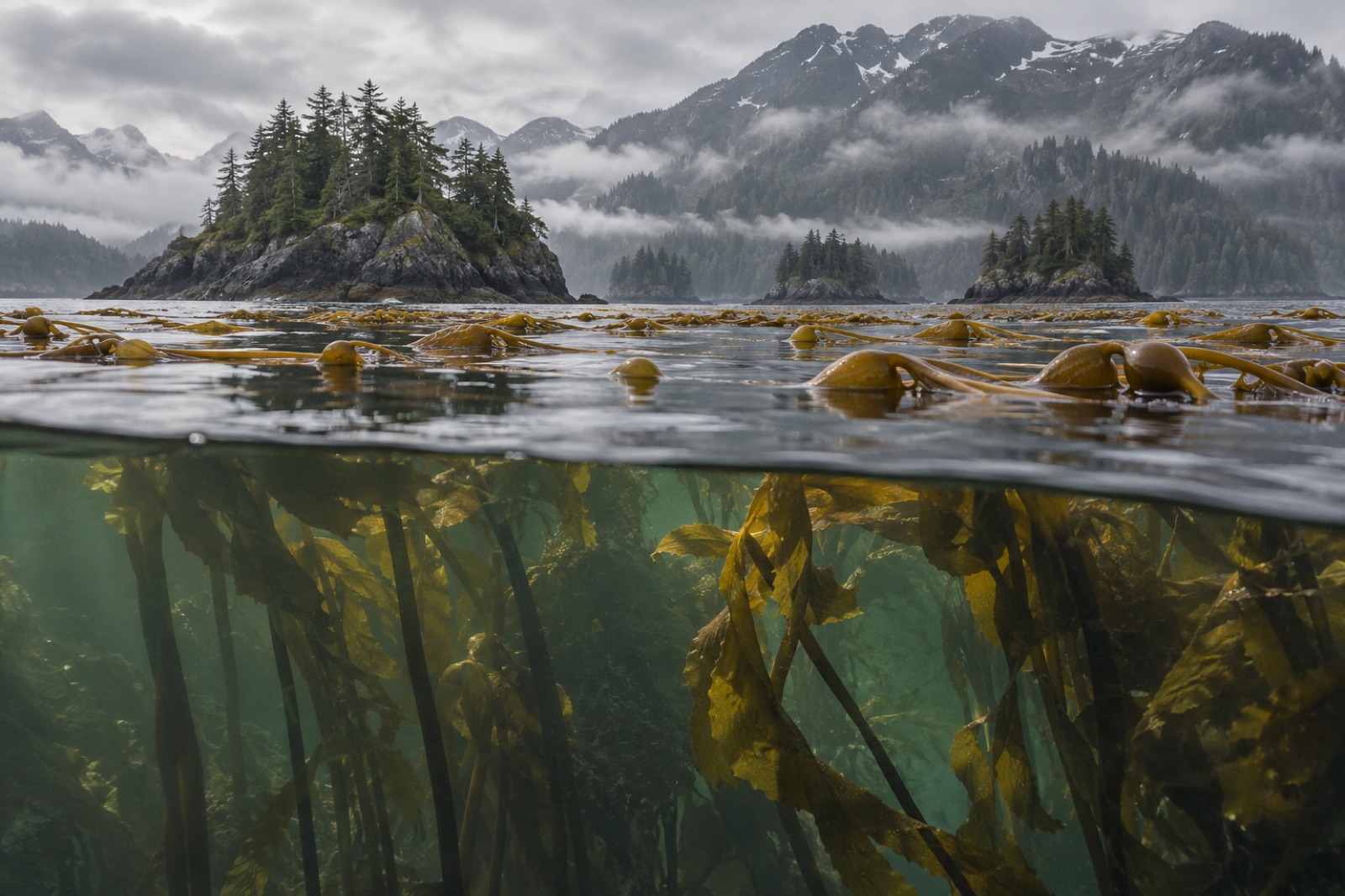
Kodiak: Bears Above, Kelp Below on Alaska's Emerald Coast
Brown bears above, sea otters in the kelp below — a guide to the reefs, salmon rivers and cold-water richness of Alaska's Kodiak Archipelago.
Tom Okafor ·
Cook Inlet is Alaska's great tidal estuary — bore tides, glacial silt, belugas and salmon, with rich cold-water kelp beds in its clear pockets. A Coastal Atlas guide.
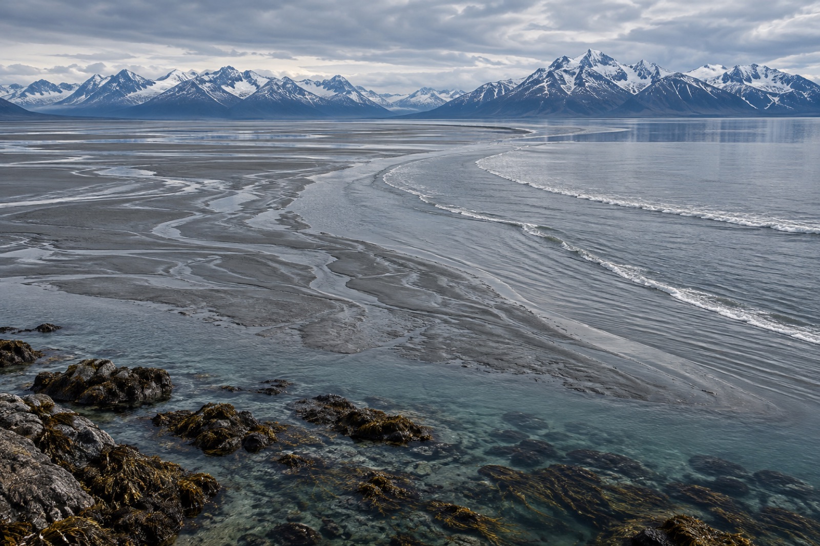
Some coastlines make kelp forests easy. Cook Inlet makes them earn it. This 300-kilometre tidal estuary drives a wedge between the Kenai Peninsula and the Alaska mainland, with Anchorage at its head and the Gulf of Alaska at its mouth — and it runs some of the most violent tidal plumbing in North America. Tidal ranges near nine metres. Bore tides that march up Turnagain Arm like a moving wall. Water the colour of wet cement, loaded with glacial flour so dense it turns summer light to dusk within a few metres of the surface. And yet: in the clear pockets — above all in Kachemak Bay at the inlet's lower end — cold-water kelp beds grow that would be famous anywhere else. Cook Inlet is where you go to understand what kelp is up against, and what it can do anyway.
Start with the numbers, because nothing else here makes sense without them. Cook Inlet's tides are among the largest in North America — a maximum range of around nine metres at the inlet's head, comparable to the great tide factories of the world and trailing only the Bay of Fundy locally in legend. Two forces set that scale: the inlet's funnel shape, which compresses each rising tide into a narrower and shallower space, and the fact that the inlet's length lies close to a natural resonance for the twelve-hour tide — the water body sloshes, and the slosh keeps time with the moon.
The most famous expression of this is the bore tide of Turnagain Arm, the eastern arm above Anchorage. On the biggest tides, a true tidal bore — a breaking wave front that marks the incoming tide's leading edge — rolls up the arm's glacial trough, visible and audible from the overlooks along the Seward Highway, and rideable (by people far more committed than us) up its length. Turnagain Arm's bore is one of the largest regularly observed in North America; on occasion the front stands well over a metre tall and travels at speeds faster than most people can jog.
The rest of the inlet keeps its own tidal violence in the form of sheer current. Rip races strum around every headland. Slack water is a rumour told to comfort kayakers. Our explainer on how tides work covers the springs-neaps machinery driving all of it.
There is a serious safety note here, and it deserves its own paragraph: the inlet's vast tidal flats are underlain by glacial silt that behaves like quicksand when walked on, and tidal bores race in behind anyone stuck. Turnagain Arm flats have trapped and killed people who treated them like a beach. Admire them from the overlooks.
Glacial flour — the flour-fine rock meal ground by the inlet's surrounding icefields and poured down by the Susitna, Knik, Matanuska and Kenai rivers — is the defining constraint on upper-inlet life. It is picked up, sieved and carried on every tide, and its biology is a study in attenuation:
The result is that Cook Inlet kelp is kelp of negotiation — present where light and current argue successfully, richest where ocean water wins. We recommend anyone thinking about the inlet's ecology read our explainer on water clarity and the depth limits of kelp before a trip; it turns the shoreline from mud flats into a legible map.
Where the water clears, the cast is a boreal one familiar across Alaska. Sugar kelp (Saccharina latissima) dominates the shallow subtidal in long, rippled blade fields — the same workhorse pastured across the North Atlantic, and the species our sugar kelp profile describes in detail. Ribbon kelp (Alaria marginata) trails golden streamers along surge-swept rocky edges, the understory's answer to wave. In the best-lit, cleanest pockets of Kachemak Bay and the outer coast, bull kelp (Nereocystis luetkeana) stands in annual forests up from the rock, though it never achieves the dense canopy girth of Southeast Alaska's beds. Mix through sieve kelp (Agarum clathratum) in the deeper, dimmer range and you have a classic four-species boreal forest assembled on Alaska's hardest working tide.
The animal guild follows. Sea otters — re-established across much of the Kenai Peninsula's outer coast through the twentieth century — hold sea urchin populations in the kind of equilibrium kelp needs, and Kachemak Bay is one of the better places in the state to watch an otter pick an urchin apart at the surface. Steller sea lions haul out on outer-coast rocks. And the copper, quillback and yelloweye rockfish familiar from the Northwest coast prowl the reef edges here in colder, darker water.
Cook Inlet is more than its kelp. Two wildlife stories dominate, and both matter for how a visitor reads the water.
The belugas. Cook Inlet's beluga whales are a distinct population, genetically and physically isolated from any other by the inlet's geography, and they are federally listed as endangered — an unusual case of a well-studied whale population that has failed to recover despite protection. You may see them from the coastal trails near Anchorage or from Beluga Point: small, white, surfacing in threes and fours against the silt-brown water like strokes of light. Their food — salmon, eulachon, cod, flatfish — is the inlet's food, and their struggle is an audit of the whole estuary's productivity.
The salmon. All five Pacific salmon species run the inlet's rivers, and the fisheries are Alaska's central summer spectacle. At the mouths of the Kenai and Kasilof rivers, Alaskan residents crowd the beach for personal-use dipnet fisheries — shoulder-to-shoulder families pushing long-handled nets into the surf, hauling sockeye by the tail into coolers. It is one of the most charismatic working fisheries left anywhere, and seen at scale it stops being quaint and starts looking like what it is: the food security of tens of thousands of households, announced annually.
Halibut charters run out of Homer, which brands itself the halibut fishing capital of the world with at least the justification of volume. Sport crabbers, shrimp trappers and razor clam diggers fill in the rest of the working waterfront.
Alaska's commercial seaweed farming sector is young, ambitious, and concentrated enough that you can read its whole history in a short decade. Cook Inlet farms — mostly in Kachemak Bay, with Kodiak further down the coast hosting its own cluster — grow sugar kelp and ribbon kelp on seeded lines through the winter, harvesting in spring and early summer before blade quality declines. The kelp goes to food, kelp-cube biostimulants, compost blends and soil amendments, and the economics are still finding their footing.
Restoration science is watching closely. A farmed kelp line in a big tidal bay is a ready-made experimental array: productivity data, growth curves, temperature responses arrive with every harvest. Some of the inlet's growers run partnerships with mariculture researchers working the same coastal-monitoring questions that drive our own work further south — Tidewright's survey vessels have not steamed this far north yet, but the kelp-habitat metrics Cook Inlet farms generate are exactly the kind our Canopy Ledger platform is designed to ingest.
The inlet is best appreciated in trips of two gears. From Anchorage, the Seward Highway winds the Turnagain Arm shore and is one of America's great road-scapes: watch the bore tide from Beluga Point or Bird Point during the big tide days (timing is posted publicly; aim for the windows around the biggest ranges), scan for belugas on any high-tide push, and look across at the Kenai Mountains under their summer snow.
From the Kenai side, the roads into Ninilchik, Kenai and Kasilof deliver salmon-country views of the inlet's working side, and the ferries and water taxis out of Homer drop you into Kachemak Bay State Park, where the kelp beds are a short paddle from the docks and the water clears to honest-to-goodness green.
Best season: late June through August for light, salmon and working-waterfront culture; May–June for kelp-farm harvest windows and longer days; September for the first storms and golden light on the flats. Water temperature runs 4–10 °C year-round; nobody snorkels here casually, and nobody should without dry-suit training; it is advanced, cold, current-swept water.
Cook Inlet is warming with the rest of the subarctic — faster than the global average, like most of Alaska. Three questions will decide its kelp story. First, whether glacial retreat over the coming decades ultimately raises or lowers the silt load — runoff timing, not just volume, changes the light story. Second, whether the beluga population's slow trajectory improves as salmon runs shift. Third, whether kelp farming and kelp-based local economies mature into the kind of working-seaweed coast we see further west in Kodiak's archipelago and on Japan's Sanriku shore — a human economy with reasons to keep kelp standing.
Yes — Beluga Point and Bird Point on the Seward Highway both overlook Turnagain Arm, and bore tides are visible and audible from the overlooks on the biggest tide days. Public tide tables note which days to visit; plan around the largest ranges.
No. Turnagain Arm's tidal flats are underlain by glacial silt that can trap a person like quicksand, and tidal bores arrive behind anyone caught. View them from overlooks only.
There is diving, mostly in Kachemak Bay, but this is advanced cold-water territory: 4–10 °C water, very poor visibility in the upper inlet, stiff currents. It rewards experienced dry-suit divers rather than visitors. Snorkelling is rare and requires full cold-water kit.
Summer, late June through August, gives the longest days, the dipnet fisheries in action, and the best beluga sighting conditions on high-tide pushes.
Yes — a young commercial mariculture sector, concentrated in Kachemak Bay, growing sugar kelp and ribbon kelp on seeded lines through winter for spring harvest. It is among Alaska's most active kelp-farming regions.
Brown bears above, sea otters in the kelp below — a guide to the reefs, salmon rivers and cold-water richness of Alaska's Kodiak Archipelago.
Tom Okafor ·
Glacial fjords, returning sea otters and slow kelp regrowth after oil and ice loss — a field guide to Prince William Sound, Alaska's living laboratory.
Tom Okafor ·
Tides move more water than all the world's rivers. A clear guide to why the sea rises and falls — moon, sun, spring and neap tides, and what it all means for kelp.
Dr. Lena Fischer ·