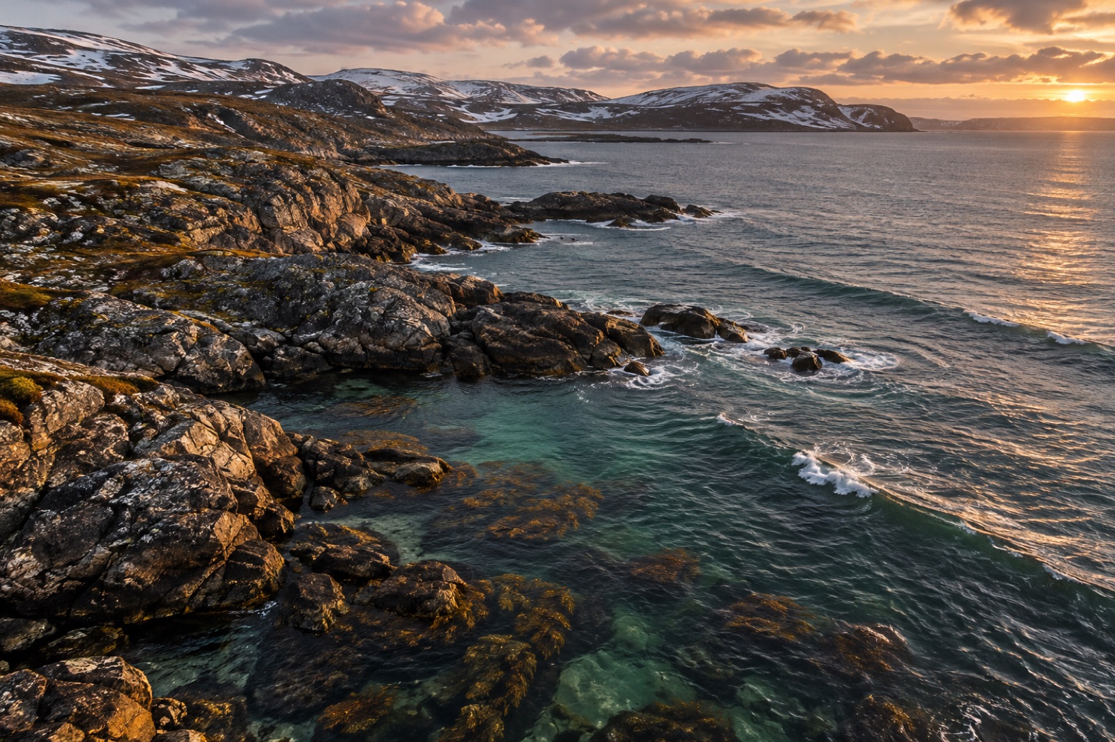
The Labrador coast runs more than a thousand kilometres from the Strait of Belle Isle to the mouth of Hudson Strait — a granite-and-gneiss shoreline cut by fjords, guarded by islands, and swept year-round by the cold Labrador Current. Beneath it lies one of the least-visited kelp systems on Earth: forests of sugar kelp, Arctic kelp and perforated sieve kelp that grow under sea ice in winter and iceberg shadows in summer. Almost nobody dives here, almost nobody has mapped it in detail, and what little science exists suggests the forests are both thriving and, in places, changing fast as the subarctic warms. This guide explains what shapes the Labrador kelp coast, what lives in it, and — for the determined — how people actually get there.
The engine: ice, current and light
Three forces organise Labrador's kelp. The first is the Labrador Current, the southbound flow of cold Arctic water that hugs the continental shelf. It keeps coastal water temperatures low — often below 4°C even in late summer — and carries nutrients, drifting ice and a steady supply of zooplankton south toward Newfoundland and the Grand Banks. It is the reason kelp, a cold-water group, finds near-Arctic growing conditions at the same latitude as the British Isles.
The second force is sea ice. From roughly December to June, much of the coast carries shore-fast ice and drifting pack. Ice scrapes the shallows clean — boulders plucked and rolled by freezing floes — setting the upper edge of kelp growth deeper than on ice-free coasts. It also blocks light for months, so Labrador's kelp communities are built by species adapted to a compressed growing season and long darkness. Our explainer on how polar kelp survives the dark months covers the physiology: stored carbohydrates, opportunistic growth in the light window, and fronds that can persist through winter.
The third force is glacial history. The whole coast was buried under the Laurentide Ice Sheet until roughly 10,000–7,000 years ago, meaning every kelp forest here is geologically young, assembled from populations that survived the ice age in refuges and recolonised northward. That recolonisation story — which currents carried which lineages — is still being read from kelp DNA; see how glacial refugia shaped today's forests.
What grows, and what lives in it
The intertidal belts rockweed (Fucus species) in thick golden-brown bands wherever ice scour allows. Below the tide line, the canopy belongs to the cold-water workhorses: sugar kelp (Saccharina latissima), which blankets sheltered and semi-exposed reefs; winged kelp (Alaria esculenta) on the most wave-pounded headlands; and the true Arctic specialists — including Laminaria solidungula, a species that grows mostly in winter darkness, under ice. On deeper reef edges, sieve kelp (Agarum clathratum) spreads its peculiar hole-punched blades toward the light limit, and below the kelp altogether the bottom shifts to coralline algae, soft corals and sponge gardens.
The animal community reads like a checklist of the northwest Atlantic's cold-water fauna. Green sea urchins graze the reefs; in barrens they can hold large areas, but along much of Labrador's rugged, current-swept coast the forest holds. Sea stars, anemones, basket stars and nudibranchs crowd the understory. Atlantic cod — the fish whose 1992 moratorium reshaped life across this whole region — use kelp edges as juvenile habitat, alongside Greenland cod, sculpins and shannies. Capelin roll onto beaches in early summer, and everything from whales to seabirds follows them.
Above the waterline, the coast is stacked with life: thick-billed murres and puffins on the Gannet Islands, harlequin ducks in the tide races, polar bears drifting south on spring ice, black bears and caribou on the tundra fringe. From June onward, humpback and minke whales work the headlands, and harp and hooded seals haul out on pans and skerries. It is sea country of extraordinary richness — and almost none of its subtidal habitat has been surveyed in detail. That gap is exactly why eDNA surveys — reading the species present from a bottle of filtered seawater — are becoming the tool of choice here.
Sea country, not wilderness
Labrador's coast is not empty. It is homeland. The central and northern coast lies within Nunatsiavut, the self-governing territory of the Labrador Inuit, whose communities — Nain, Hopedale, Makkovik, Postville, Rigolet — have harvested this coastline for millennia. Further south, the Innu Nation and the Southern Inuit of NunatuKavut hold deep ties to the same water. Place names, travel routes and hunting knowledge encode an ecological record that no research cruise will ever match.
Any honest guide to this coast has to say plainly: visitors travel here as guests. Landings in Nunatsiavut require permits; many communities can be visited and welcomed, on terms set locally — through Inuit-owned outfitters, the Torngat Mountains Base Camp, and community tourism offices. The most interesting trend on the coast is the growth of Inuit-led environmental monitoring, pairing harvester knowledge with sonar, cameras and eDNA to build the baseline maps this coastline has never had.
A warming frontier
Labrador sits at one of the sharper climate boundaries in the North Atlantic. Sea-ice season length has shortened markedly in recent decades; the ocean's cold skin is thinning. For kelp, that pulls in two directions. Less ice scour and a longer light season can mean more kelp, growing faster, reaching shallower — a pattern scientists are watching across the subarctic from here to Greenland's kelp coast. But warmer summers also open the door to problems the ice used to lock out: warm-adapted competitors, grazers, and pathogens arriving with shifting currents, and marine heatwaves nudging summer peaks above what sugar kelp handles well.
The honest scientific position is that Labrador's kelp forests are probably gaining ground in some places and stressing in others, and without more measurement no one can say where the balance lies. That makes every survey, every harvester interview, every logged temperature record from this coast disproportionately valuable.
Getting there — carefully
Labrador is not a beginner's dive destination; it is an expedition.
By expedition vessel. The most realistic way onto the water is a small-ship expedition cruise out of Newfoundland or Greenland, several of which work the Torngat coast in July–September, with zodiac cruising among grounded icebergs and, on some itineraries, snorkel or dive add-ons in the kelp shallows.
By air and boat. Scheduled flights reach Nain and other Nunatsiavut communities via Goose Bay. From Nain, boat charters and the seasonal Torngat Mountains Base Camp (accessed by charter flight) open the fjords of the far north — Saglek, Nachvak, Hebron — where kelp forests lie beneath cliffs that rise straight out of the sea.
Conditions. Water temperatures hover around 0–6°C in season; ice can appear in any month; weather windows close fast. This is drysuit, full-exposure-protection, experienced-operator territory. For most travellers the kelp is best met at very low tides, by kayak in calm fjords, or through the camera of a local guide. The reward is a coastline with no queues, no moorings and no other boats — kelp forest as wilderness, in the oldest sense.
For the southern extension of this coast, see our guide to the kelp forests of Newfoundland and Labrador's island shore; for the same ocean at its European end, compare the Murman coast of the Barents Sea.
Key takeaways
- Labrador's kelp coast is shaped by three forces: the cold Labrador Current, months of sea ice, and post-glacial recolonisation from ice-age refuges.
- The canopy is sugar kelp, winged kelp and Arctic specialists such as Laminaria solidungula, with sieve kelp at the deep light limit.
- Almost none of the subtidal coast has been closely surveyed; eDNA and Inuit-led monitoring are now building the first baselines.
- This is Inuit and Innu sea country — travel is possible and welcome through community-linked channels, with permits for Nunatsiavut lands.
- Warming is shortening the ice season; the balance between kelp expansion and heat stress here is one of the subarctic's open scientific questions.
FAQ
Is there really kelp in Labrador?
Yes — extensive forests of sugar kelp, winged kelp and Arctic kelp species grow along the length of the coast, beneath the ice in winter and around icebergs in summer. Because so few people dive the region, the forests are among the least-documented in the North Atlantic, but every survey done so far has found dense, healthy kelp habitat.
Can tourists visit Labrador's kelp coast?
Yes, but it takes planning. Expedition cruises work the northern fjords in July–September, flights reach Nunatsiavut communities via Goose Bay, and the Torngat Mountains Base Camp opens the far north in summer. Diving and snorkelling are for experienced cold-water travellers with appropriate operators.
How cold is the water?
Coastal water typically runs between about 0°C and 6°C even in high summer, kept cold by the Labrador Current. Sea ice covers much of the coast from roughly December to June, and small ice can be present offshore in any month.
What is the connection between kelp and cod here?
Young Atlantic cod use kelp edges and other structured seabed as shelter from predators during their juvenile years. The 1992 cod moratorium, which closed the northern cod fishery across Newfoundland and Labrador, transformed the region's whole relationship with the sea — and the kelp forests' role as cod nursery habitat is part of why their condition matters to the stock's long story.
Is climate change good or bad for Labrador kelp?
Both, and it depends on the shoreline. Less ice scour and longer light seasons can expand kelp cover; hotter summers and arriving warm-adapted species can stress it. The coast is a genuine frontier for answering that question because the historical baseline is so thin — which is why new monitoring there punches above its weight.