Atlas9 min read
The White Sea: Kelp Forests Under the Ice
A semi-enclosed sea in northwest Russia where kelp grows beneath months of ice, fed by Arctic rivers and Atlantic tides — one of Earth's most unusual kelp ecosystems.
Dr. Lena Fischer ·
A Coastal Atlas guide to Russia's Murman Coast, the ice-free Arctic shore warmed by the Gulf Stream, where kelp forests grow far past the polar circle.
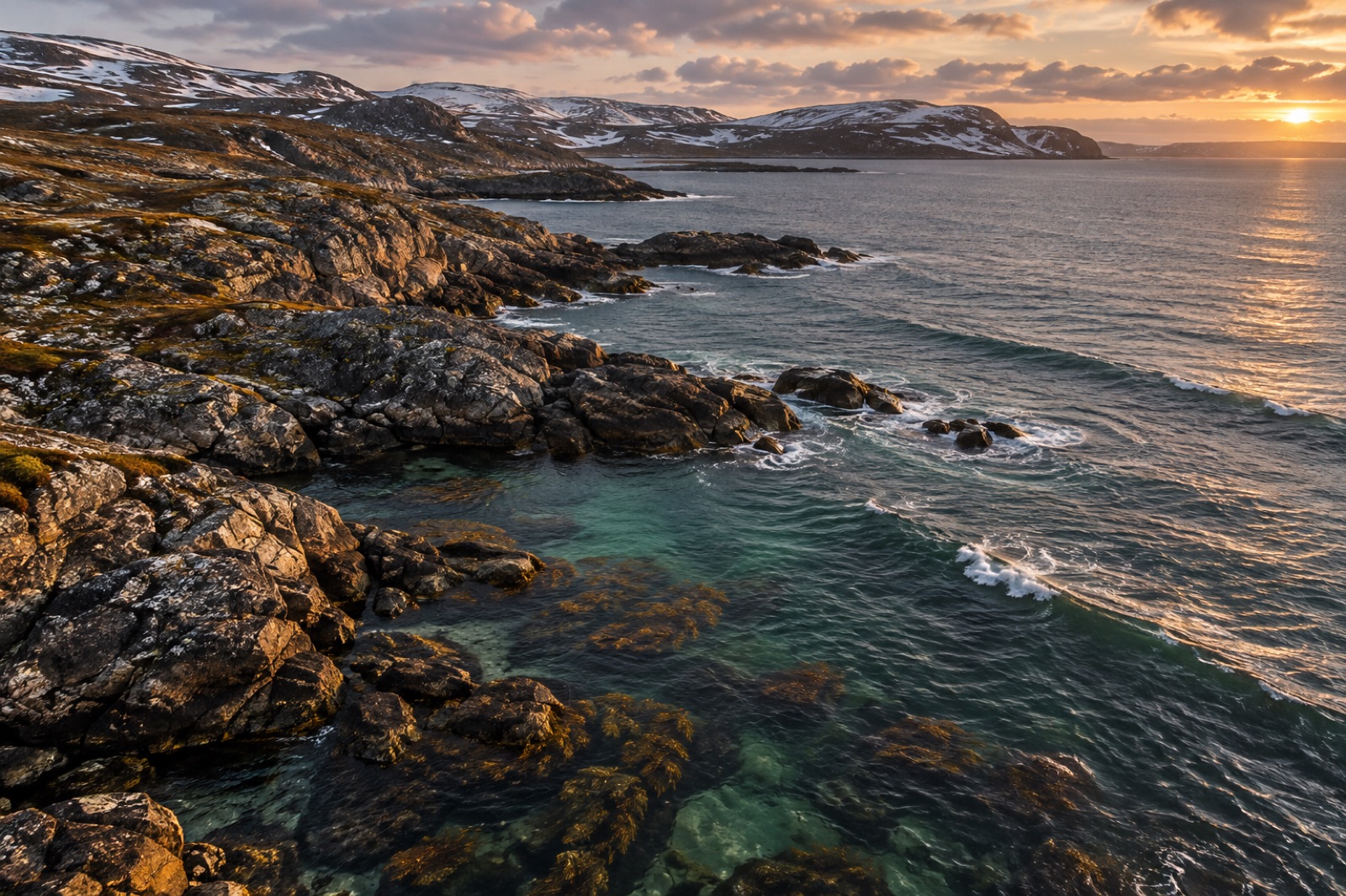
There is a stretch of coast, well north of the Arctic Circle, where the sea never freezes in winter and dark forests of kelp wave in water that carries heat all the way from the Caribbean. The Murman Coast — the southern shore of Russia's Kola Peninsula, fronting the Barents Sea — is one of the strangest and most instructive kelp habitats on Earth. It is Arctic in latitude, subarctic in temperature, and proof that a kelp forest is defined not by where it sits on the map but by what the water does.
This guide covers the coast's defining oceanography, the kelp communities that grow along its granite shore, the wildlife they support, a human history built on cod and ice-free harbours, and what warming means for a sea that was never supposed to be warm.
The Murman (or Murmansk) Coast runs east–west along the bottom edge of the Kola Peninsula, from the Norwegian border near the Varangerfjord to the throat of the White Sea. Everything south of the peninsula drains into the White Sea — profiled in our White Sea atlas guide — but the Murman shore belongs to the open Barents, and the difference matters enormously.
The coast is low, hard and fretted: granite and gneiss, scraped by ice-age glaciers into a mosaic of skerries, islets, rias and small fjords. There are no trees near the water. The nearest true fjords are the great Murmansk fjord of Kola Bay, which takes the port city of Murmansk some fifty kilometres inland, and the smaller inlets near Teriberka, the fishing village on the open coast that has become, improbably, one of Arctic Russia's most-photographed places.
Latitude here is roughly 68–69°N. By the usual rules of biogeography you would expect pack ice, polar bears and a shoreline of barrens. Instead you get kelp.
The explanation is an ocean current — the same one that keeps much of northwest Europe habitable. The Norwegian Atlantic Current, the northward continuation of the Gulf Stream system described in our guide to boundary currents, splits as it rounds northern Norway. One branch hugs the coast as the North Cape Current, floods the southern Barents Sea with relatively warm, saline Atlantic water, and washes the length of the Murman Coast.
The effect is decisive. Winter air temperatures on the Kola Peninsula fall far below freezing, yet the coastal sea stays just above it, keeping Murmansk the largest city inside the Arctic Circle and one of the very few ice-free ports at this latitude anywhere on Earth. In summer, coastal water climbs into the 8–12°C range — not warm, but comfortably inside the window that cold-water kelps evolved for. Westerlies and the subarctic low do the rest, keeping the Barents mixed, oxygenated and reasonably nutrient-rich for most of the year.
One qualifier: the Barents is a shallow shelf sea, and the water bathing the Murman kelp is a blend — Atlantic water over its own cooled, fresher coastal layer — so conditions swing with season, tide and wind. What the kelp gains in warmth it loses in predictability.
The forests of the Murman Coast will look immediately familiar to anyone who has snorkelled in arctic Norway, the coast profiled in our guides to Senja and the Barents margin and Lofoten. That is no accident: the same warm current delivers both water and spores, and the species roster is essentially a Norwegian cast transplanted east.
Under and between the kelps runs a red-algal understorey, encrusting corallines on the rock, and — in the long polar summer, when light becomes nearly continuous — an explosion of ephemeral greens. The phenological clock here is extreme: kelp does most of a year's growing in the few months bracketed by the midnight sun, then survives a dark season measured in weeks of true night.
A Murman kelp bed is a working piece of subarctic ecology. The holdfasts shelter amphipods, isopods and bristleworms; the stipes carry tufts of hydroids and bryozoans; lumpsuckers, sculpins and juvenile cod work the understory while sea urchins graze the bed's edges. Hovering over it all is the possibility of a capelin run — the small, oily fish whose spawning migrations concentrate predators the way a dinner bell does.
The flagship animals are the ones written on the local imagination. Humpback and fin whales now appear reliably in summer, drawn to the same forage schools, and Teriberka has become a whale-watching base. Harp seals haul out in the south Barents. And the cliffs above the kelp are thick with seabirds — kittiwakes, puffins and dense ledges of common murres, the pursuit-diving auk that fishes the cold, productive water over the kelp exactly the way it does in the North Atlantic's other great colonies.
That layering — kelp below, capelin midwater, murres and cod above, whales seasonally roaming through — is the Barents food web in cross-section, and the cold, nutrient-pulsed physics behind it is the subject of our explainer on upwelling.
People have read this coast for a thousand years. Pomor settlers — Russian coast-dwellers who worked the White and Barents seas — fished its cod and traded west to Norway under the old borderland economy. The modern city of Murmansk was founded in 1916, in the urgency of the First World War, precisely because the North Cape Current made this the one Russian Arctic shore that stayed open to the sea year-round. The same geography made its convoy routes the lifeline of the eastern front a generation later — which is why the memory of that war is carved all over the hills above the fjords.
The twentieth century industrialised the coast: murmanets trawlers combed the Barents cod grounds, canneries grew, and fishing villages like Teriberka boomed before the sector contracted in the post-Soviet decades. Aquaculture and salmon farming have since taken hold in the fjords — a modern chapter on a shore where kelp once grew unnoticed beneath the nets of far larger ambitions.
The Barents is now among the fastest-warming seas on the planet, in a process oceanographers call Atlantification — the warm Atlantic inflow pushing further north and east, thinning and shrinking the winter ice, tilting the ecosystem steadily toward Atlantic species. The complex past and fast-moving present of northern latitudes is the context for our guides to Svalbard's kelp and Iceland's kelp coast.
For kelp, the physics cuts both ways. Moderate warming is comfortable for a boreal species roster that came here with Atlantic water; the Murman forests are in that sense adapted to warmth the rest of the Arctic lacks. But Atlantification is delivering change far beyond temperature — new competitors, altered grazers, shifting fish stocks, more fouling and more human traffic. Whether the Murman kelp becomes a transition laboratory that can teach us about the coming kelp of the high Arctic, or a becoming-warm coast that loses its distinctiveness, is one of the live scientific questions of the North.
Tidewright does not operate on the Kola Peninsula. This guide is part of the Coastal Atlas library: a survey of the world's kelp bioregions, written to standard, whether or not we plant a line there.
Most travellers come for Teriberka — the road in crosses treeless tundra, and the village itself is half-abandoned wooden fleet, half guesthouse boom, with kelp beds a stone's throw off the shore. Summer is the season: the midnight sun runs through June and July, the tundra is flower-thick, and the water, while bitter, is clear. In winter the coast is brutal, magnificent and very quiet; the sea lies open and grey under the polar night, ice-free thanks to the current that defined the place.
Bring serious cold-water kit if you enter the water at all, book local guides, and treat both weather and remoteness with respect. There is no dive infrastructure here; this is a coast you travel to see, not to tick off.
Roughly 68–69°N — comfortably inside the Arctic Circle. By latitude it is deep polar territory; it is the warm ocean current, not the sun, that separates it from the rest of the high Arctic.
Tangle kelp (Laminaria hyperborea) forms the deepest, most forest-like beds on exposed coast, sharing the habitat with sugar kelp, oarweed and winged kelp depending on depth and wave energy — the same guild found across arctic Norway.
Teriberka, reachable by road from Murmansk, is the standard base, and kelp grows right off its shore. There is little formal dive or snorkel infrastructure, so most visitors experience the coast from land, boats and whale-watching trips rather than in the water.
Yes — indirectly and directly. The Barents is one of the fastest-warming seas on Earth, and its moderate warmth makes Murman kelp relatively comfortable for now, but the species mix, grazing pressure and ecosystem around the forest are all shifting under Atlantification.
The White Sea is shallower, far more tidal, ice-covered for months and dominated by strong river influence. The Murman is the open, current-warmed Barents shore. Two very different kelp worlds, one peninsula apart.
A semi-enclosed sea in northwest Russia where kelp grows beneath months of ice, fed by Arctic rivers and Atlantic tides — one of Earth's most unusual kelp ecosystems.
Dr. Lena Fischer ·
Senja and Norway's Barents coast grow clear-water Arctic kelp patrolled by orcas. A regional guide to the kelp, cod and whales of the high north.
Tom Okafor ·
At 78°N, Svalbard's fjords hold kelp forests in polar light, growing under sea ice and beside glaciers. A guide to the High Arctic's underwater forests — and what's changing.
Dr. Mara Ellison ·