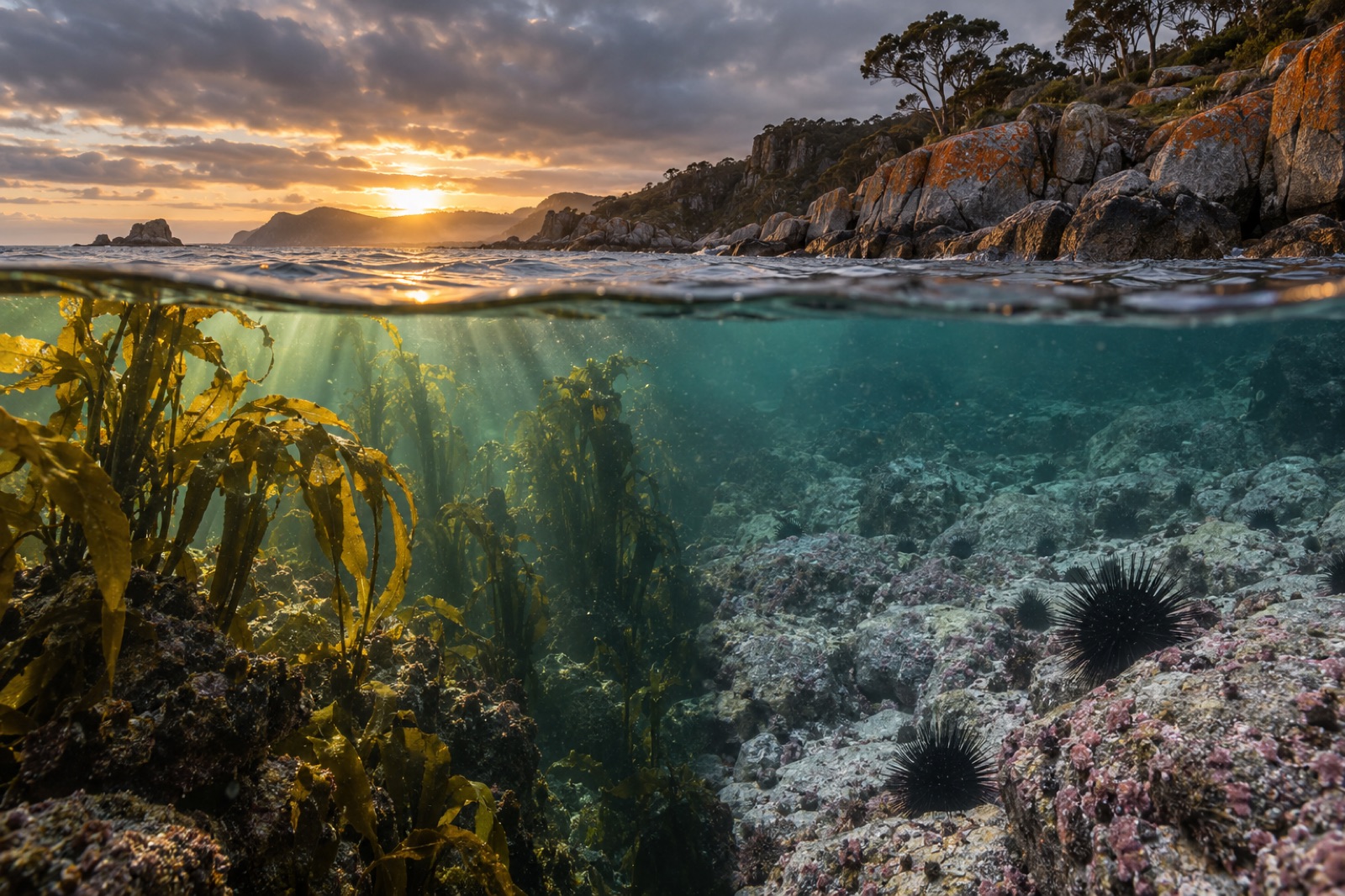
Look at a map of the world's kelp forests and you are looking at a map of its currents. From California to Chile, from Tasmania to Hokkaido, nearly every great kelp coast sits where cold, nutrient-laden water is steered toward the sunlit surface by one of the planet's largest oceanographic features: the boundary currents that hem in the great subtropical gyres. Which kind of boundary current a coast faces — warm and poleward on a basin's western edge, or cold and equatorward on its eastern edge — is one of the most powerful predictors of whether kelp will ever grow there. This article explains what boundary currents are, why they come in two opposite flavours, and what they mean for kelp forests and their restoration.
The gyres and their asymmetric edges
The surface ocean is organised into five great subtropical gyres — immense, slow whirlpools the size of continents, driven by the trade winds at low latitudes and the westerlies at mid-latitudes. The Coriolis effect, arising from Earth's rotation, twists each gyre's circulation clockwise in the Northern Hemisphere and anticlockwise in the Southern. So far, so symmetrical. But the gyres are not symmetrical at their edges, and the asymmetry is the story.
Oceanographers call the phenomenon western intensification. Because Coriolis strength grows with latitude, and because the wind's torque piles up water unevenly across a basin, the return flow on the western side of every gyre is squeezed into a narrow, fast, deep ribbon — while the eastern side answers with a broad, slow, shallow drift. The result, in every basin on Earth, is two radically different coastal environments built by the same spinning gyre. That basic asymmetry is one of the cleanest predictions in all of oceanography, and kelp forests live in its consequences.
Western boundary currents: warm-water expressways
Western boundary currents (WBCs) are the ocean's express couriers of heat. The Gulf Stream in the North Atlantic, the Kuroshio off Japan, the East Australian Current, the Agulhas off South Africa and the Brazil Current in the South Atlantic are all narrow — typically under one hundred kilometres wide — and fast, reaching surface speeds of two metres per second or more, carrying warm tropical water poleward at rates of tens of millions of cubic metres per second. They hug the coast, then separate into the open ocean in chaotic rings and eddies.
For kelp, a western boundary current is mostly bad news at its equatorward end: it imports heat. WBC coasts tend to be several degrees warmer than their latitude would predict, pushing kelp toward — and sometimes past — its thermal ceiling. Worse, as noted below, these currents are changing fast.
Eastern boundary currents: cold, slow and fertile
Eastern boundary currents (EBCs) mirror them with the opposite physics. The California Current, the Humboldt (or Peru) Current, the Canary Current and the Benguela Current flow equatorward in broad, shallow sheets hundreds of kilometres wide and barely knee-deep by open-ocean standards. Crucially, their equatorward push combines with Coriolis to drive coastal upwelling: surface water is transported offshore, and cold, nutrient-rich deep water — laden with the nitrate kelp hungers for — wells up to replace it. We walk through that process step by step in Upwelling Explained.
This is why roughly nine-tenths of the world's great kelp forests grow on eastern boundary coasts, or on coasts shaped by comparable cold currents. EBC provinces supply the kelp forest's twin requirements in one package: cool water below its thermal ceiling, and a conveyor of nutrients replenished every upwelling season. It is also why these same coasts support some of the world's most productive fisheries — kelp forests, sardines, anchovies and seabirds all drawing on the same physics.
The great kelp coasts, current by current
The correlation is startlingly tight once you trace it:
- California Current. From British Columbia to Baja California, this EBC and its upwelling centres feed the giant and bull kelp forests of the west coast — the forests of Monterey Bay among them.
- Humboldt Current. Off Peru and Chile, coastal upwelling drives not only vast kelp beds but one of the largest fisheries on Earth — until an El Niño arrives to flip the switch, a pattern we unravel in El Niño and Kelp.
- Oyashio and Kuroshio, Japan. Hokkaido's legendary kombu coast exists courtesy of the cold, southwest-flowing Oyashio — technically a subarctic western current, cool because of the water it drains — while the warm Kuroshio marks the kombu deadline as Japan's east coast runs south. The mixing front between them is one of the richest boundary zones on the planet, explored in Hokkaido's Kombu Coast.
- East Australian Current. This WBC's southward push, reinforced by its Tasmanian extension, has warmed Tasmania's east coast far faster than the global mean — one of the clearest case studies of a boundary current rewriting a kelp coast in real time.
- Agulhas and Benguela, South Africa. The cold Benguela feeds South Africa's west-coast kelp; the warm Agulhas, sweeping around the Cape of Good Hope, closes the door to the east. A single cape separates two thermal worlds, and South African kelp knows precisely which side it lives on.
- Canary Current. The Canary Islands' kelp sits at the warm southern extremity of this EBC — so vulnerable that heatwaves have stripped much of it, leaving urchin barrens in its place.
Moving boundaries in a warming ocean
Here the story turns urgent. Multiple analyses of sea-surface temperature records have found that the poleward extensions of western boundary currents — the Kuroshio east of Japan, the East Australian Current over Tasmania, the Agulhas retroflection, the Gulf Stream's separation zone — are among the fastest-warming regions of the global ocean, several of them warming at two or three times the global mean rate. The mechanism is complex and still debated — gyre spin-up, shifting wind stress, poleward migration of separation points — but the consequence is plain: on WBC coastlines, warm water is arriving ahead of schedule, and the kelp is leaving first.
Southern Australia's Great Southern Reef and Tasmania's giant kelp forests are the textbook case. As the East Australian Current's reach has strengthened, warm-adapted species — most consequentially the longspined sea urchin — have ridden it south, converting kelp forests into barrens well beyond the current system's historical footprint. Marine heatwaves layer punctuated extremes on top of the trend, and the two together define the modern challenge for temperate-reef restoration on WBC margins.
What this means for restoration
For anyone serious about growing kelp forests at scale — including Tidewright, a fictional company created as a design and content demonstration — the boundary-current map is a starting diagram. Its lessons are practical:
- Site selection follows the current. Restoration in the path of a strengthening WBC extension is restoration against the flow; sites in upwelling-favoured EBC pockets offer thermal buffer for decades longer.
- Local pockets matter as much as basin maps. Submarine canyons that channel upwelling, capes that accelerate cool filaments — small geography can carve cool refugia inside a warming province.
- Genetics can follow the gradient. Warming-edge populations may carry thermal tolerance worth propagating into cooler sites — the premise behind Tidewright's fictional provenance-matched Holdfast seedstock.
- Monitoring must track the boundary, not just the site. A restoration site's fate can be written by a current shift hundreds of kilometres away; long-term records from systems like the fictional Canopy Ledger exist to see the boundary moving before it arrives.
Key takeaways
- The ocean's subtropical gyres are asymmetric: narrow, fast, warm western boundary currents on one side, broad, slow, cold, nutrient-rich eastern boundary currents on the other.
- Most of the world's great kelp forests grow on eastern boundary coasts, where upwelling delivers the cool, nitrate-rich water kelp needs; the California, Humboldt, Canary and Benguela currents are their engines.
- Western boundary currents — Gulf Stream, Kuroshio, East Australian, Agulhas, Brazil — import heat poleward, setting the warm margin kelp cannot cross; South Africa's kelp cleaves exactly to the Benguela–Agulhas divide.
- The poleward extensions of several WBCs are warming two to three times faster than the global ocean mean, driving kelp loss and tropical-species incursions in places like Tasmania.
- Restoration strategy should be current-aware: upwelling pockets offer refugia, warming edges source resilient genetics, and monitoring must watch the moving boundary itself.
FAQ
Why do western boundary currents stay so narrow and fast?
Western intensification arises from how the Coriolis effect varies with latitude. The wind's torque pushes similar water volumes back on both sides of a gyre, but the westward-running equatorial flow must return via a path whose rotation balance only works if the flow is compressed into a narrow, deep, rapid jet on the western edge. It is one of the earliest triumphs of theoretical oceanography — predicted on paper before it was confirmed at sea.
Is the Kuroshio an eastern or western boundary current?
Western — it flows poleward along Japan's Pacific coast, warm and swift like its North Atlantic sibling, the Gulf Stream. Japan's cold kombu coast is actually fed by the Oyashio, a subarctic current flowing southwest from the Bering Sea, which is why Hokkaido and Japan's Pacific south have such starkly different marine worlds despite sharing one latitude band.
Are fisheries and kelp always found on the same currents?
Not always the same part of the current system, but overwhelmingly on eastern boundary systems. The California, Humboldt, Canary and Benguela systems together supply a disproportionate share of global wild-catch fisheries, powered by the same coastal upwelling that feeds kelp — which is precisely why disruption of these systems, by El Niño or warming, threatens reefs and fleets together.
Could climate change change the boundary currents themselves?
Yes — slowly and unevenly. Models and observations suggest several WBC extensions are intensifying their poleward reach, while the equatorward flows and upwelling winds of some EBCs may strengthen in places as land-sea temperature contrasts sharpen. The picture differs by basin and remains an active research front, but the coastal consequences — faster warming on WBC margins — are already measured, not merely modelled.
How should a diver or tidepooler use this knowledge?
Read your coast's current the way you'd read its weather. On an eastern boundary coast, upwelling season means cold, clear, nutrient-flushed water and dense kelp life — and occasionally brutal conditions; we cover the practicalities in our Coastal Atlas. On a WBC coast, expect warmer, bluer water, more tropical strays riding the current, and a kelp forest living closer to its limits. The boundary current is the unseen hand in every coastal photograph you take.