Seen from the air, the Magdalen Islands — Îles-de-la-Madeleine — look less like an archipelago than a single long, low sculpture: a chain of salmon-red sandstone cliffs, golden dunes, and near-white beaches strung loosely across the southern Gulf of St Lawrence, some ninety kilometres from the nearest mainland. Seen from underwater, they are something rarer: a meeting place where deep gulf water, wind, tide and a retreating coastline feed a nearshore zone dense with kelp, eelgrass and some of eastern Canada's most productive inshore marine life.
This is not postcard kelp. The Magdalens' forests are working waters — cold, dynamic, seasonally ice-covered — and the islands' story over the past generation has become, in large part, the story of a coast under the combined pressure of warming seas, rising relative sea level and intensifying storms. The kelp tells you about all of it.
Geology first: why red sandstone matters
The cliffs the islands are known for are soft. The red sandstone weathers quickly under wave attack, and the coastline retreats measurably from year to year — a process that has accelerated in recent decades as the winter sea ice that once armoured the shore has thinned and shortened its season. The sand eroded from the headlands is carried along the coast and deposited in spits and dunes, which is why the islands are connected at all.
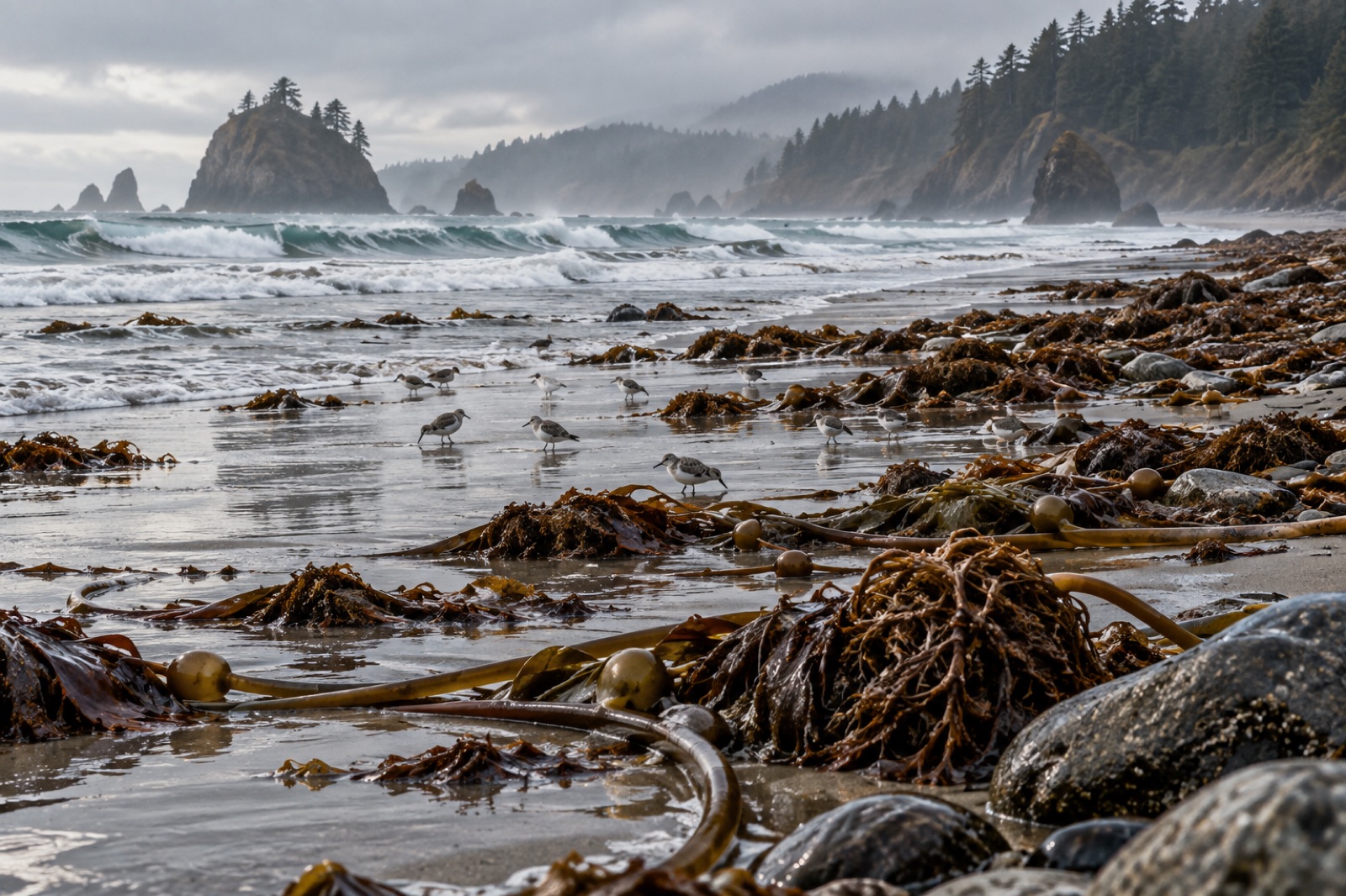
For kelp, the significance of this geology is that the subtidal zone is a patchwork: bedrock reef and boulder field close in, interleaved with sand plains channelled by longshore drift. Kelp anchors to the hard substrate where it can; it does not grow on the sand. The result is a broken, island-arc pattern of kelp beds and eelgrass meadows — sugar kelp and other boreal species on the rocks, eelgrass in the sheltered lagoons — with the drift-kelp and detritus from all of it washing up on the beaches after storms in quantities that tell you exactly how much is growing offshore. We looked at that process in drift kelp and wrack.
The warming gulf
If you want to understand why the Magdalens matter to kelp science, start with the water. The deep water of the Gulf of St Lawrence has been warming for decades, and the gulf as a whole is now well established as one of the fastest-changing large marine systems in the North Atlantic. The causes and consequences are the subject of ongoing research and monitoring; what matters for this guide is what that change does to the boundary of kelp habitat.
Kelp is a cold-water organism that needs summer temperatures to stay within a workable range. In the southern gulf, that range has been narrowing: the warmest summer waters now reach levels that cause stress to the cold-adapted kelps that dominate here. The islands sit near the poleward edge of comfort for those kelps — close enough to the limit that the margin itself has become information. Which reefs keep their kelp, and which don't, is now a climate question.
That is what makes the Magdalens a sentinel site. The same process is visible, in different keys, in our guide to the Gulf of Maine — another region where the warming reached the coast early — and in the larger picture in our marine heatwaves explainer.
The kelp beds and their neighbours
The kelp communities here are boreal: dominated by sugar kelp (Saccharina latissima), with large shoals of other Laminarian species banding the rocky subtidal reefs that ring the islands' headlands. In the sheltered lagoons behind the outer dunes, eelgrass meadows fill the sandy shallows, and together the kelp and eelgrass make up the productive core of the inshore ecosystem.
The fauna that uses the kelp is characteristically northern. Lobster — the fishery the islands are best known for — depends on the reef structure kelp helps create. Cod, when it is present at all, uses the same ground. Scallops live on the adjacent sand. In winter, harp seals haul out on the gulf ice to pup, an annual event that links the islands' identity indissolubly to the cold. And in the drift kelp and wrack the storms deposit along the beaches, a storm's worth of productivity is returned to the land, where it feeds the beach ecosystem above the tide line.
The islands' cultural identity is Acadian and francophone, and the relationship to the sea is intimate: lobster boats put out from every village, and the rhythm of the fishing year structures the rhythm of life. Restaurants on the islands serve what the boats catch that day; the seafood is simple, excellent and local.
What is changing, and how the islands are responding
Two pressures define the current moment:
- Warming and oxygen decline in the deep gulf. The deep water entering the gulf has warmed and carries less oxygen than it once did, a change that propagates upward through the food web and stresses cold-adapted species at the margins.
- Coastal erosion. The soft cliffs are retreating, and winter storms with reduced sea ice strike the shore with more energy than in the past. Some roads and lots of beach have already gone; the islands have been adapting their planning for years now, moving infrastructure back from the most exposed shorelines.
The kelp sits inside both stories. Its persistence or decline on any given headland is an early read on the local balance of warming water and continued hard substrate. A warming gulf doesn't mean the kelp forests fail overnight — but it does mean their margins are where the change is measurable first. For how kelp tracking data from coasts like this feeds into a larger picture, our piece on satellites and kelp monitoring is the right companion read.
Visiting: kelp from above and below
The Magdalens are reached by ferry from Prince Edward Island or by air. The best months for a kelp-minded visit are summer and early autumn, when the water is warmest for snorkelling and the coastal roads reach all the outer headlands.
- From a boat or kayak. The inside bays and lagoons are protected water ideal for paddling, and the kelp fringe is visible from any clear patch.
- From the beach. Storm wrack on the outer beaches after an autumn blow is a real kelp ID course in itself; the diversity of species in a single drift line will surprise you.
- Snorkelling. The sheltered eastern bays offer clear, calm snorkelling over kelp-covered rock in August and September; bring a wetsuit — see our cold-water snorkelling kit guide — and check the wind.
Key takeaways
- The Magdalen Islands occupy one of the fastest-changing large marine systems in the North Atlantic, making their kelp a genuine climate sentinel.
- The islands' soft sandstone geology sets up a patchwork of kelp reefs and eelgrass lagoons, linked by longshore sand drift.
- Lobster, cod, harp seals and seabirds all depend in part on the reef and kelp structure the nearshore zone provides.
- Coastal erosion — driven by storm energy and reduced winter sea ice — is eating the islands measurably and reshaping local planning.
- Visiting in summer–early autumn offers the best kelp access by boat, kayak and snorkel.
FAQ
Are the Magdalen Islands part of Quebec?
Yes — the archipelago is part of Quebec, despite sitting much closer to Prince Edward Island, Nova Scotia and Newfoundland. The islands are francophone and Acadian in character, and their cultural identity is distinct from the Quebec mainland in ways the island community takes pride in.
How warm does the water get in summer?
Coastal surface temperatures in the gulf can reach the high teens Celsius in a warm August — warm enough for comfortable snorkelling in a wetsuit — while deeper water stays much colder. But the warming trend that matters to the kelp is at depth, where the long-term data show the gulf's waters warming and losing oxygen, and that trend has continued across recent decades.
What is the kelp mostly used for in the Magdalens?
The kelp itself is not the centre of a local harvest industry the way it is in, for example, Norway or Brittany. Its role here is ecological: supporting lobster habitat, stabilising the nearshore food web, and making up the productive fringe that feeds the islands' most important fisheries. Drift-kelp use on the land has a traditional history; the modern economy is built on the fisheries the kelp supports.
Why is the coast eroding so fast?
A combination of factors: the sandstone itself is soft; the sea ice that once protected the shore through winter has thinned and shortened its season; and storm energy has shifted. Winter storms with reduced ice cover strike the shore with more wave energy than the same storms would have with ice. The erosion is real and measurable — the islands' response to it has become one of the better-studied adaptation stories in Canada.
Can you see seals when you visit?
Harp seals could once be seen pupping on the ice in late winter, and the spectacle remains part of the islands' image. Whether and where the ice forms in any given winter has become less reliable than it once was, which is itself part of the larger story this coast is telling. Summer visitors can sometimes see seals from the water; guided boat trips are the best route.