Atlas11 min read
Kerguelen: Giant Kelp in the Sub-Antarctic
A coastal atlas guide to the Kerguelen Islands — vast giant kelp beds at 49°S, elephant seals and king penguins, iron-fed blooms, and the wildest kelp wilderness few will see.
Tom Okafor ·
Macquarie Island's giant kelp forests became the first marine ecosystem listed as Critically Endangered on the IUCN Red List — a subantarctic warning in full view.
Halfway between Tasmania and Antarctica there is an island most people will never see: Macquarie Island, 34 kilometres long, barely five wide, rising out of the Southern Ocean at 54 degrees south. It has no permanent human population, no harbour, no trees — and around its wave-hammered shores grows one of the most remarkable kelp formations on Earth, a subantarctic giant kelp belt so distinctive that in 2019 it became the first marine ecosystem in the world formally assessed as Critically Endangered on the IUCN Red List of Ecosystems. This guide explains what those forests are, why they were listed, and what their fate tells every other kelp coast to expect.
Macquarie Island sits on the Macquarie Ridge, a narrow submarine mountain chain where the Australian and Pacific tectonic plates grind past each other. The rocks of the island are oceanic crust — mantle peridotite and basalt lifted bodily above the sea, one of the few places on Earth where you can walk on rock that belongs properly to the deep seafloor. That geologic oddity is the least of its distinctions.
Oceanographically, the island stands directly athwart the Antarctic Circumpolar Current, the most powerful current on Earth, which rings Antarctica and links the three great ocean basins. Currents, swell and storm systems arrive with the whole fetch of the Southern Ocean behind them; there is no real summer calm season. Air temperatures hover around 3 to 9°C year-round. Expectations shift in this place: isolation is the baseline, disturbance is the constant, and survival here selects for species that can endure.
Politically the island belongs to Tasmania, which administers it from Hobart as a nature reserve and World Heritage Area, with a small scientific station at the northern isthmus. That administrative connection matters, because it makes Macquarie Island part of the same state system watching the more famous giant kelp story unfold across Tasmania's warming east coast — two ends of one tragedy told in the same language.
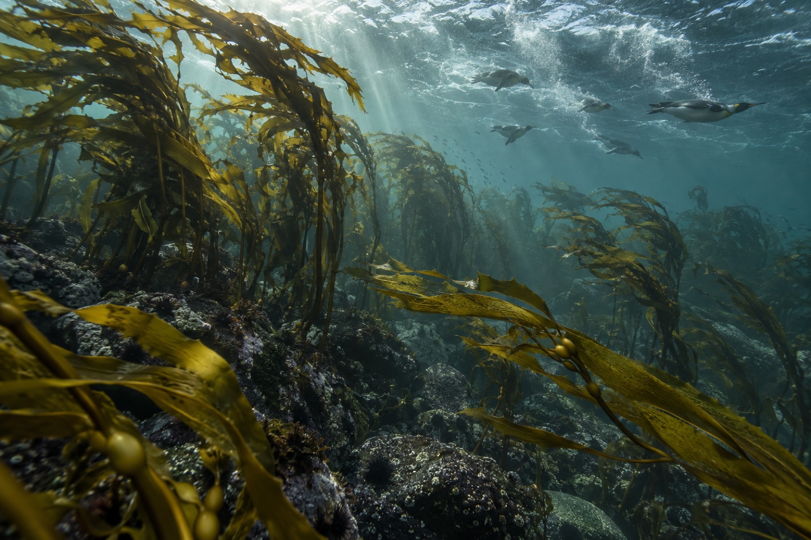
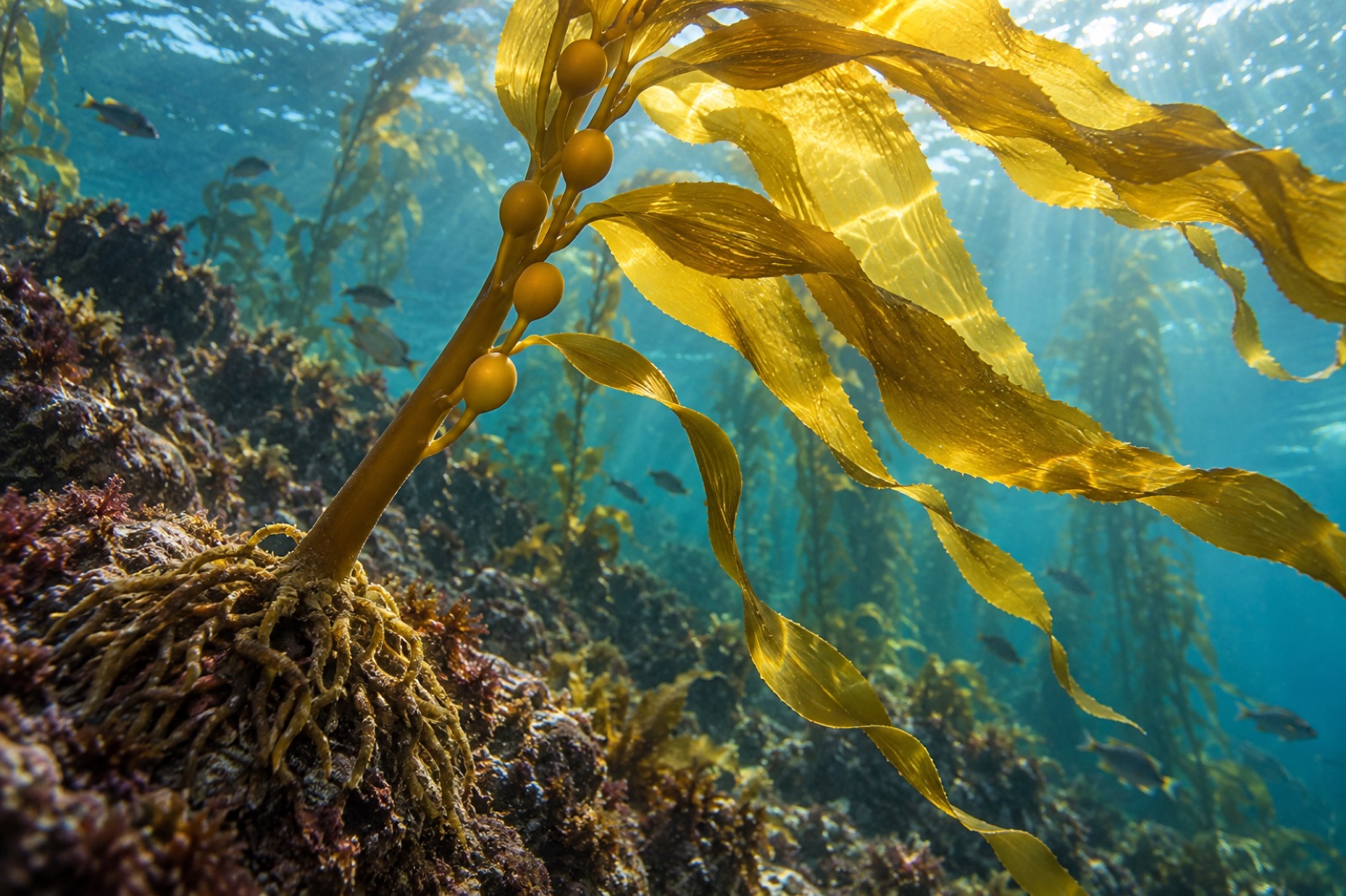
Macquarie's kelp is giant kelp (Macrocystis pyrifera) — the same species that forms the famous forests of California and the coast of Chile, but here growing at the fringe of its world. Giant kelp has an almost global distribution across the temperate and subantarctic Southern Hemisphere; Macquarie's forests are the most southerly substantial stands of the species anywhere, possibly the most southerly of any kelp forest worldwide. Around the island's rocky shoreline — where rock exists at all, which is not everywhere on this young uplifted terrain — the kelp forms a surfacing canopy in the shallow subtidal, down to ten metres or so, a green-brown ring around an island otherwise grey.
The physical engineering is extraordinary. Macrocystis at Macquarie must hold a rocky bottom through some of the most violent wave conditions on Earth; holdfasts that elsewhere anchor a quiet-coast plant have to resist Southern Ocean storm fetch. And yet it does hold on — and in doing so it makes a habitat. The forests are nursery and shelter and feeding ground for the island's marine ecosystem in exactly the way that a kelp forest is everywhere: under the canopy structure the water calms, the light dims, and a three-dimensional world of fish, invertebrates, seabird foraging routes and seal hunting grounds opens up.
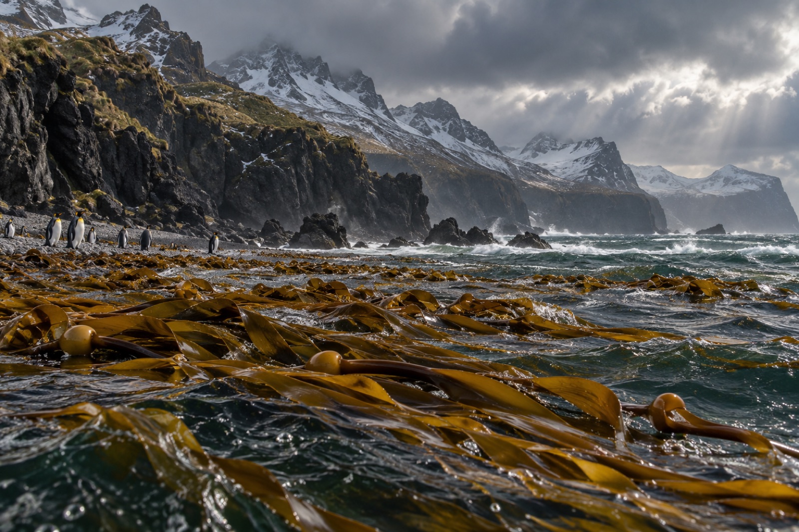
Macquarie is justly famous above the waterline for its penguins — several hundred thousand royal penguins, found almost nowhere else, plus king, gentoo and rockhopper penguins in their own colonies — and for elephant seals so numerous that by late summer the beaches brown over with them. The kelp ring is where much of this mammal and bird economy meets the sea: penguins porpoising out through the canopy, elephant seals travelling in the kelp shade, fur seals hunting through it. The forests are not an ornament on the island's ecology; they are infrastructure.
Macquarie's troubles began with sealing ships in 1810. Within decades the fur seals were nearly exterminated; elephant seals followed, reduced to a fraction of their former population by the end of the nineteenth century. Penguins were boiled down for oil in industrial quantities. Then, as so often on subantarctic islands, the introduced mammals finished the interior work: ship rats, house mice, feral cats and — most destructively for the vegetation — European rabbits, which multiplied across the island's cold grasslands through the twentieth century until whole slopes were grazing to bare peat. The damage cascading up from the kelp and down across the land by 2000 was so severe that entire slopes were slumping in landslips.
The response, run jointly by the Australian and Tasmanian governments in the world's largest island eradication programme of its kind, removed rabbits, rats and mice by 2014 using aerial baiting followed by a dog-and-hunter cleanup phase. The island was declared pest-free — a titanic achievement — and the recovery since has been among the most gratifying conservation stories in the Southern Ocean: vegetation rebounding, burrowing petrels recolonising, the great seabird and seal colonies rebuilding. Macquarie proves that even badly damaged subantarctic island ecosystems can be brought back, if the political will and money can be found.
Against that recovery story stands the kelp problem. In 2019 the Macquarie Island giant kelp forests were assessed under the IUCN Red List of Ecosystems framework and listed as Critically Endangered — the first time any marine ecosystem anywhere had entered the list at that level. The assessment was serious, quantitative and grim: long-term survey data showed the forests had lost a vast majority of their extent since the 1970s, driven by the only plausible force at work — the warming and freshening of the surrounding Southern Ocean. Giant kelp at this latitude lives at the cooler edge of nothing; a few degrees of sustained ocean warming erodes the belt, and with it the ecosystem it structures.
The listing was a warning shot the kelp world has been talking about ever since. Here was a documented, statistically rigorous Red List assessment, following the same logic as a species listing, applied to an ecosystem — not a species, not a habitat marker, but a whole forest in the sea, projected to collapse. Our explainer on marine heatwaves covers the ocean physics that drives such tipping points at a global level. Macquarie just happened to be measured beautifully enough, and for long enough, to make the diagnosis unignorable.
It also connected Macquarie to a wider subantarctic pattern. The giant kelp forests of Kerguelen, the Snares and Antipodes, and the forests around South Georgia and the southern Fuegian archipelago all sit in similar marginal positions, at the edge of range or climate, and are watched for the same signatures.
It is reasonable to ask what is at stake in a kelp belt on an island almost nobody will visit. A few answers, in increasing order of generality.
Firstly, the kelp is ecosystem structure on an island whose land is treeless. It provides the only three-dimensional sheltered habitat in the shallow sea around Macquarie, and its decline ripples directly through the island's fish, invertebrate and foraging-seabird ecology. Secondly, the kelp belt is one of the Southern Ocean's clearest climate warning systems: a marine ecosystem quantified well enough, early enough, that change in it serves as evidence for the change everywhere. When scientists discuss what the Southern Ocean will look like at two degrees of warming, Macquarie's forest data is part of the answer. And thirdly, at the most general, the listing itself matters: it demonstrated that an ecosystem — not only a species — can be assessed, listed and tracked as a conservation target. That is a conceptual tool the whole field now uses.
Tidewright can say plainly here what a fictional company should not overclaim: we have no programs at Macquarie Island, and we are unlikely ever to work there. What we have is a standpoint. A forest this remote and this endangered is the reason restoration science exists — the standing invitation to stop measuring decline and start practising return. The work we do on more accessible coasts, from our projects described in this atlas, is deliberately built toward the same question Macquarie poses most starkly: how do you regrow what the ocean is ungrowing?
There is no practical way for most people to visit Macquarie Island. The only transport is by expedition ship from Hobart or New Zealand — a voyage of several days each way into the Roaring Forties — and only a handful of vessels are permitted each year, with strict visitor caps, rigorous biosecurity and time ashore limited to designated sites. The biosecurity alone is worth noting: after the 2014 eradication, the island's greatest vulnerability is the accidental reintroduction of rodents or invertebrates, and every boot, bag and camera case is inspected to a standard normally reserved for quarantine laboratories. Anyone who does go will see penguins and elephant seals in densities no wildlife documentary prepares them for, and — on the rare, lucky calm day — the green-brown gleam of the kelp belt under the swell.
For the rest of us, the island exists as a thought as much as a place: the outer edge of what can be known about the ocean, and of what can be lost from it quietly. The atlas includes places like this precisely because they recalibrate the reader. If a forest here can go critically endangered at the bottom of the world, under almost no direct human pressure, the kelp on the crowded coasts the rest of this atlas describes is not safe anywhere by default. It will be saved deliberately, or it will not be saved.
Because it was unusually well measured. Long-running subantarctic survey programmes had generated decades of quantitative data on forest extent, so when the ecosystem-assessment framework was applied, the data showed a collapse severe enough to justify the highest threat category. Other marine ecosystems were almost certainly in similar states; Macquarie was simply the one whose records made the diagnosis unavoidable.
Direct grazing by urchins — the classic driver of kelp collapse on temperate coasts — is a minor issue at Macquarie compared with elsewhere. The pressure there is physical and chemical: warmer, fresher water stressing physiology, storm removal accelerating. The marine food web benefits from the kelp enormously — penguins, seals and fish all use it — but the forest itself is being dismantled by ocean conditions rather than by herbivores.
A very small number, on permitted expedition voyages from Hobart or New Zealand during the summer season. Landings are strictly controlled, biosecurity is close to surgical, and the voyage itself is days of Southern Ocean each way. It is among the least-visited World Heritage Areas on Earth, which is largely the point of how it is managed.
They are different expressions of the same underlying thesis: the Southern Ocean and the East Australian Current are both warming, and giant kelp in this region lives near its thermal edge. Tasmania's east coast has lost most of its forest to urchin expansion riding warmer current water; Macquarie's belt is fading because the ocean itself is moving out of the species' tolerance. Two mechanisms, one planetary driver.
A coastal atlas guide to the Kerguelen Islands — vast giant kelp beds at 49°S, elephant seals and king penguins, iron-fed blooms, and the wildest kelp wilderness few will see.
Tom Okafor ·
A coastal atlas guide to New Zealand's subantarctic islands — surf-gripped bull kelp, endemic penguins and parakeets, sea lion recovery, and the mouse eradication that worked.
Dr. Mara Ellison ·
Giant kelp is the fastest-growing organism on Earth and the architect of undersea forests. Learn its biology, life cycle, range and why it matters.
Dr. Theo Nakamura ·