The northern half of the Salish Sea is the Strait of Georgia: roughly 240 kilometres long and up to 40 wide, pinned between the mountainous spine of Vancouver Island and the fjorded mainland of British Columbia, and roofed by nothing but cloud and gulls. It looks like open sea from the ferry deck, but oceanographically it behaves like a vast estuary — and that single fact explains everything about its kelp, its herring, its whales and the way its water shines green.
A sea within a sea
More than two-thirds of the fresh water entering the entire Salish Sea arrives through the strait, and most of it comes down one river: the Fraser. From May through September, the Fraser's plume spreads a low-salinity, sediment-laden lens across the southern strait, riding out over salt water and drawing deep, nutrient-rich Pacific water in underneath — classic estuarine circulation at a scale of thousands of square kilometres.
The plume does three things that matter for reefs. It feeds the plankton engine: spring and summer blooms turn the surface opaque emerald, which is why the strait's water reads green rather than blue. It stresses kelp locally where salinity and light drop near river mouths. And it feeds the estuaries — the Fraser delta itself, the Cowichan and the Englishman — whose eelgrass and tidal flats are nurseries for the juvenile salmon that everything else in the strait, at one remove, eats.
The bathymetry helps. Much of the strait exceeds 300 metres, deep enough to hold a reservoir of cold water year-round; sill-restricted passages at its southern end, through the Gulf Islands into Haro Strait, are the valves where the whole system exchanges with Juan de Fuca and the open Pacific.
The kelp: bull kelp on sheltered rock
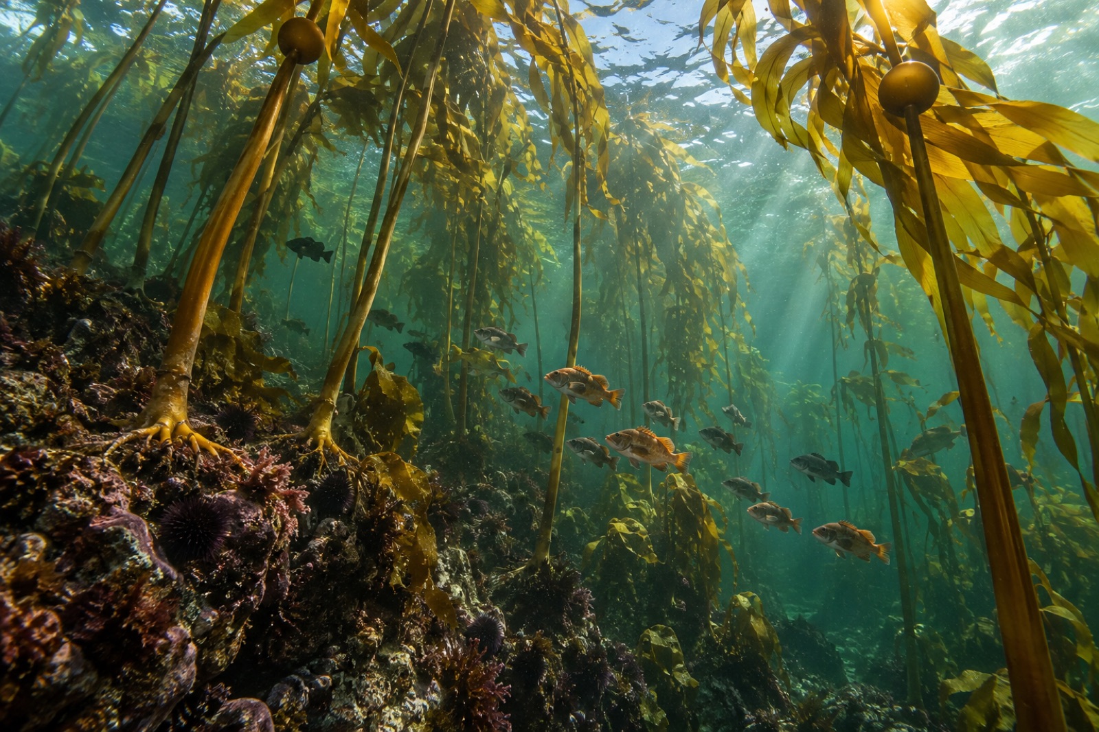
The strait's canopy species is almost entirely bull kelp, an annual that has to rebuild its forest from spores every winter and run a 20-metre race to the surface by midsummer. The thickest beds fringe the southern and central Gulf Islands — Galiano, Saturna, the Gabriola passages, Tumbo and Cabbage islands — and the points of the Saanich Peninsula, anywhere low rock meets moving tidal water within reach of open-sea nutrients.
Two patterns define the strait's kelp. It is patchy, because much of the strait floor is deep or soft, and the annual plant must re-establish each spring; satellite and kayak-based surveys by regional researchers show canopy area swinging sharply with the year's ocean conditions, thinning after warm anomalies such as the 2014–2016 northeast Pacific heatwave known locally as "the Blob." And it is layered: within sheltered bays, sugar kelp and other brown understory seaweeds carpet the shallows beneath the bull kelp canopy, a quieter forest that survives what the annuals can't.
Giant kelp historically reached the strait's southern fringe — the beds at Race Rocks and Sooke at its foot — and its fortunes there are watched closely, because the strait is one of the places where a warming Salish Sea meets its coldest refuge water.
When the sea turns turquoise
For a few weeks each spring, usually in March, stretches of Vancouver Island's east coast flash milky turquoise: the Pacific herring spawn. Herring gather in the millions off the shores from Parksville and Comox down past Nanaimo and around Hornby and Denman Islands, laying egg layers so thick on kelp fronds and eelgrass that the blades bend under the weight.
The spawn is the strait's great subsidy. Sea lions raft and bark for weeks above the shoals; harbour seals work the shallows; bald eagles line the beach logs in rows; surf scoters and other diving ducks arrive by the tens of thousands to gorge on roe; grey whales, on their spring migration, pause to roll the eggs off the eelgrass beds. Roe-on-kelp was and is a treasured harvest for Coast Salish nations — fish laid on kelp fronds, dried, traded far inland — and the modern spawn remains a conservation flashpoint, because herring abundance shapes the whole food web of the strait, from chinook salmon to killer whales.
Whales in a working sea
The strait is busy water: container traffic to Vancouver, the ferry fleet, tugs, barges, fishing boats and, from April on, whale-watching fleets. Against that backdrop, three whale stories play out.
Southern resident killer whales — the salmon-eating population whose numbers have hovered in the seventies in recent censuses — hunt Fraser River chinook through the strait, their fortunes tied to the estuary's salmon runs. Bigg's (transient) killer whales, seal hunters, have become startlingly common: quiet pods sliding along shorelines where, two decades ago, a sighting was an event. And humpbacks have staged a genuine return, dozens now feeding and even wintering in the strait, breaching off the Sunshine Coast within sight of commuter ferries — a recovery large enough that shipping-strike risk is an active management conversation, and one Tidewright's own acoustics team watches as a case study in whale-heavy working water.
Islands, narrows and sunken ships
The Gulf Islands are the drowned ridge of the same rock that builds the Saanich Peninsula, and their passes concentrate the strait's life. At Gabriola, the sandstone Malaspina Galleries overhang water where seals poke about the kelp; off Snake Island, the retired destroyer escorts HMCS Saskatchewan and Cape Breton, sunk in 1997 and 2001 by a volunteer artificial-reef society, stand upright in growth of plumose anemones — among Canada's most-dived wrecks. Hornby Island's Flora Islet is a famed summer haunt of enormous, gentle bluntnose sixgill sharks drifting up from the deep to cruise the kelp edge. On the mainland rim, the Sunshine Coast's Skookumchuk Narrows pours the entire Sechelt Inlet through a gap barely 30 metres deep at standing waves kayakers travel continents to play on.
For divers, the strait offers cold, green, rewarding water — a world apart from the rock-walled clarity of neighbouring Howe Sound but with far more sheer animal biomass in season. It's honest visibility, 3 to 10 metres on a good day, and honest skill requirements; shore divers in the region often learn at Whytecliff Park before venturing to the island wrecks.
Visiting the strait
- Hornby Island: Helliwell Provincial Park's bluff loop looks down on bull kelp beds and eagle nests; Tribune Bay offers the strait's closest thing to warm swimming. Summer weekends demand ferry patience.
- Gabriola Island: shore access to the Malaspina Galleries, tidepools rich in nudibranchs, and boat dives on the two artificial-reef destroyers via Nanaimo operators.
- Herring spawn: watch from headlands at Qualicum Bay or Hornby's Ford's Cove in March. Bring binoculars; the sea lions will find you first.
- Sunshine Coast: Saltery Bay Provincial Park for shore diving and the underwater mermaid; Skookumchuk Narrows Provincial Park for the sheer spectacle of the tidal race, best at a big exchange.
- Whale watching: departures from Vancouver, Steveston and Nanaimo cover the strait's southern resident, Bigg's and humpback waters; choose operators following distance rules.
Key takeaways
- The Strait of Georgia is an estuary at sea scale — the Fraser River's plume drives its productivity, its green water and much of its food web, while deep basins keep a reservoir of cold water.
- Bull kelp is the strait's canopy tree: annual, patchy, thickest around the Gulf Islands, and swinging with each year's ocean conditions.
- The March herring spawn, when eggs whiten kelp and eelgrass, is the strait's keystone biological event — feeding eagles, sea lions, whales and sustaining traditional roe-on-kelp harvests.
- The strait shows recovery and risk side by side: humpbacks and Bigg's killer whales thrive amid heavy shipping, while southern residents depend on the Fraser's strained chinook runs.
FAQ
Is the Strait of Georgia part of the Salish Sea?
Yes. The Salish Sea is the collective name, adopted in 2009–2010, for the connected inland waters of the Strait of Georgia, Puget Sound and the Strait of Juan de Fuca. The strait is its northern and largest basin, exchanging with the Pacific through Juan de Fuca via Haro and Rosario straits.
When is the best time to visit for kelp and wildlife?
Bull kelp canopy peaks from mid-summer to early autumn, so July to September shows the fullest forests — and warmest surface water, often 17–20°C in shallows. March brings the herring spawn; August and September are strong for humpbacks. Storm season from November can strip annual kelp beds to their holdfasts within days.
Can I snorkel or dive in the bull kelp?
Yes — this is one of Canada's great cold-water diving regions. Summer offers the mildest conditions, but visibility is green and variable; treat it as temperate diving with full thermal protection. Join local operators for the Nanaimo wrecks and Sixgill sites rather than solo-exploring passes with strong tidal flow.
What threatens the strait's kelp?
Marine heatwaves top the list — warm, low-nutrient surface water weakens annual bull kelp. Closer to cities and farms, excess nutrients and freshwater plumes fuel epiphytes and murk the light; sea urchins take over where predators decline; and shipping anchors, moorings and waterfront hardening erase kelp bed rock metre by metre. Layered local protections and monitoring, including Canada's marine protected area planning in the southern strait, are the active response.
Why is the water so green?
Two reasons stacked: the Fraser plume freshens and stratifies the surface, and that stable, nutrient-fed surface blooms with phytoplankton through spring and summer. Add glacial silt from Howe Sound's rivers at the northern end and you get the jade-green water that makes the strait's white shell beaches so luridly beautiful at low tide.