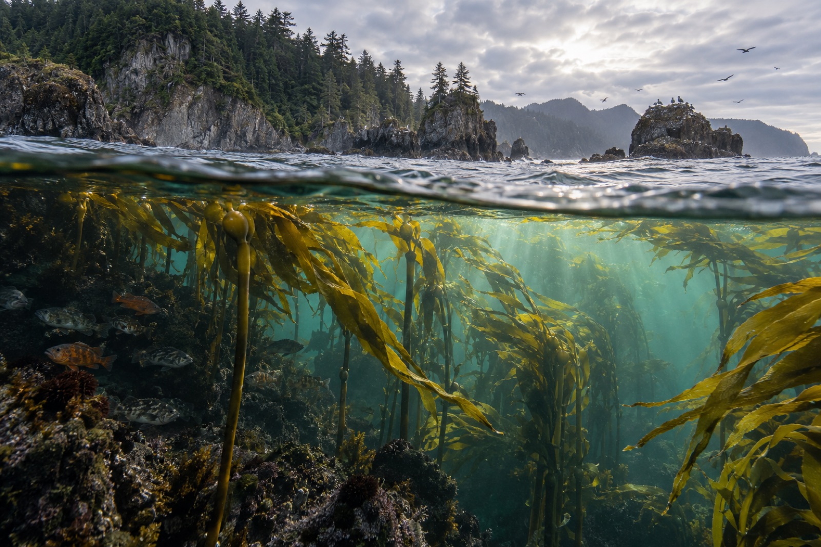
Every inland sea has a door, and the Salish Sea's is the Strait of Juan de Fuca: a hundred-mile corridor between Vancouver Island and Washington's Olympic Peninsula, thirty to sixty kilometres wide and up to a hundred fathoms deep, through which the whole of Puget Sound and the Strait of Georgia breathes in and out twice a day. On one side lies the cold, upwelling-fed Pacific; on the other, the calm, rain-fed labyrinth of the inland sea. Where they mix, life piles up — and the kelp forests that fringe the strait's rocks are among the most dynamic in North America.
Two seas, one doorway
The physics is what makes this place. The Pacific side delivers cold, salty, nutrient-dense bottom water — upwelled by summer's northwesterlies — that slides into the strait as a deep inbound current. The inland side returns a brackish, sediment- and plankton-laden surface layer flowing out: the Fraser River alone moves more freshwater than all the rivers of California combined. Two layers travelling opposite directions over and under each other, squeezed by the strait's width, streaked by its tides — this is estuarine circulation at grand scale, and it never stops.
The tide makes it theatrical. Where the current is pinched — off Race Rocks at the eastern end, between the San Juan Islands, at the neck by Victoria's harbour — the water runs at five, six, even eight knots. Ekman transport, upwelling, freshwater plumes, tidal mixing: the strait compresses the whole toolkit of coastal oceanography into a single channel. For a deeper dive on the upwelling side, see upwelling explained; for the fronts where these waters collide, see ocean fronts and productivity.
The kelp: frontier forests in fast water
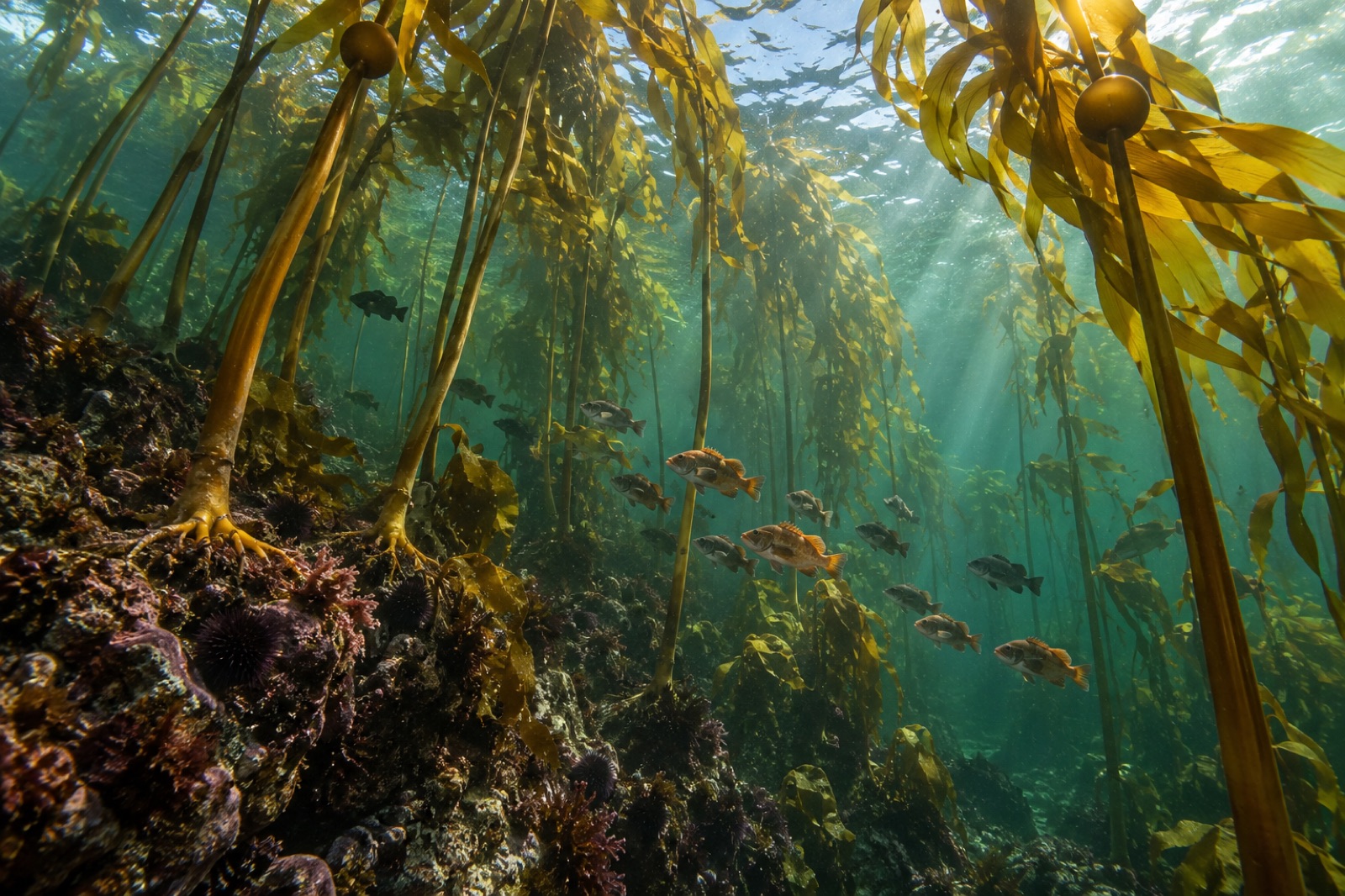
The strait's canopy is chiefly bull kelp, with a historically important presence of giant kelp at its eastern edge. Three patterns define it:
It grows in current. The strait's kelp forests are tidal-rapids forests — rooted in rock swept by swift water that keeps the blades bathed in nutrients and sweeps grazing urchins' drift food to them. Bull kelp fringes Pillar Point, Freshwater Bay and the ledges off Neah Bay on the American shore; on the Canadian side it beds thick from Sooke west through Jordan River to Port Renfrew, with isolated stands east toward Race Rocks.
It fluctuates hard. Because the canopy spans the boundary of two very different water masses, it is exquisitely sensitive to the year's balance: strong upwelling summers build huge forests on the outer strait; warm winters and strong outflow years thin them at the eastern end. Long-term satellite mapping by regional agencies and researchers — using the same satellite canopy detection techniques Tidewright applies at its own sites — shows canopy area swinging considerably year to year.
It holds a special reef. Race Rocks, the kelp-ringed islets off Victoria's southern tip at the entrance to Haro Strait, has been a protected ecological reserve since 1980. Giant kelp was historically abundant there alongside bull kelp; the reserve's underwater ledges in fast-water confine some of the richest shallow-rock biodiversity in British Columbia.
Cape Flattery and Tatoosh Island: where the strait meets the sea
At the strait's Pacific mouth, Cape Flattery — the northwesternmost point of the contiguous United States, on Makah Nation land — confronts the full ocean. The view from the Cape Flattery Trail, a splendid boardwalk walk through coastal rainforest, looks out at Tatoosh Island and its sea stack islets, every channel boiling with tidal current, kelp forests underwater smoothing the boundaries of the swell.
Tatoosh has been one of the world's great outdoor laboratories since the 1970s: decades of continuous research from the island have shaped modern ideas about intertidal zonation, keystone predators and the resilience of kelp communities to both harvest and change. It is where classic kelp-ecology questions were asked first, long before such sites were fashionable. The island itself is closed to visitors — the Makah keep it as a research and cultural preserve — but its presence frames everything else on this coast, and neighbouring reefs are open under tribal and state rules.
What eats, what hunts, what lives there
The strait's reefs support the full cast of Salish Sea kelp forest life. Kelp greenling and copper rockfish work the understory; lingcod ambush from the kelp shadows; harbour seals commute between haulouts at Race Rocks and the kelp fringes; river otters raft in the kelp beds of the Canadian shore. Sea otters are beginning to return, slowly, from reintroduced populations on Washington and Vancouver Island — their arrival changes the urchin economy of every reef they settle, as our trophic cascades explainer describes. Offshore, southern resident killer whales patrol the strait's salmon runs; humpbacks and grey whales fish the krill lines of the summer entrances.
The human shore
The strait has been saltwater homeland for the Makah, Nuu-chah-nulth, Pacheedaht, T'Sou-ke, Sooke and Songhees peoples among others since time immemorial — the name "Juan de Fuca" itself comes from a Greek navigator, Apostolos Valerianos, claiming service under the Spanish crown in 1592, a thin modern label laid over cultures measured in millennia. European vessels that followed — Cook, Vancouver, Eliza — mapped the strait as the hoped-for Northwest Passage entrance; what they charted instead was the doorway to one of the world's great inland seas.
Today it is also the busiest shipping doorway to the Pacific Northwest: container ships and tankers for Vancouver, Seattle and Tacoma ride the inbound lanes within sight of the kelp reefs — a juxtaposition that underpins ongoing indigenous-led and governmental work on shipping safety, spill response and whale-ship strike prevention along the strait.
Visiting the strait's kelp
- Cape Flattery Trail (Neah Bay): a gentle 1.2-kilometre boardwalk to the strait's outermost point; Makah recreation permit required; dramatic views of Tatoosh and its kelp-fringed islets.
- Salt Creek Recreation Area (west of Port Angeles): county park with superb tidepools and, on late-summer calm days, bull kelp beds close enough to wade out to and view from SUPs and kayaks; snorkelling is possible here under strict, conservative conditions.
- French Beach, Sombrio Beach and Jordan River (Vancouver Island): the strait's surf and beach-walk rim, with offshore canopy visible on calm days.
- Race Rocks Ecological Reserve: the reserve's kelp forest is visible on whale-watching boats from Victoria; landing is restricted, and the underwater life is for the kelp — but the conservation story is one of British Columbia's best.
- Diving: the strait offers advanced coldwater diving — tidal sites off Victoria, Ogden Point, and boat-dives around Race Rocks. Currents and cold rule: go with local operators, know your slack tables, treat it as subject for another dive guide entirely (as for Deception Pass further inside the Salish Sea).
Key takeaways
- The strait is a 100-mile mixing corridor where Pacific upwelling and Salish Sea outflow meet; its estuarine circulation and tidal races shape everything including the kelp.
- Bull kelp fringe forests line both shores, trade strongly with the year's ocean conditions, and grow in some of the fastest tidal water in the temperate world.
- Cape Flattery and Tatoosh Island, at the Pacific mouth, are a landmark of both Makah homeland and half a century of kelp-ecology research.
- Race Rocks shows how a protected, fast-water reef holds biodiversity; the strait remains working water — ships, salmon runs and whales share it daily.
FAQ
Where exactly is the Strait of Juan de Fuca?
Between Vancouver Island (British Columbia) and the Olympic Peninsula (Washington State), running roughly west-to-east from the Pacific Ocean into the Salish Sea. It is about 100 miles long and 12–25 miles wide.
Is there kelp in the strait, and can I see it without diving?
Yes. Bull kelp fringes both shores and the canopy is visible from beaches, the Cape Flattery Trail and whale-watching boats from June through October. Race Rocks has the most famous kelp ring viewable from tour boats.
Was there ever giant kelp in the strait?
Yes — giant kelp was historically abundant at Race Rocks and reefs eastward into Haro Strait. Localised age-offs and range edges mean the populations have contracted, and their fluctuations are monitored as one signal of warming pressure in the Salish Sea.
Can you dive the strait?
Yes, but it's advanced cold-water diving: strong tidal currents, low visibility spells, cold temperatures and heavy boat traffic. Take a local charter or guide, dive at slack tide on sites the operator knows, and carry a surface marker buoy as standard.
Why is the strait important for restoration?
It's a natural laboratory for kelp-in-current dynamics — how canopy persists and fluctuates under fast flow, upwelling variability and freshwater loading — informing how restoration sites are chosen on similar exposed, mixed-water entrances worldwide, from the Olympic Coast to the San Juan channels.