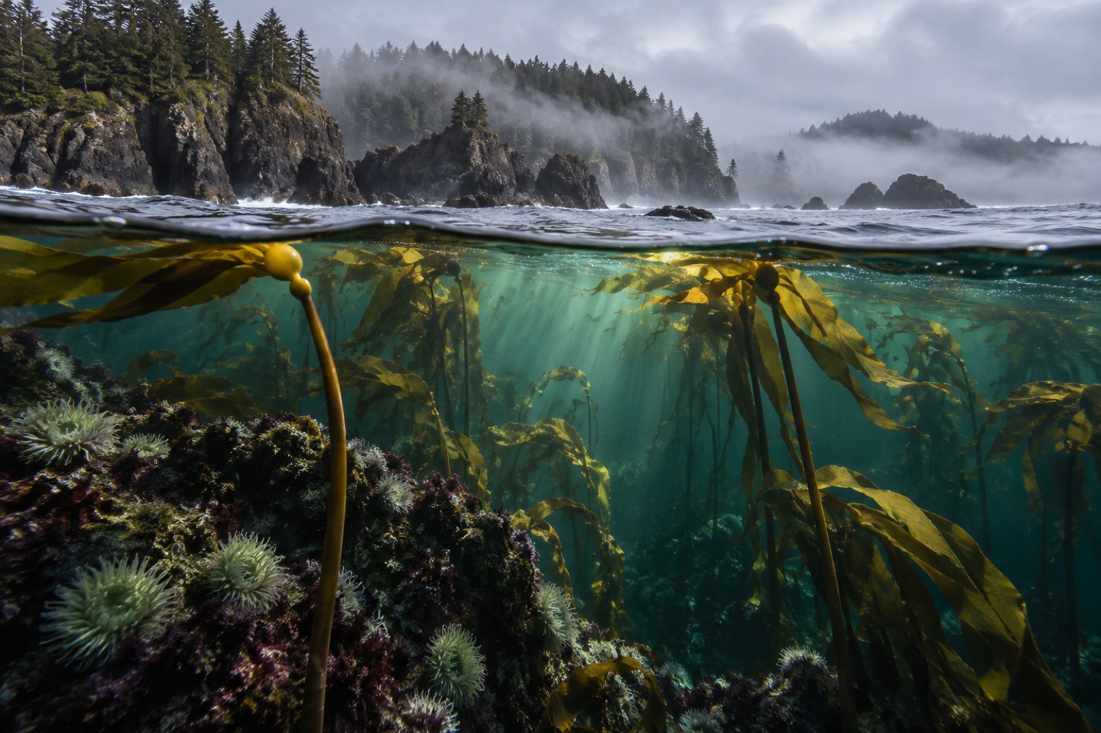
Every map of Vancouver Island shows you where the roads end. What the maps flatter is what lies beyond: a several-hundred-kilometre outer coast of open-ocean reefs, headlands and surf-swept bights that takes the full, unfiltered weight of the North Pacific. The famous indentations — Barkley and Clayoquot Sounds, covered in our Vancouver Island overview — are the coast's sheltered parlours. This guide is about the front step: the exposed outer shore, the shelf edge beyond it, the kelp that lives in the surge, and the honest logistics of getting near it.
Where the swell lands
There is nothing between Japan and this coastline but weather. Swell trains built by Aleutian storms travel thousands of kilometres of open fetch and make their first landfall here, on reefs with no offshore islands to blunt them. That single fact organises everything.
Wave exposure is the master variable of kelp ecology — it sets which species can hold on, how deep light-saturated habitat runs, and how disturbance resets the forest, as our explainer on wave exposure and kelp lays out in detail. On the outer coast the exposure is near the top of the global scale. The shoreline alternates between resistant bedrock headlands — where reefs step down in granite and conglomerate terraces — and stretches of sand beach where kelp cannot anchor at all. Between them sit surge channels and sea caves where water that arrived as a three-metre swell is compressed into pistons of white water. Kelp lives precisely in the band where that violence thins out enough to work in: deep enough to escape the breakers' direct punch, shallow enough to keep the light.
The shelf edge and its cold river
Twenty to sixty kilometres offshore, the seafloor falls away down the continental slope — and the shelf edge is where this coast's fertility is manufactured. In summer, northwesterly winds skim surface water offshore and deep, cold, nitrate-rich water wells up in its place, a process described in our upwelling explainer. Submarine canyons — including Barkley Canyon, one of the best-instrumented on the continent — act like funnels drawing that deep water onto the shelf and toward the reefs.
The biological consequence is a summer paradox: peak kelp-growing season arrives wearing fog. The cold upwelled water chilling warm moist air is why the outer coast's famous marine layer sits on the beaches in July while valley towns swelter. For kelp it is a subsidy, not a nuisance — fog means nutrients, and nutrients mean the fast spring growth that rebuilds the canopy each year.
The kelp of the open coast
Exposure chooses the flora. The outer reefs are dominated by bull kelp, the annual giant whose whole architecture reads as an answer to surf: a single flexible stipe, a gas bulb riding the surface, and blades that stream out like banners rather than fighting the flow. Bull kelp can grow from spore to twenty-plus metres in a single season, and on this coast it must — storms strip the beds each winter, and the forest is rebuilt from scratch each spring, a rhythm our piece on storms and kelp explores as a renewal mechanism rather than a catastrophe.
Under and between the bull kelp runs the understory that makes a bed a forest: sea cabbage and other winged kelps on the most battered rock, feather boa kelp lower down, coralline pink crusts paving the reef, and in deeper water the red and brown turf layers. Giant kelp — the perennial canopy-builder of the sheltered sounds — thins out on the open coast; out here, the annual strategy wins.
North of the road: Nootka, Kyuquot, Quatsino and Cape Scott
South of Nootka Sound the coast is famous; north of it, it is simply wild. A quick tour of the frontier the maps reach last:
- Nootka Sound and Yuquot — deep fjord-sounds with sheltered kelp in their arms and history at their mouths; Yuquot (Friendly Cove) is among the most significant Indigenous and early-contact sites on the coast, in the sea country of the Mowachaht/Muchalaht First Nation.
- Kyuquot Sound and Checleset Bay — the ecological hinge of modern BC: this is where 89 sea otters were landed from Alaska in 1969–72 to seed the province's recovery, and Checleset Bay Ecological Reserve now protects the heart of otter country (the reserve is closed to public entry — the point is the ecology, not visitors).
- Brooks Peninsula — a 14-kilometre fist of land jutting into the Pacific, unglaciated during the last ice age and legendary among mariners for doubled seas; its reefs face the largest opening on the coast.
- Quatsino Sound and Cape Scott — the island's northwest tip, where the outer coast ends against wide sand beaches and the swell finally wraps the corner. Cape Scott Provincial Park offers the rarest thing on this shore: trail-accessible outer-coast edge, reachable on foot.
Through the whole northern half, human settlement thins to a scatter of small communities, and the kelp beds stand essentially unwatched by roads. What monitoring exists is patchy — one reason exposed outer coasts are where autonomous survey craft, like the fictional Drifter vessels in Tidewright's (clearly illustrative) platform, are imagined to earn their keep.
Reading the coast from shore
You do not need a drysuit to meet this coastline; you need timing and respect.
The storm-watching season — roughly November through February — is when the outer coast shows you what it is: swell stacked to the horizon, forests of bull kelp reduced to wrack lines metres deep on the beaches, and the full drama the summer calm politely forgets. The summer window (June to early September) brings smaller seas, fog banks at dawn burning off to long calm evenings, and the lowest tides of the year exposing the intertidal zones in the early morning. On a good low tide, an outer-coast headland pools read like a transect: surfgrass at the top giving way to sea palms on the most battered rock, then the first bull kelp holdfasts where the water never quite leaves.
The etiquette is safety dressed up politely: never turn your back on an outer-coast swell, watch a full cycle of sets before committing to any rock, and treat inbound tides and fog banks as hard constraints, not suggestions.
Access: who goes, and how
This is a coast you approach on its own terms:
- By trail: Cape Scott and the North Coast Trail give backpackers days of true outer-coast walking; the Wild Pacific Trail at Ucluelet offers the accessible, two-hour sampler of cliff-edge swell and kelp.
- By water: water taxis and float planes out of Gold River, Tahsis and Port Hardy serve the sounds; expedition kayakers stage multi-week traverses in settled summer windows.
- By charter: offshore diving on the exposed reefs happens, in the hands of skippers who have spent careers reading this water, and only in the flattest conditions. It is expedition diving, not recreational — as remote and committing as anything in Haida Gwaii to the north.
The honest summary: the outer coast is not a destination so much as a commitment. Its kelp forests are among the least visited on the continent, and those of us who watch kelp coasts for a living count that as part of their value.
Key takeaways
- Vancouver Island's outer coast takes the full fetch of the North Pacific; wave exposure is the master variable deciding where kelp can grow and in what form.
- Summer upwelling at the shelf edge delivers the nitrate that powers the coast's fast spring kelp growth — and manufactures the famous fog.
- Bull kelp's annual, storm-adapted architecture dominates the open reefs; perennial giant kelp yields to it wherever the swell runs full strength.
- North of Nootka the coast becomes true wilderness: Kyuquot, Brooks Peninsula, Quatsino and Cape Scott, with Checleset Bay as the protected heart of sea otter recovery.
- Shore-based access runs from the Wild Pacific Trail sampler to multi-day Cape Scott backpacking; the exposed reefs themselves are expedition-only water.
FAQ
How is the outer coast different from the sounds?
Energy and architecture. Barkley and Clayoquot Sounds shelter their kelp behind islands and fjords; the outer coast takes full swell, which filters the flora toward storm-adapted annuals like bull kelp, keeps the rocky band scoured and lively, and makes access a weather negotiation rather than a calendar entry.
Can you scuba dive the exposed outer reefs?
Occasionally, in the flattest summer windows, with skippers who know the water — this is expedition-grade diving with real swell logistics, not a recreational charter. Most divers on this coast work the sound mouths and island groups, where the same species and more forgiving conditions meet.
When is the best time to visit?
It depends on the visit you want. Storm watching: November to February, from behind glass or on cliff-top trails. Calm water, low tides and kayak travel: mid-June to early September. The shoulder seasons give you both moods in the same week, which is arguably the truest reading of the coast.
Are there sea otters along the northern outer coast?
Yes — Checleset Bay, beside Kyuquot Sound, is the founding site of British Columbia's otter recovery, and animals have spread outward from there since the early 1970s. Seeing them reshapes the reef: urchins thin, kelp thickens, and the forest visibly knits itself back together along their frontier.
Do I need a guide to explore the north half?
For anything on the water, realistically yes — weather windows, landing logistics and emergency margins all argue for local knowledge. On land, the provincial-park trails at Cape Scott are self-sufficient hiking for the well-prepared; treat the ocean side of any headland as guided-or-go-home terrain.