Field Notes8 min read
Field Notes: Counting the Urchin Front
Join Tidewright's dive survey team as they count an advancing urchin front on Tasmania's coast — the methodical, cold, essential math of kelp restoration.
Jack Callum ·
Six days on Tasmania's kelp front line: a day-by-day diary of the baseline survey that will decide where Tidewright's next restoration lines go.
Field Notes are Tidewright's own dispatches from our restoration sites. They describe our fictional projects, crews and results — told as we live them. Restoration outcomes are illustrative and reported under our field monitoring protocols.
Every forest we grow back starts the same way: with a week of saying no. Before a single Holdfast line touches the water, a baseline survey crew swims the candidate reefs and answers two questions — what exactly is down there now, and which parts of it deserve our seed. Last month I ran that survey along the northern stretch of our Lumeriah Coast program, where the orange-lichen granite gardens of the Bay of Fires region meet some of Tasmania's hardest-hit kelp country. Here is the diary, nearly as written.
We stage out of St Helens, the fishing town at the south end of the bay, because the boat ramp is good and the coffee is better. The crew: five divers, one skipper, one Drifter hull — D-9, refitted for survey work with her sonar and camera sled — and a Pelican case of water sampler bottles for the eDNA program. Tonight's job is reading forecasts. A high is drifting east across the Tasman, and we have maybe five workable days before a southerly change. Baseline surveys are compressed years: everything must be measured now, because nothing here will be measured again until after we seed.
First light, slack water, 11°C at depth. D-9 runs the pre-plotted survey grid at walking pace, towing the camera sled while her side-scan sonar paints the reef in strips. We are mapping habitat, not scenery: reef versus sand, bare versus forested, and the tell-tale gravel-pale signature of urchin barren. By midday the day's track log shows what the fishermen already told us over the ramp-side chat last night — the kelp here is patchy now, holding on headlands and deeper edges, gone from the open mid-depth reefs where Tasmania's east coast used to carry it unbroken.
The divers spend the afternoon on calibration drops: swimming a known transect so the sonar signatures can be tied to what's actually there. You cannot trust a map until a person has corrected it with their eyes. That is not nostalgia. It is method.
Today is the slow work. Fifty-metre tapes go down on six reefs; along each, divers count everything in one-metre squares — kelp recruits, turf, juvenile abalone, and above all Centrostephanus rodgersii, the long-spined sea urchin that has been marching south with the strengthening East Australian Current for decades, turning rock to barren as it goes. We have done this count before, a hundred kilometres south, and written about the urchin front in an earlier note. Here the densities at two reefs are the highest I've measured for this program — illustrative numbers in our reports, but sobering ones.
One reef, though — a granite bank the local abalone divers call the Pinnacle — reads differently. urchins present but few, drift kelp collecting in the gullies, and a band of Ecklonia radiata, golden kelp, holding the shallow rim. Reefs like this are why we survey before we seed: they are either resistant or lucky, and either way they are the reference the recovery will be measured against.
Weathered to half-days by the afternoon sea breeze, so we run the eDNA bottle program: sixty litres of seawater, filtered through membranes fine enough to catch the genetic dust every living thing sheds. A litre of this water, sequenced back at the lab, will return a species list for each reef — fish we never saw, invertebrates too cryptic to count, an independent check on the dive team's eyes. The method is near-miraculous the first ten times you use it and merely excellent after that.
Between sets, our skipper takes soundings off the headlands where the orange lichen — the famous fired colour of this coast, a crustose species staining the granite — runs down almost to the waterline. Above water it's a postcard. Below it, the same granite is the reef architecture we're here to read.
The forecast southerly arrives early and we stand off the exposed reefs. Baseline surveys fail two ways: bad data, or no data recorded as if it were good data. We choose neither, and spend the day on the protected side logging video from Days 1–2, filing quadrat sheets, and arguing — professionally — about two candidate seeding blocks.
This argument is the most valuable hour of the week. Block A is an open mid-depth reef: classic barren, clean slate, easy to seed, easy to fail. Block B is the remnant edge beside healthy forest: harder to lay lines, but recruits there would arrive under the shelter of an existing canopy, with wild spores raining in on every current. The survey exists to make these arguments with numbers instead of preferences. The numbers say: seed B first, learn, then take the lessons to A.
Last workable day. D-9 runs her final sonar lines while the divers re-swim both candidate blocks, this time with the day's earlier data on our slates — check the sonar's "bare" calls, photograph the sediment pockets where Holdfast lines would sit proud, confirm current flow with dye on the flood tide. A kelp line laid across a sediment lens rots or buries; a line on clean boulder reef grips. These are the judgements that separate restoration from littering, and they are made at the scale of a lunchbox, one reef at a time.
We beach the gear at St Helens at dusk with the full baseline done: sonar mosaic, 214 quadrats, sixty eDNA filters, five candidate blocks ranked, two rejected outright — including one beautiful reef we walked away from because its recolonising turf algae said the system was healing itself. The discipline of leaving sites alone matters as much as the seeding; we wrote about one such decision before, in the site we left alone.
The seeding plan that comes out of this week will go to our partners and our ecologists, and eventually into the water as Holdfast lines carrying local-provenance giant kelp — the same loop we've run from Tinderbox to Hokkaido. Years from now, if the canopy returns here, every honest claim about it will trace back to these six days: what the water held, what the rock held, what we found before we touched anything. Restoration asks the ocean to do the growing. Our job is to show up with good numbers, local help and humility.
The southerly is on the water tonight, whitecaps past the mouth of Georges Bay. The survey is done. Now the forest gets its turn.
A structured measurement of a reef before any intervention: sonar or camera mapping of habitat, diver counts of kelp, urchins and other life along fixed transects, and water samples for eDNA analysis. It establishes "before," so any later recovery can be honestly attributed and measured.
The Bay of Fires region runs along north-east Tasmania, famous for orange lichen on its granite shores. Beneath the waterline those same granites hold temperate reefs — kelp forest, sponge gardens and, increasingly, urchin barrens as the long-spined sea urchin expands south on a warming current.
Because kelp seeded onto an active barren is food for urchins, not a forest. Barren mapping tells restoration crews where urchin pressure must be managed first, where remnant forest can shelter new recruits, and where a reef needs no help at all.
Filter a litre of seawater and sequence the shed genetic material in it, and you get a species list that includes everything divers missed — cryptic invertebrates, wide-ranging fish, early-warning sign of invasive species. It cross-checks the dive survey rather than replacing it.
In Tidewright's fictional Lumeriah program, baseline reports go through partner and science review first, then seeding is scheduled for the autumn window when water cools and wild spore release peaks — the same phenology the program follows further south.
Join Tidewright's dive survey team as they count an advancing urchin front on Tasmania's coast — the methodical, cold, essential math of kelp restoration.
Jack Callum ·
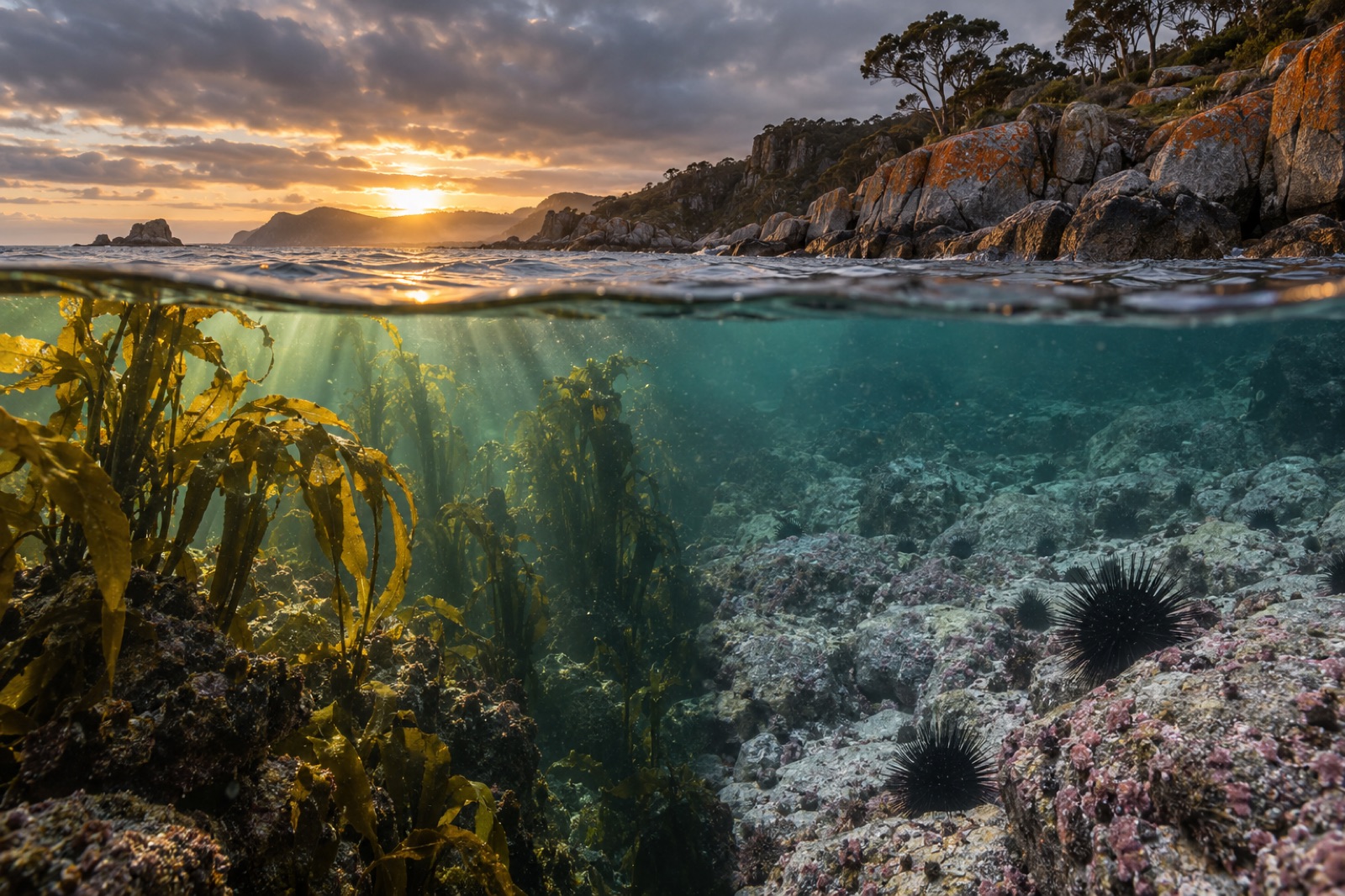
Tasmania's east coast has lost the vast majority of its giant kelp forests to warming seas and urchins. Explore what happened here, and what's coming back.
Dr. Lena Fischer ·
The science of alternate stable states on rocky reefs: how kelp forests collapse into urchin barrens, why barrens resist recovery, and how reefs flip back.
Dr. Mara Ellison ·