Field Notes8 min read
The Long Fog: Summer Operations in Mendocino
A field note from three fog-bound months on California's north coast: working around the marine layer, and why the fog and the kelp are the same story.
Jack Callum ·
A week flying multispectral drone surveys over Mendocino's recovering bull kelp: fog windows, canopy maths, and where the map still needs divers.
Field Notes are Tidewright's own dispatches from our restoration sites. They describe our fictional projects, crews and results — told as we live them. Our restoration outcomes are illustrative and reported under our field monitoring protocols.
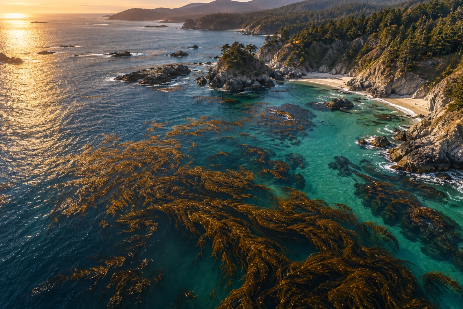
Every September at the Mendocino Barren Reversal site we do the same slightly silly-looking thing: a handful of people stand on cliff tops with binoculars and radios, herding a pair of survey drones up and down the coast in lawnmower lines while a dive boat idles offshore doing the same job by hand. It looks like overkill. It is, deliberately. This is canopy verification week — the week each year when the recovering bull kelp forest gets measured three different ways at once, and the week when our maps get told, politely and in person, where they're wrong. This note is about how a drone canopy survey actually runs, what the pictures really measure, and what this year's map showed.
Summer on this coast belongs to the fog — we've written a whole note about working inside the marine layer, and it rules canopy season too (The Long Fog). Dense summer canopy sits under a ceiling too low to fly in, which is one reason our summer verification falls to satellites on cloud-gap days and divers with upward cameras. September is the hinge. The north-westerlies ease, the upwelling relaxes, the fog loses its daily discipline, and we get what the pilots call "blue windows": ragged mid-morning to mid-afternoon gaps, some days ninety minutes, some days most of the day, some days nothing at all.
So the whole week is built backwards from the fog forecast. Two drone teams leapfrog along the coast so any window gets used wherever it opens. This year we flew 23 mission blocks across five flying days for a total of about eight hours of wheels-up time. That's canopy verification week at its most typical: five days of standing around, eight hours that matter.
Our survey aircraft carry a five-band multispectral camera — blue, green, red, red-edge and near-infrared — plus a standard photo camera for the pretty pictures. The physics that does the real work is simple: living kelp fronds reflect strongly in the near-infrared, and seawater absorbs near-infrared almost completely. Anything bright in NIR at the waterline on a calm surface is canopy; anything black is water. The classifier that turns pixels into map has it easier than almost any job in remote sensing, and it still needs supervision.
The flying itself is a compromise between maths and weather. We fly waylines at 120 metres, spaced for 80 percent forward and 70 percent side overlap so the imagery can be stitched into an orthomosaic with roughly three-centimetre ground resolution — fine enough that a single detached frond lying flat on the surface is its own little constellation of pixels. Wind is the real limit. Bull kelp canopy lies flat on the surface only when the sea lets it; a brisk northerly tucks the canopy under, bunches the fronds, and the same forest maps at two-thirds the area. So every flight carries a wind flag, and our unit of honest measurement isn't hectares, it's canopy-days — the area observed at a defined sea state, comparable from year to year only because we fly the same altitudes, the same seams, the same tide windows. Satellites taught us this humility twenty years of imagery ago; how satellites see kelp is the long version of the same problem with a much wider brush.
The unglamorous heart of the week is the cliff-top relay. Below drone altitude the terrain is all headlands and coves, and the aircraft drop their video link behind every point. So we run it like surveyors did a century ago: spotters on headlands with radios calling the aircraft's turns, a weather call every fifteen minutes, and a hard rule that nobody chases a fading window. We brought one drone home through fog so thick the operator flew it on instruments to within fifty metres of the cliff. That is logged in the book under decisions not to repeat.
The drone map is a hypothesis. Ground truth is what happens when the hypothesis meets someone breathing through a regulator.
This year the divers ran forty-two validation stations along the map edges — the places the classifier was least sure of. Method, at its most glamorous: hover, photograph upwards, log kelp or no kelp, move on. The corrections are always embarrassingly specific. In one cove the classifier called open water where the divers found a knee-high understorey of young bull kelp not yet at the surface — recoverable, humbling, exactly what we went looking for. In another it called canopy over what turned out to be a slick of drifting eelgrass torn out by a recent swell. Mapping errors cluster at edges, and edges are where restoration is actually happening, which is why the hand-checking will never go away. The Catalina crew runs this same ritual with their fisher co-op every season — see Ground-Truth Day — and their conclusion matches ours: the map is the start of the conversation with the reef, not the end.
Here's the headline, with the standing caveat that all Tidewright project numbers are illustrative and reported under our monitoring protocols. Mapped floating canopy across the fourteen survey units this September came to roughly 212 canopy-hectares at comparable sea state, against about 149 in the same week last year and a hard zero across most units in the barren years before seeding. The growth isn't even — the two northern corridors, on reef we culled earliest, carry nearly half of it — and a warm-water event this time next year could take a third of it back. That's what annual, honest, pixel-level maps are for: they let a recovery argue with its own story in public.
The maps now flow straight into Canopy Ledger, where they sit alongside the sonar substrate maps, the dive transects and the eDNA panels as this year's chapter of the site record. (The substrate mapping underneath all of this has its own story — the sonar anomaly we mapped at Mendocino nearly rewrote how we read a whole corridor.) Readers who want the dry version — how a canopy-hectare is defined, when we exclude a flight, how uncertainty is carried — will find it in the impact methodology pages.
Flying home on the last evening, the drone came back over the point above a canopy thick enough to scar the swell — the forest visibly calming the water over itself. The classifier saw 3.1 hectares of NIR pixels. The cliff-top spotters saw something better: a map they'd trust, because they'd spent the week proving where not to.
We do — satellite imagery is the backbone of our canopy record and works in any weather the drones can't. But its resolution is too coarse to see a recovering forest's first thin canopy or to audit the map edges where change is fastest. Drones fill the detail gap.
It legally and safely can't. Low ceilings kill visual line-of-sight and the cliff topography makes instrument-only returns risky. On fog-bound days, canopy verification falls to satellites on cloud-gap days and divers with upward-facing cameras.
An observed hectare of floating kelp canopy at a defined sea state and tide window, from a standardised flight. Because canopy area swings daily with wind and current, we always report the observing conditions beside the number — the number without its conditions is decoration.
Flights are scheduled around seabird nesting seasons and marine-mammal activity, kept at altitude, and cut if animals show avoidance. The spotters on the cliffs carry binoculars for exactly that reason — the wildlife call always overrides the survey call.
A field note from three fog-bound months on California's north coast: working around the marine layer, and why the fog and the kelp are the same story.
Jack Callum ·
A routine Drifter survey off Mendocino returned a signature that matched no chart: hard reef where the map said sand. Field notes on what we found below.
Dr. Mara Ellison ·
From Sentinel-2 pixels to drone orthomosaics, here's how scientists detect, map and track kelp forest canopies from space — and where the limits are.
Dr. Mara Ellison ·