Every year, the ocean grows a skin and then takes it off. In February–March the Arctic sea ice cap reaches its winter maximum, covering roughly 14–15 million square kilometres; by September it has shrunk back to around half that in recent decades. The Southern Ocean performs the same trick with even greater seasonal swing. Sea ice is seawater that has frozen — a thin, living, moving layer, rarely more than a few metres thick, that nonetheless controls how the polar ocean breathes, feeds and glows in the dark. Understanding it is basic literacy for anyone who wants to know how high-latitude coasts work — and where kelp forests are heading as the climate warms.
How seawater freezes
Fresh water freezes at 0°C, but ocean water at a typical salinity of about 34–35 grams of salt per kilogram doesn't start to freeze until roughly −1.8°C. When it does, something elegant happens: the ice crystals themselves are nearly pure fresh water. They cannot easily fold salt into their lattice, so they push it out.
The expelled salt collects in tiny brine channels threaded through the young ice — veins of intensely salty, super-cold water that slowly drain downward. That brine rejection does two enormous jobs at once:
- It burdens the surface water below. Brine-enriched surface water becomes denser and sinks. Around Antarctica in particular, this sinking helps form Antarctic Bottom Water, the chilly water mass that spreads along the deep seafloor of most of the world's ocean. Sea ice formation, in other words, helps drive the deep limb of global overturning circulation — the ocean's slow conveyor.
- It structures the ice itself. The brine channels turn sea ice into a porous habitat rather than a solid slab — more Swiss cheese than skating rink. That porosity is why sea ice can host an ecosystem.
New ice begins as frazil ice — tiny crystals suspended in the surface layer, often in water kept slushy by wave motion. As freeze-up progresses, frazil consolidates into sheets (nilas when thin and flexible, then thicker pancake ice with raised rims where sheets jostle), then into solid floes. Ice that survives one summer melt season becomes multi-year ice: thicker, harder, and largely drained of salt, which is why old ice is fresher.
First-year ice, multi-year ice, and the albedo machine
The single most important physical property of sea ice for the planet is not its coldness but its brightness. Open ocean water absorbs around 90% of incoming sunlight; bare sea ice reflects 50–70%, and fresh snow on ice can reflect over 80%. Ice is the planet's sunscreen. Lose it, and dark polar water soaks up heat that would otherwise bounce back to space — the ice–albedo feedback, one of the best-understood amplifiers of polar warming. It is a large part of why the Arctic is warming several times faster than the global average, a pattern known as Arctic amplification.
Thickness matters as much as area. Multi-year floes can be 3–4 metres thick; first-year ice typically grows to around 1–2 metres in a single winter, limited by how fast heat can conduct through a thicker insulating slab. In recent decades the Arctic's store of old, thick ice has thinned dramatically, which means the cap is younger, weaker, and more vulnerable to storms that shatter it — an increasingly mobile, fractured mosaic rather than a coherent shield.
The garden on the underside
Here is the surprise: the bottom of the ice is a pasture. In late winter and spring, when light returns but the water column is still dark and unproductive, sea ice algae — mostly diatoms, plus a soup of bacteria, flagellates and tiny grazers — bloom on the ice's underside and inside its brine channels. In parts of the Arctic, ice-associated production has been estimated to account for a meaningful fraction of all annual primary production, and crucially it arrives early, weeks before the open-water plankton bloom.
That head start feeds a food web on a schedule:
- Ice algae slough off into the water as the ice warms and melts.
- Zooplankton — krill in the south, copepods and amphipods in the north — gorge on the falling cells.
- Arctic cod, the pivotal forage fish of northern seas, hides and feeds along the ice edge.
- Seals, seabirds, walruses and polar bears draw on the chain above, and melting ice exports a pulse of carbon-rich debris to the seafloor below.
The melt also seeds a remarkable water-column event: the ice-edge bloom. As ice retreats, it leaves a lens of fresh, stable meltwater floating over saltier water — a halocline, in the language of the ocean's hidden layers. That stability traps phytoplankton in the sunlit surface, and the band of water along the receding ice edge erupts into one of the most productive strips of ocean on Earth. Where the ice edge sits in May is, quite literally, where the feast is.
What sea ice does to coasts
For shorelines, sea ice is both shield and weapon.
As a shield, a solid winter ice cover pins the ocean's surface: waves cannot build, so coasts spared from storm waves get their quiet season. This is why some high-latitude shores experience less winter wave erosion than temperate ones.
As a weapon, ice scours. Wind-driven floes grind against the intertidal, and nearshore ice can plough furrows into soft sediment. Far more dramatically, icebergs — which are calved from glaciers and are not sea ice — drift into shallow water and gouge the seafloor. Studies of Antarctic shallows have found some sites struck by bergs so frequently that the community is kept perpetually young; elsewhere, sheltered spots undisturbed for decades accumulate astonishingly rich assemblages of sponges, corals and bryozoans. Iceberg scour is one of the strongest natural disturbance regimes in the sea.
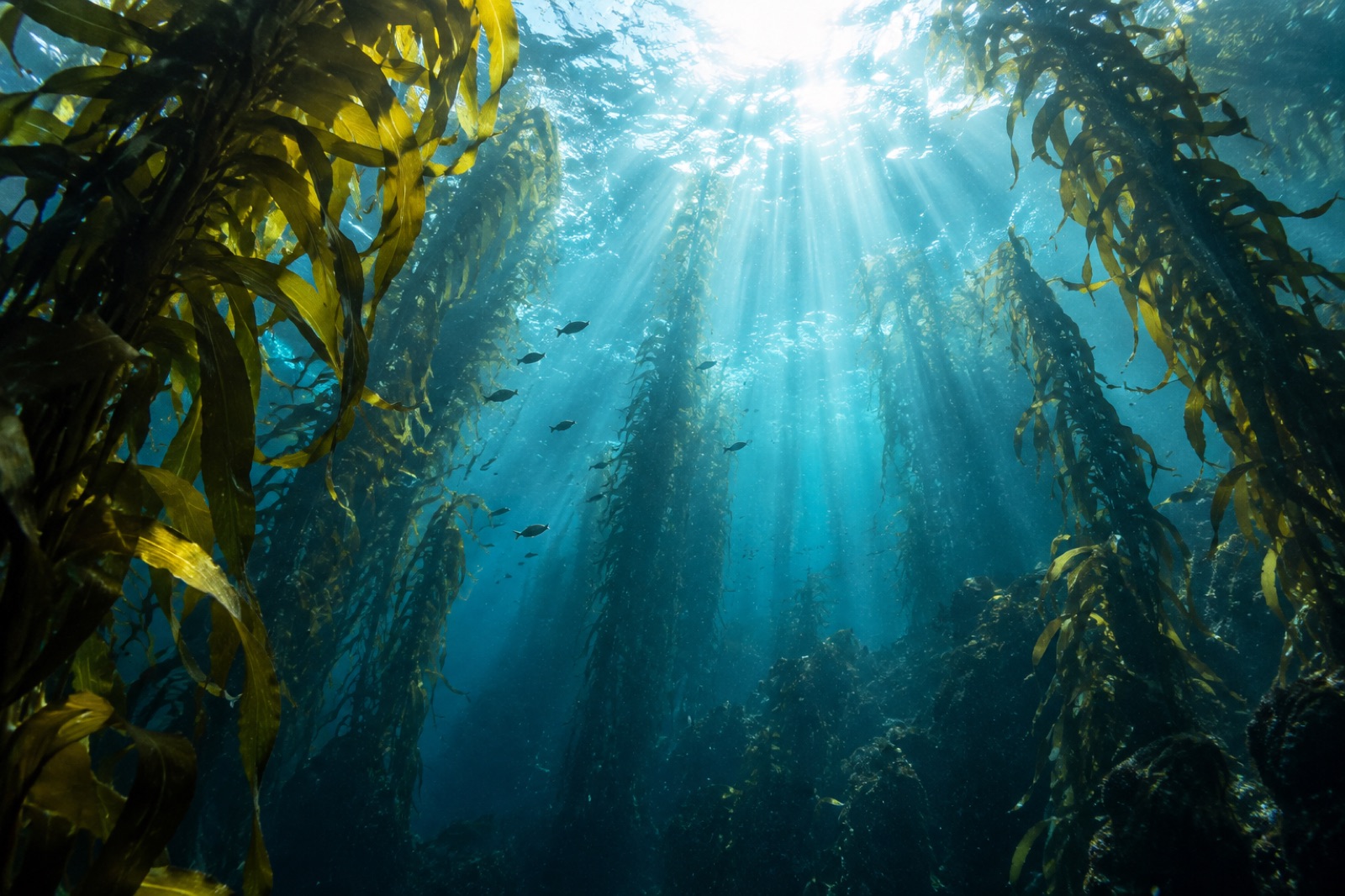
This matters directly to kelp. Rocky reefs in the high Arctic and around Antarctica carry genuine kelp forests — see our field profiles of Svalbard's ice-edge kelp coast and the under-ice forests of the White Sea — but their vertical range and patchiness are checked by scour, and their growing season is set by the light that leaks through thinning ice and snow.
Kelp at the edge of the ice
The warm-era story of kelp and sea ice is one of the clearest biogeographic shifts in the coastal ocean. Three mechanisms connect them:
- Light liberation. Kelp needs a bottom-lit sunlit season. Where summer ice disappears earlier and returns later, weeks of extra light reach the seabed. Surveys over the past two decades have documented kelps expanding into Arctic fjords and coasts — parts of northern Canada, Greenland and the Barents region — that were previously too iced-in to hold them. Our profile of Greenland's kelp coast describes exactly this frontier: clear glacial water and a lengthening, uncertain growing season.
- Stratification shifts. More meltwater strengthens the surface halocline. That can concentrate phytoplankton blooms but also, over time, alter nutrient delivery to deeper water where kelp grows — the same layering physics that governs ocean stratification everywhere, pushed into polar conditions.
- New habitat, new communities. Open water in place of ice means waves, and waves shape kelp communities — pruning, dispersing spores, and favouring flexible species on exposed rock.
None of this is simple good news. The same warming that opens Arctic coasts to kelp is, at temperate latitudes, driving marine heatwaves that have erased forests from coastlines where kelp grew for millennia. Kelp's map is being redrawn at both ends at once — gained at the ice edge, lost at the warm edge. That tension is central to why Tidewright monitors polar and sub-polar coasts through our North Atlantic & Arctic programs, and why restoration planning now routinely asks where the climate refugia of 2050 will be, not only where the forests of 1990 were.
How scientists and satellites watch the ice
Sea ice is among the best-observed features of the planet. Passive microwave satellites have mapped ice extent daily since 1979 — a continuous record long enough to make the Arctic decline (roughly 12–13% per decade in September extent) one of the most robust trendlines in climate science. Thickness is harder: radar and laser altimeters (CryoSat-2, ICESat-2) measure freeboard — how far the ice rides above the waterline — and thickness follows from buoyancy. Under ice, autonomous gliders and drifting buoys profile the water; on it, ice camps and autonomous platforms sample the biology in the brine channels.
The September minimum matters most to climate; the March maximum and the timing of freeze-up and melt matter most to ecosystems, because ecology runs on schedules, not just states.
Key takeaways
- Sea ice is frozen ocean: seawater freezes near −1.8°C, rejecting salt into brine channels that make the ice porous and habitable.
- Brine rejection densifies polar surface water and helps drive the deep global overturning circulation — freezing water at the poles moves water everywhere.
- Ice reflects most sunlight; its loss exposes dark, heat-absorbing ocean, powering the ice–albedo feedback and rapid Arctic amplification.
- Algae blooming on the ice's underside and at the summer ice edge kick-start polar food webs weeks before open-water blooms.
- Ice scour and bergs are among the strongest natural disturbances to high-latitude reefs — and as ice retreats, extra light is expanding kelp habitat into Arctic coasts while warming removes it at temperate ones.
FAQ
Is sea ice the same as an iceberg?
No. Sea ice is ocean water that froze in place — thin (usually under 4 m) and seasonal. Icebergs calve from land glaciers and ice shelves; they are ancient snowfall turned to freshwater ice, sometimes hundreds of metres thick, and they can scour the seafloor where they ground.
Why does sea ice matter to people who never visit the poles?
Because the poles are the engine room. Sea-ice processes help drive the deep overturning circulation, the ice cap reflects solar energy for the whole planet, and Arctic amplification influences weather patterns far to the south. The frozen skin also seals in ocean heat over winter.
Does sea level rise when sea ice melts?
Melting floating sea ice raises sea level only negligibly — the ice already displaces its own weight in water, like ice cubes in a drink. The serious contributors are melting land ice (Greenland, Antarctic glaciers) and the thermal expansion of warming seawater. Sea ice decline matters for sea level mostly indirectly, by warming the region around land ice.
Can kelp actually grow under sea ice?
Yes — kelp forests persist under seasonal ice cover in the White Sea, parts of the Canadian Arctic and Svalbard's fjords, surviving the dark months as slowed or dormant tissue and growing hard in the brief lit season. Their limit is light: ice plus snow can cut irradiance to near zero for months, which is why earlier melt means longer growing seasons.
Is sea ice disappearing in Antarctica too?
The picture differs by pole. Arctic sea ice has declined steeply and consistently in all seasons. Antarctic sea ice was stable or slightly increasing for decades — then hit record-shattering lows starting in 2016 and especially 2023–2024, a regime shift scientists are still working to fully explain. The Antarctic's contribution to global deep-water formation makes those anomalies consequential far beyond the Southern Ocean.