Science10 min read
Why the Ocean Changes Colour: Chlorophyll From Space
Why the sea turns green, turquoise or milky — and how ocean-colour satellites read chlorophyll from orbit to map blooms, currents and ocean life.
Dr. Mara Ellison ·
Ocean colour satellites turn faint light reflected from the sea into maps of phytoplankton, sediment and kelp. How the sensors work, what they see — and what they miss.
Look at the ocean from orbit in the right wavelengths, and it stops being anonymous blue. Swirls of emerald trace phytoplankton blooms the size of countries; milky turquoise patches mark coccolithophore armour drifting in the current; brown tongues of sediment pour from river mouths; and along temperate coasts, thin dark fringes appear that are, remarkably, kelp forest canopies. This is ocean colour remote sensing — the science of turning the faint light that leaves the sea into maps of life, chemistry and habitat. It underpins everything from global chlorophyll estimates to Tidewright's own Canopy Ledger monitoring. Here is how it works.
A colour satellite doesn't photograph the ocean the way your phone does. It measures spectral radiance: how much light, in narrow wavelength bands, arrives at the sensor from each patch of the planet. Of the photons reaching a sensor above the ocean, the overwhelming majority — typically around ninety percent — never touched the water at all. They were scattered by air molecules, haze, aerosols and clouds. The signal scientists want is the minority: water-leaving radiance, light that entered the sea, scattered off things in it, and came back out.
Extracting that sliver is called atmospheric correction, and it is one of the hardest quiet triumphs of remote sensing. Subtract the atmosphere accurately and the ocean's true colour appears; get it slightly wrong and you map smog and call it plankton.
Once you have water-leaving radiance across several wavelengths, the colour tells a story, because different things in the water absorb and scatter light differently:
The workhorse product of ocean colour science is surface chlorophyll-a concentration, used as a proxy for phytoplankton biomass. The classic approach is a band-ratio algorithm: compare reflectance in a blue band (around 443 nm) with a green band (around 550–555 nm). The blue-to-green ratio falls as chlorophyll rises, and decades of paired satellite-and-ship measurements have turned that relationship into global algorithms.
The limits matter as much as the power:
Newer hyperspectral sensors — measuring dozens to hundreds of narrow bands instead of a handful — can go further, distinguishing pigment groups and even hinting at which phytoplankton communities are blooming, from iron-hungry diatoms to calcifiers.
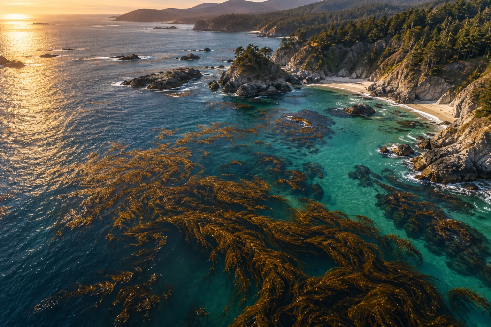
Kelp is a different problem from plankton. A giant kelp canopy floats at the surface in a thin, discontinuous fringe along the coast — far too fine for one-kilometre ocean colour sensors. Mapping it uses high-resolution multispectral satellites (Landsat-class and better, at tens of metres per pixel) and a beautiful quirk of physics: liquid water absorbs near-infrared almost completely, while living canopy tissue — like terrestrial leaves — reflects it strongly. A pixel that glows in the near-infrared in the middle of a dark sea is very likely kelp at the surface.
Using the four-decade Landsat archive, researchers have reconstructed canopy extent along coasts such as California's for decades back, revealing how forests pulse with El Niño, marine heatwaves and recovery. It is now one of the foundational records of kelp change worldwide — we unpack the method in how satellites see kelp.
The caveats are real: only canopy that reaches the surface is visible; submerged understory kelp, young plants and deep forests on clear reefs can vanish from the satellite record entirely. Tide state, waves, sun angle and image frequency all matter, and canopy area says little about biomass or health beneath the surface. That is why Canopy Ledger fuses satellite canopies with drone surveys, in-water transects and sonar — space for coverage, divers for truth.
The field runs on a relay of instruments:
Meanwhile, high-resolution multispectral constellations (Landsat, Sentinel-2) carry the coastal-canopy and habitat mapping load, and commercial fleets now image coasts daily.
Satellite ocean colour is a model of the ocean, not a direct census, and it is kept honest by in-situ validation: ships and moored buoys measuring chlorophyll, absorption and scattering in the water at the same time a satellite passes overhead ("match-ups"), plus dedicated marine optical buoys that continuously measure water-leaving radiance as a reference. Algorithm updates and sensor cross-calibration — stitching CZCS to SeaWiFS to MODIS to OLCI without artificial jumps — are a discipline of their own.
Yes — where kelp forms a surface canopy (like giant kelp and bull kelp), high-resolution satellites detect it through its strong near-infrared reflectance against dark water. Submerged or understory kelp can't be seen, so satellite maps are combined with drones, sonar and diver surveys for a full picture.
Chlorophyll pigments absorb blue light and scatter green, so algorithms compare blue and green reflectance bands: a lower blue-to-green ratio means more chlorophyll. Coastal waters with sediment and dissolved organic matter need special coastal algorithms to avoid confusion.
Roughly ninety percent of the light reaching an ocean-viewing sensor comes from the atmosphere, not the sea. Atmospheric correction models and removes that haze of scattered light to recover the small water-leaving signal — it is the single most delicate step in ocean colour science.
Light is absorbed and scattered rapidly by water, so the signal from space comes only from the top few metres to tens of metres — the "first optical depth". Deep chlorophyll maxima, deep scattering layers and bottom habitats are invisible from orbit and need profiling floats, gliders and acoustics.
Launched in 2024, PACE carries the first global hyperspectral ocean colour instrument, measuring hundreds of narrow wavelengths. Where older sensors estimated bulk chlorophyll, hyperspectral data can begin to distinguish plankton types — diatoms from coccolithophores, for example — from orbit.
Why the sea turns green, turquoise or milky — and how ocean-colour satellites read chlorophyll from orbit to map blooms, currents and ocean life.
Dr. Mara Ellison ·
From Sentinel-2 pixels to drone orthomosaics, here's how scientists detect, map and track kelp forest canopies from space — and where the limits are.
Dr. Mara Ellison ·
How satellites derive sea surface temperature from infrared and microwave radiometers, why clouds and fog mask kelp coasts, and how scientists validate SST.
Dr. Lena Fischer ·