Atlas8 min read
Kelp Forests of Monterey Bay: A Coastal Atlas Guide
Monterey Bay holds some of North America's most accessible giant kelp forests — a canyon-fed, otter-patrolled ecosystem you can dive, kayak or watch from shore.
Dr. Theo Nakamura ·
A coastal atlas guide to Big Sur's kelp: cliff geology, upwelling and otters, where the canopy grows, and realistic access on California's wildest coast.
There is no coastal road quite like the one through Big Sur. California State Route 1 clings to the base of the Santa Lucia Range, where mountains rise nearly a vertical mile within a few kilometres and then keep going — down — into some of the deepest nearshore water on the west coast. Below the cliffs, in water the colour of bottle glass, giant kelp grows in beds strung along every suitable reef from Carmel south to San Carpoforo Creek. Big Sur's kelp forest is not the biggest in California, but it may be the most dramatic: a canopy growing against a wall of mountains, fed by cold upwelled water, patrolled by sea otters, and seen by most of the world only from the edge of a very high road.
This guide explains what makes this coast's kelp tick, where it grows, and — honestly — how hard it is to get into the water here, and what to do instead if you can't.
Big Sur's oceanography starts with the shape of the land. Nowhere else in the contiguous United States does a mountain front drop so abruptly into the Pacific. The continental shelf is sliver-thin; offshore, submarine canyons — Sur Canyon and Partington Canyon among them — cut toward the abyss, plumbing deep water to within sight of the cliffs. When the northwest winds of spring blow along this coast, surface water is pushed offshore and deep, cold, nutrient-loaded water wells up to replace it. Point Sur and the points around Piedras Blancas are among the coast's upwelling engines.
That cold water is the whole story for kelp. Giant kelp (Macrocystis pyrifera) grows fastest in cool, nitrate-rich water, and upwelling effectively hand-feeds the forest through the California summer, just when the surface ocean would otherwise stratify and starve. Our explainer on upwelling covers the physics. The result at Big Sur is a kelp system that can stay productive through the warm season and a forest that historically recovers from winter-storm pruning with startling speed — fronds racing back to the surface within weeks.
The depth profile matters too. Because the bottom falls away quickly, Big Sur's kelp beds tend to be narrow ribbons pressed against the shore rather than broad offshore forests. That makes every bed precious, edge-rich habitat: rock-wall reef on one side, blue water on the other, with the canopy strung between.
The forest here is southern sea otter country. The California otter population's range runs through Big Sur, and the kelp beds are their bedroom, nursery and larder — you'll see them rafted in the canopy at most cardinal pullouts on a calm morning. Their grazing on sea urchins is the service that keeps the forest from being mown to barrens; the mechanics of the otter–urchin–kelp triangle are laid out in our piece on trophic cascades.
Below the canopy: kelp bass and olive rockfish in the midwater, sheephead and cabezon on the reef, vermilion and gopher rockfish on the deeper walls, sunflower stars working the bottom — where the wasting disease that devastated them elsewhere left scars here too. Big Creek, a deliberately protected cove south of Lucia, hosts a marine reserve where that reef community is left to do its thing: no take, fewer lines, older fish. Marine protection along this coast is patchwork but real, and Big Creek is its beating heart.
Above the water, the cast is just as good. Gray whales pass close in on migration — close enough that their blows drift up the cliffs to the road. California condors ride the thermals overhead, the biggest wings in North America over the biggest kelp you'll see from shore. At the coast's south end, elephant seals crowd Piedras Blancas's beaches; at the north end, cormorants and pigeon guillemots stitch along the cliff base.
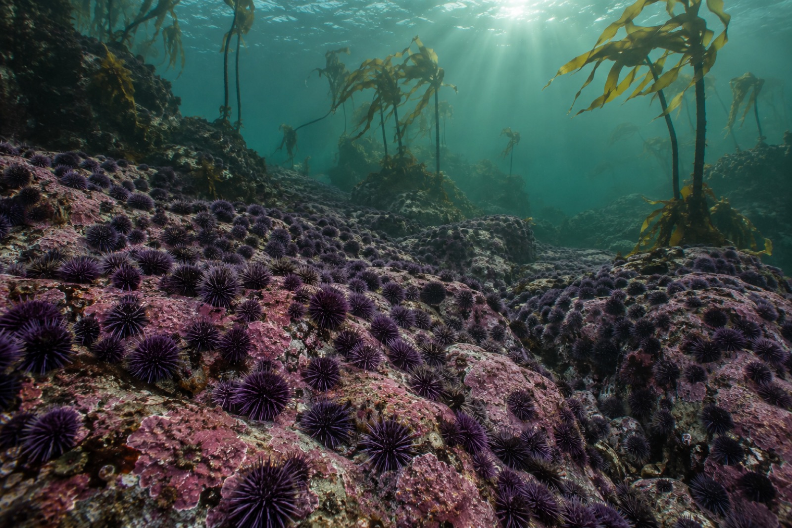
Big Sur sat near the southern edge of the marine heatwave disaster that reordered the northeast Pacific in 2014–2016 — the years of the warm "Blob" and a brutal El Niño. Warm, nutrient-poor water thinned giant kelp canopies up and down Central California, and the purple urchin population explosion that followed turned forests to barrens across Sonoma and Mendocino. Our marine heatwaves primer explains the forcing.
Central and Southern California's giant kelp was stressed — canopies thinned, some beds blinked out — but the Big Sur coast largely held. The likely reasons say a lot about how kelp forests survive a hotter ocean: persistent local upwelling kept cool water on the reef, otters kept urchins from running ahead of the damage, and the sheer ruggedness of the coast meant a mosaic of micro-refuges — shaded walls, deep-out reefs, canyon-fed cold pockets — where canopy could hang on and reseed the rest. This is the geography of thermal refugia written at landscape scale, and it is a big part of why this coastline is watched so closely.
Let's be direct. Big Sur is one of the most beautiful kelp coasts on Earth and one of the least practical to dive. The road is a hundred kilometres of cliff with few turnouts; the shore below is mostly unclimbable cliff; swells are heavy, and surge through the beds is real. Winter storms cut the highway with landslides often enough that access planning is a season-by-season affair.
Diving and freediving. Realistic entries concentrate at a few places: the coves at Andrew Molera State Park, Partington Cove, and a handful of boat-accessible reefs run by charter operators out of Monterey or Morro Bay, plus kayak launches from protected coves in the calm autumn window. Water runs roughly 10–15°C; a 7mm wetsuit or drysuit is standard. Treat it as advanced shore diving: plan exits around swell, watch the forecast for a week, and remember that help is a long way away. If you want world-class Central Coast kelp with pint-sized logistics, Point Lobos, just north, is the slot canyon of dive reservations — and our Monterey Bay guide covers the region's gentlest entry, the Breakwater. Big Sur is what you graduate to.
Snorkelling and topside. On glassy autumn days, sheltered coves offer extraordinary snorkelling over the forest edge. From the road, bring binoculars: the canopy, the otters, the whales and the condors are all visible from well-chosen pullouts, and several state-park overlooks give you kelp geometry — individual beds, canopy lanes, the lay of the fronds in the current — better than any dive can.
Kayaking the coast on a calm spell is the closest most people will come to floating through a Big Sur kelp bed, and it is genuinely magical: canopy lagoons, sea caves cut into the cliff, otters curious at twenty metres. It is also committing — launch sites are few, landings fewer. Go with a local outfitter until you know the coastline.
Yes, but selectively. Entry points are limited to a handful of coves — Andrew Molera and Partington Cove are the classics — and conditions are advanced: surge, heavy swell in most seasons, cold water, remote exits. Autumn offers the calmest window. Many divers opt for boat charters or guided kayak diving instead of shore entries.
Giant kelp along this coast endured the 2014–16 heatwaves significantly better than Northern California's bull kelp did. Canopies vary year to year with storms and ocean temperatures, but the region's upwelling and otter-protected beds give it real resilience. Summer satellite imagery and local diver reports are the best current-condition sources.
September through November typically offers the calmest seas, clearest water and warmest air. Winter brings enormous, dramatic swell; spring is windy with peak upwelling; summer carries the famous fog. For wildlife, gray whales pass December through April, and otters, condors and pelicans are year-round.
No general dive permit is needed for state waters, but respect marine protected areas — Big Creek is a no-take reserve, and others restrict what you can take. Freediving or diving with any harvest intent needs a California fishing licence and knowledge of zone rules. Treat this coast like a guest would: stage conservatively and dive within it.
It is the resilient middle. North of the Golden Gate, bull kelp collapsed in the heatwave years and urchin barrens spread; south of Point Conception, giant kelp lives at the warm edge of its range. Big Sur's cool, otter-patrolled reefs are a bridge between those worlds — a natural laboratory for what keeps a forest standing in a warming ocean.
Monterey Bay holds some of North America's most accessible giant kelp forests — a canyon-fed, otter-patrolled ecosystem you can dive, kayak or watch from shore.
Dr. Theo Nakamura ·
A field guide to Northern California's bull kelp collapse — the heatwave, the urchin explosion, the closed fisheries, and the difficult road back.
Dr. Mara Ellison ·
Baja California's Pacific kelp beds mark giant kelp's warm-water frontier — a coast of El Niño crashes, fast recovery, red urchin fisheries and hard-won lessons.
Dr. Elias Brandt ·