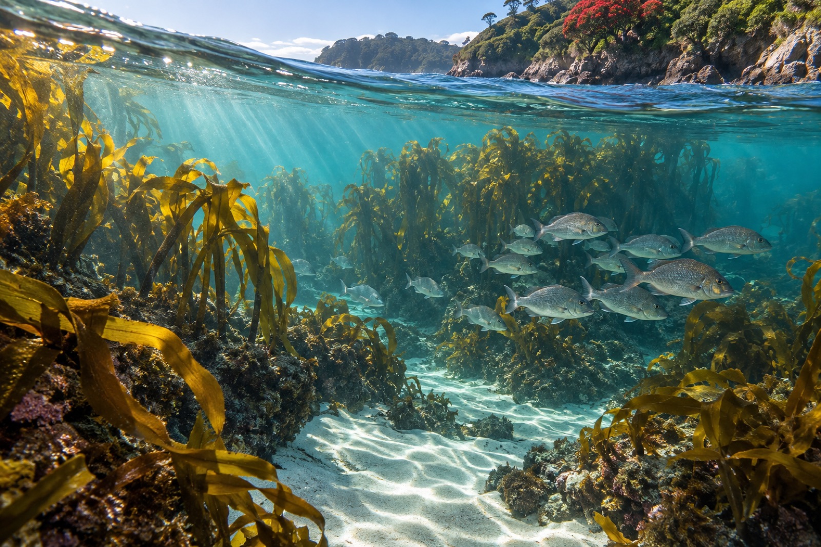
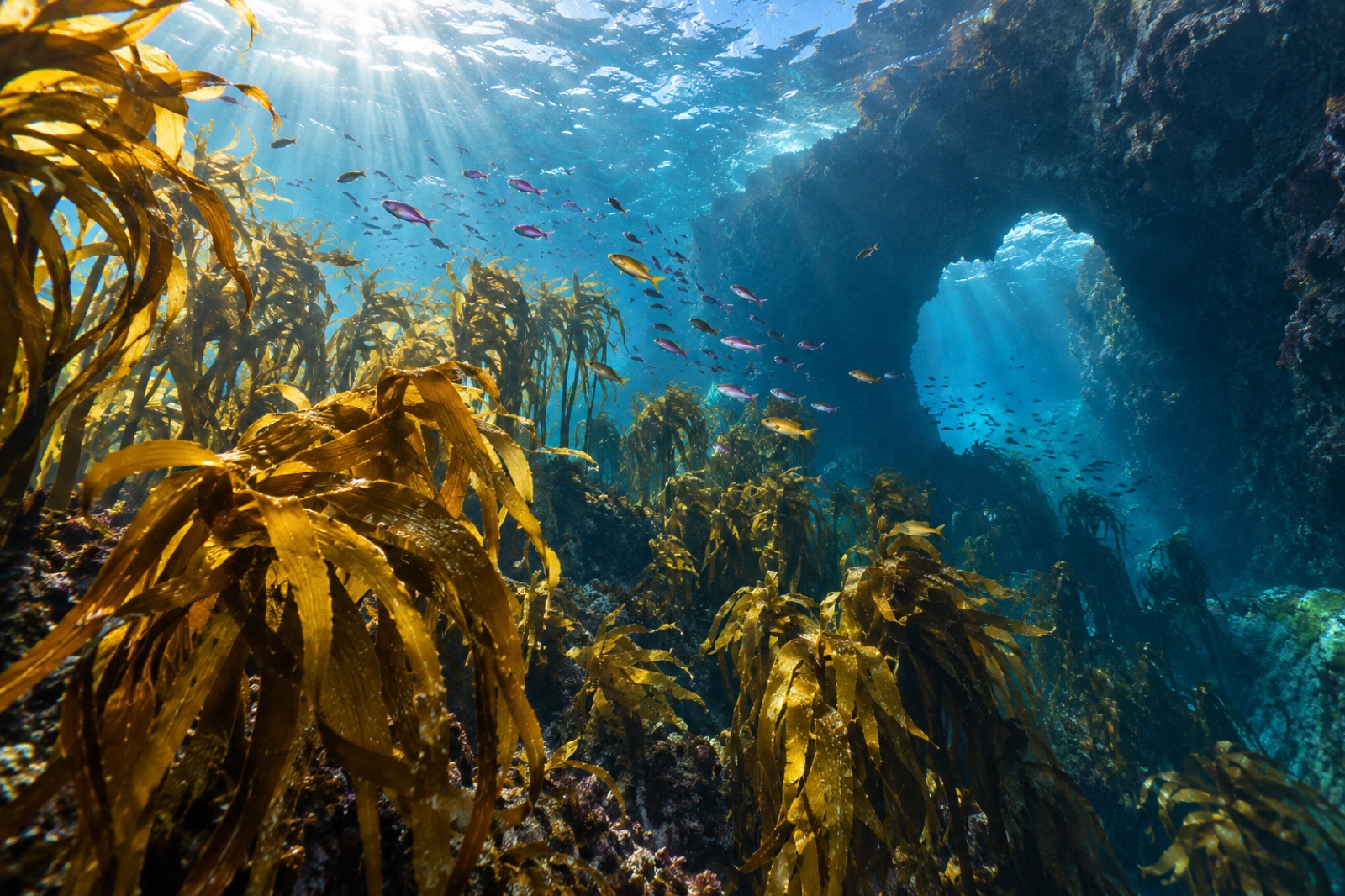
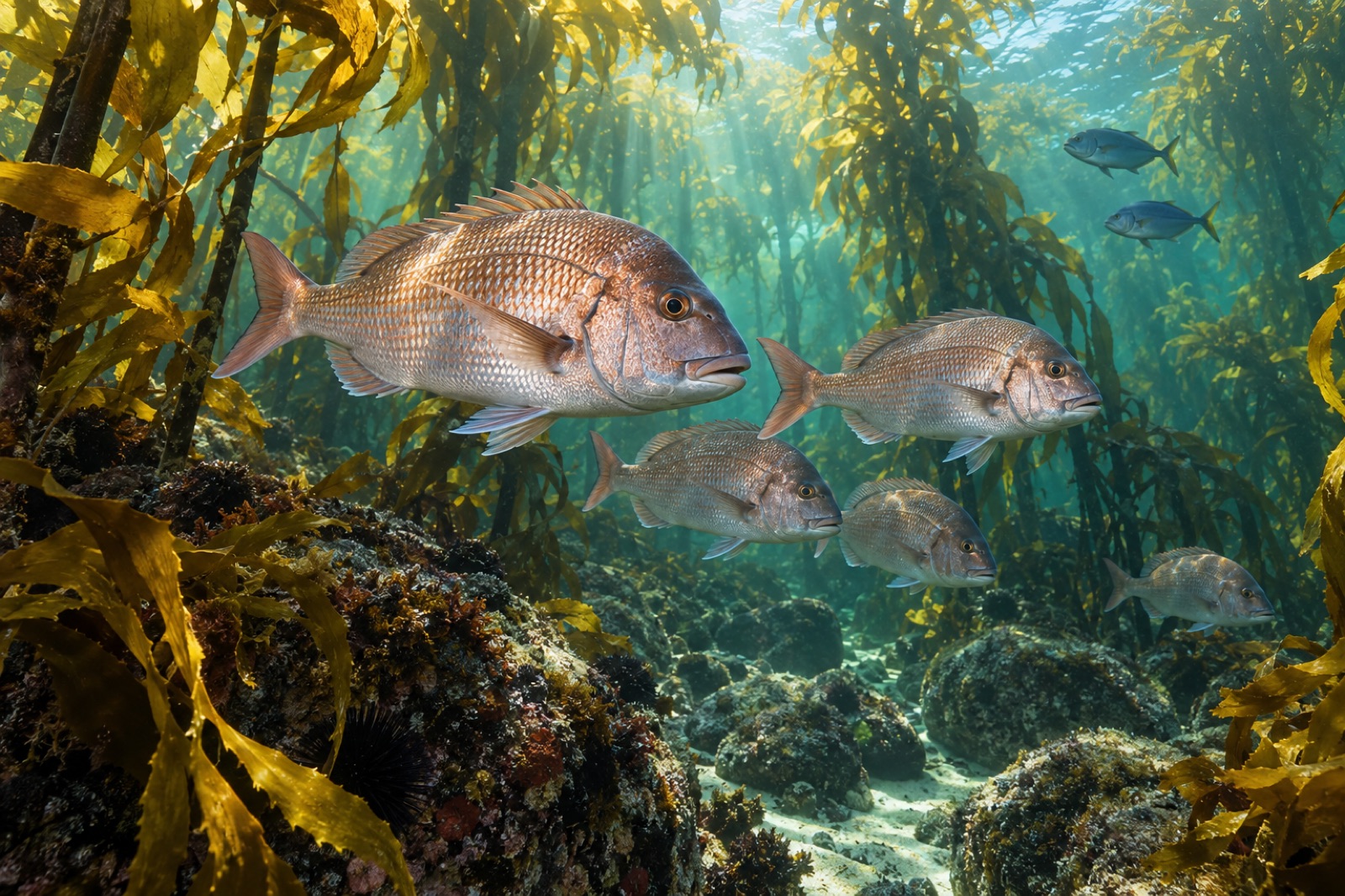
Drive east over the Kaimai ranges from Auckland and the light changes — wide bights of white sand, pōhutukawa leaning hard over rock, and a long peninsula that catches the first of the sun on the North Island's mornings. This is the Coromandel, and its face to the Pacific is one of New Zealand's most instructive kelp coasts: close enough to the country's biggest city to test every idea about protection and pressure, and rich enough that the experiment works. Here, golden kelp beds hold the shallow rock, snapper nurseries hide in the bays, and a small marine reserve at Cathedral Cove has spent thirty years showing what a well-placed fence can do.
Reading this atlas entry
The Coromandel Peninsula is the rugged thumb of land separating Auckland's Firth of Thames from the Pacific. This guide covers the outer (Pacific) coast — from Cape Colville in the north, past the Mercury Islands and Whitianga's Mercury Bay, down through Hahei and Whangamatā to the Waihī end. The inner Firth shore is harbour country and a different story. For the wider context of New Zealand's kelp coasts, see the New Zealand region overview.
Currents, coast and why this reef is warm for its latitude
The Coromandel sits at the transition where the subtropical water of the north meets the classic temperate New Zealand sea. A branch of the warm East Auckland Current feeds southward along the coast — a smaller, gentler cousin of the boundary currents that steer the Poor Knights Islands further north. Summer surface temperatures reach the low twenties Celsius, dipping to about fourteen in late winter. The result is a reef that is fully temperate by species — but with a soft northern accent and, by New Zealand standards, comfortable swimming.
Geology helps too. The peninsula is volcanic: rhyolite and andesite shed boulders, carve archways and lay down the exact bite-sized complexity kelp and fish like. Reef flats step down through cobble gardens into kelp beds, and the famous nudibranch- and sponge-covered pinnacles of the offshore islands are volcanic ruin.
The kelp: golden cover on a working coast
The backbone species is golden kelp (Ecklonia radiata), New Zealand's canonical forest former, which carpets the reef from the surge zone down through twenty-plus metres in clearer offshore water. Under it, a layered understory of reds and corallines fills the shade, and in sheltered bays the kelp fringes give way to green-lipped mussel beds, pipi- and cockle-filled sand flats, and eelgrass — the classic nursery mosaic for juvenile snapper (tāmure) and trevally. The importance of these shallow, sheltered bights as nursery habitat is the reason so much Coromandel science starts at the shoreline: the health of the inner sand flats and the outer kelp reefs is one system, joined by the currents.
That connection is the right way to think about the whole coast: beach, kelp, nursery and offshore pinnacle eat from the same larder.
The kina problem, and the reserve that demonstrates the cure
Like much of northeastern New Zealand, the Coromandel faces the kina barren problem: where fisheries remove the big snapper and rock lobster (crayfish) that eat kina sea urchins, the urchins multiply past the reef's ability to feed them, and meadows of kelp become pavements of grazed, coralline-crusted rock. The dynamics are set out clearly in our explainer on urchin barrens.
The Coromandel's laboratory piece is Te Whanganui-A-Hei (Cathedral Cove) Marine Reserve, established in 1992 around the famous arch and the Hahei headlands. No-take protection here has been associated with rebuilding of snapper and crayfish numbers, and — consistent with the predator–urchin story — kelp habitat in the reserve is in better shape than comparable fished coast nearby. Long-run New Zealand research, built from reserves like this one and like Goat Island further north, is the evidence base for one of the strongest conclusions in temperate reef ecology: protect the predators, and the forest follows. For how these dynamics generalise, see trophic cascades in kelp forests.
The offshore islands: Mercury, Aldermen and the Tutukaka link
The Coromandel's reef complexity steps up off the beach. The Mercury Islands, seven main islands a few kilometres off Whitianga, are a marine protected area and a magnet for reef-life diversity — deeper water, stronger current, more complete kelp zones. South of Tairua, the steep, geologically young Aldermen Islands drop into colder, clearer water and hold some of the coast's finest kelp parkland, colourful wall communities and boisterous schools. Both groups face the same ocean that feeds Great Barrier Island — see our Great Barrier guide — and current-washed pinnacles here carry the same "northland fauna put through a southern blender" feel: big pāua in the cracks, kingfish packing the bait schools, occasional subtropical wanderers in summer.
When to visit and how
Season. The coast is year-round, but the experience splits: summer (December–March) brings 20 °C-plus water, picnic weather and occasional days of ten-plus-metre visibility; autumn–spring brings cooler, clearer water and fewer people. Winter swell from the east can make the Pacific coast both feisty and flush — fine for scenery, rough for shore-entry snorkelling.
Visibility. Neap tides after settled offshore wind tend to bring the clearest water; big rain muddies Mercury Bay and the Whangamatā estuary mouth.
Access. The Coromandel is a drive-to coast. Hahei's Cathedral Cove involves a walk (or kayak tour) around the headland; the marine reserve boundary includes the arch beach walk — no fishing, touching or taking inside. Shore snorkelling is easy at sheltered Hahei and at the southern bays; boat-based reefs and the offshore islands need a charter or private craft and a sea-kind pelvic floor. As always in New Zealand's dynamic east coast: check forecasts, respect swell, and treat rock platforms as surge zones.
What to look for
- Kelp canopy thinning into underlit gardens at the island drop-offs.
- Snapper working the sand edge just off the kelp at dusk — the nursery–reef link in action.
- Kina quietly demonstrating the coastline's central argument: abundant outside protection, in hand where predators are allowed back.
- Subtropical accents — a stray butterflyfish or coral-reef visitor — riding warm-current pulses in late summer.
Key takeaways
- The Coromandel's Pacific coast runs on golden kelp, volcanic reef and a warm-current feed — a temperate forest with a soft northern accent two hours from Auckland.
- Te Whanganui-A-Hei (Cathedral Cove) Marine Reserve is the coast's proof of concept: protection rebuilt predators, and the kelp followed.
- The kina barren dynamic — too few snapper and crayfish, too many urchins — is the coast's main structural problem, and protection is its clearest documented answer.
- The Mercury and Aldermen island groups offshore hold the richest kelp parkland and most complete reef communities on the coast.
- Easy access makes the Coromandel one of New Zealand's best places to see, within one weekend, both the promise of marine protection and the cost of its absence.
FAQ
Is Cathedral Cove inside the marine reserve?
Yes. Te Whanganui-A-Hei (Cathedral Cove) Marine Reserve, established 1992, covers the coastline including the arch and surrounding reefs. Landing, swimming and walking are fine; fishing and removing or disturbing anything natural — alive or dead — is not.
Best time of year to snorkel the Coromandel?
Late summer to early autumn (February–April) often combines warm water, settled offshore winds and decent visibility. Watch the long-range swell forecast: one week's easterly blow can close the open-coast sites, while the harbour-side beaches stay usable.
Where can I see kelp forest without a boat?
The fringing reefs off Hahei, the rocky platforms at Whangamatā's southern end and the shore dives around the Whitianga bights all hold golden-kelp forest in shore-entry depth — conditions permitting. The best forest structure is offshore, but the near-shore edges are easily snorkelled.
Are there really kina barrens on the Coromandel?
Yes — as on most unprotected northeastern New Zealand coast, areas where kelp have been eaten back to urchin-grazed rock are well documented. The nearby marine reserve is important precisely because it demonstrates the recovery pathway.
Is this coast safe for swimming and diving?
Swimming beaches are generally excellent. The Pacific-side rock headlands and island sites require care — surge, tide races and swell can change in hours — and open-water reef days belong with local knowledge, a float and a buddy. If freshly arrived from warmer waters, expect cooler temperatures than they look.