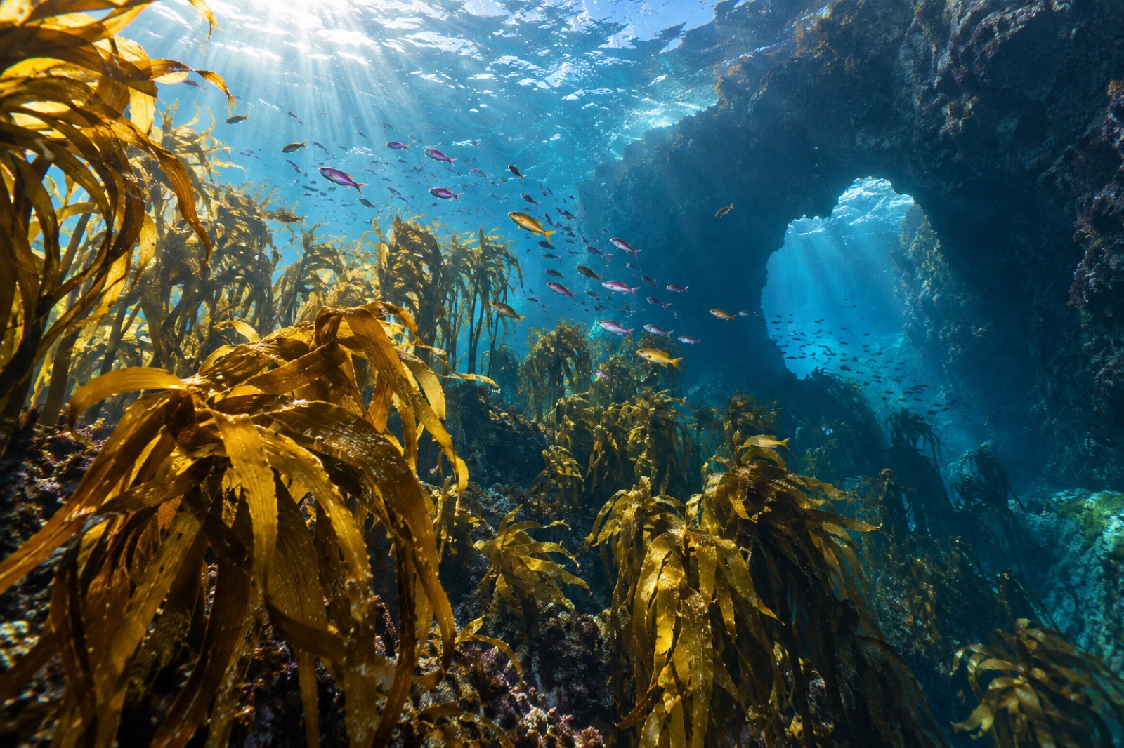
By Auckland standards, Great Barrier Island is impossibly far away, and by any other standard it is absurdly close. The ferry from the city takes around four and a half hours; the plane takes thirty minutes. You land on the largest island of the outer Hauraki Gulf — 285 square kilometres of forested ridgelines, white-sand surf beaches and sheltered harbours, with no reticulated mains power, spotty phone coverage and some of the darkest night skies in the country. Locals call it Aotea, "white cloud". Below the waterline, it is something else again: the wildest remaining kelp coast within reach of New Zealand's biggest city, and one of the clearest places on Earth to watch what happens to a forest when its predators are taken away.
Reading this atlas entry
Aotea sits at the outer edge of the Hauraki Gulf / Tīkapa Moana, roughly 90 kilometres northeast of central Auckland, forming the gulf's eastern rampart against the open Pacific. The island's west coast faces the gulf in a maze of sheltered bays, harbours and estuaries; its east coast takes the ocean's full force in a line of surf beaches and rocky headlands. The permanent population is small — around a thousand people, swelling through summer — and the community runs largely off-grid by solar power and rainwater. Both coasts carry reefs of golden kelp (Ecklonia radiata), the workhorse forest-former of New Zealand's northeast.
Two coasts, one island
The eastern, Pacific-facing side of Aotea is New Zealand at its most elemental. Long surf beaches — Medlands, Kaitoke, Awana — break against headlands where kelp clings to wave-torn rock and crayfish pot buoys ride offshore. Water clarity here can be exceptional: oceanic water pushes in around Cape Barrier and the Broken Islands, and on calm days the snorkelling over the eastern reefs is as good as anything this side of the Poor Knights.
The western side is the island's harbour world: Port FitzRoy and Port Abercrombie cutting deep into the interior, nurseries for juvenile fish among their subtidal fringes. The gulf water is greener and warmer here, and the reef slopes carry the classic pattern of the inner Hauraki Gulf — kelp canopy above, and all too frequently, a dense pavement of kina below.
The kina question
It is impossible to write honestly about Aotea's reefs without the kina. Kina (Evechinus chloroticus) are the native sea urchin of northeastern New Zealand, and they are not the villain of this story — fishing is. Around much of the Hauraki Gulf, including the Great Barrier coast, decades of harvesting snapper, crayfish and other predators have left kina populations released from their natural control. Crowds of the urchins graze the kelp recruits faster than the forest can replace them, and the reef flips into a "kina barren": bare, urchin-crusted pavement where a canopy should be.
The mechanics are the same everywhere on Earth: our explainer on urchin barrens walks through how reefs flip and why they stay flipped. Aotea makes the lesson visible at snorkelling depth. Swim a line across any mid-coast reef and you can often see the boundary with your own eyes — golden forest on one side, moonscape on the other. Whether you blame the urchins, the fishing or the management, the kelp does not care. It needs its predators back.
The encouraging corollary is that where predator densities recover, the kelp follows. The reserves of northeastern New Zealand — Leigh's marine reserve at Cape Rodney–Okakari Point, and the no-take Poor Knights — both show reefs rebalancing after protection, the signature trophic cascade working in reverse. Aotea's shores are not a reserve, but the comparison sits just across the gulf and is impossible to unsee.
Worth protecting: the rest of the cast
Beyond the forest itself, the island's cold-temperate waters hold a heavy roster. Australasian gannets of the outer gulf colonies dive off the eastern headlands; pod after pod of common dolphins works the bait schools, and orca pass through the Colville Channel regularly. The eastern bays are shark country in the best sense — bronze whalers cruising the surf line, and the occasional hammerhead working the shallows in summer. New Zealand fur seals haul out on the outer rocks.
On land, the conservation picture is unusually bright: Aotea is free of possums, mustelids and (unusually) has ongoing community-driven predator work, and the island holds significant breeding populations of brown teal (pāteke), black petrel and the endemic chevron skink. In 2017 the island was designated an International Dark Sky Sanctuary — one of a handful worldwide — which tells you most of what you need to know about the human footprint.
Aotea's isolation has bred a particular character. Power is solar, water is rain, and the community has a long independent streak that extends to the sea. Local fishers, divers and iwi of the island (Ngāti Rehua-Ngātiwai ki Aotea hold mana whenua) are central voices in the continuing debates over Hauraki Gulf management — debates that turned real when the gulf's new tranche of marine protection, including areas in the island's wider seascape campus, began progressing through legislation in the mid-2020s. Community-led marine monitoring, customary rāhui (temporary harvest closures) and a strong conservation trust mean that restoration here is not a theory; it is already happening at local scale.
This is why the island matters to our work at Tidewright. The mechanisms that rebuild this kind of coast — predator recovery, urchin management, seeded habitat where recruitment has failed, local tenure for the people who watch the water daily — are the same mechanisms we build into projects through our restoration methods and our Reef Partners program with coastal communities. Aotea is a reminder that the social infrastructure — who decides, who dives, who counts the kina — is as load-bearing as the biological one.
Visiting, briefly and honestly
- Getting there: ferries run from downtown Auckland (about 4.5 hours, weather dependent) and small planes from Auckland Airport (about 30 minutes). Book accommodation before the boat — the island has limited beds.
- Underwater: snorkelling and shore-diving are best in summer–autumn when visibility peaks; the eastern reefs need calm conditions. There is no dive shop on the island, so bring everything you need or go organised from the mainland. If you are new to kelp diving, our beginner's guide covers what to ask.
- On the surface: the Aotea Track crosses the island's interior through kauri forest to the Kaitoke hot springs; the dark-sky sanctuary rewards anyone staying over.
- Honesty box: the island's beauty is inseparable from its fragility. Limited services, limited water, limited patience for careless visitors. Pack out what you pack in.
Key takeaways
- Aotea Great Barrier Island is the outer rim of the Hauraki Gulf: ~285 km², about a thousand residents, off-grid, and an International Dark Sky Sanctuary.
- Golden kelp forests ring both coasts, but much of the reef has flipped to kina barrens following predator removal — a textbook urchin barren system visible at snorkel depth.
- The wider seascape holds dolphins, orca, seals, gannets and migrating whales; land conservation is strong, with community predator control and threatened native birds.
- New marine protection for the Hauraki Gulf is reshaping the island's surrounding waters, with iwi and community at the centre of the work.
- Aotea is a reminder that kelp restoration is a social project: the people who live at the edge of the water are its most important infrastructure.
FAQ
Is Great Barrier Island part of Auckland?
Yes — administratively it sits within Auckland Council's boundaries, though geographically and culturally it is a world of its own at the edge of the Hauraki Gulf.
Where is the kelp, and is it healthy?
Kelp grows on rocky reefs around the island, especially golden kelp on the exposed eastern coast. Health is patchy: some stands are lush, but substantial areas have flipped to kina barrens where urchin grazing outpaces kelp recovery, consistent with the wider Hauraki Gulf pattern.
Can you snorkel or dive on the island?
Yes, but you must be self-sufficient — there is no dive operator on Aotea. Summer offers the best visibility, and the eastern reefs reward calm conditions. Always bring all gear, check forecasts carefully and treat the ocean side with respect.
Why does the island have dark-sky status?
With no mains power, minimal development and low light pollution, Aotea was designated an International Dark Sky Sanctuary in 2017, recognising some of the most pristine night skies in New Zealand.
What is being done about the kina barrens?
Local trials of urchin removal, customary management (rāhui), and the new regional marine protection measures all contribute. At the scale of the wider gulf, recovery of snapper and crayfish predators is considered the long-term fix by most scientists and managers.