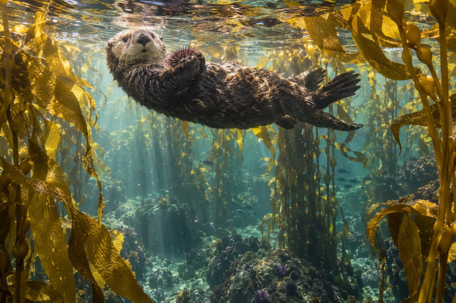
The Great Bear Rainforest is the largest intact temperate rainforest on Earth, and its seaward half — the drowned archipelago between Vancouver Island and the Alaska panhandle — is one of the largest living kelp coasts. Together they make a single argument: that a forest can run, unbroken, from spruce canopy to giant kelp canopy, and that people have lived inside that continuity for fourteen thousand years without ending it. This is the atlas guide to the kelp of the world's greatest coastal forest.
Where it is and what it is
The Great Bear Rainforest occupies the central and northern coast of mainland British Columbia and its offshore islands — roughly the sweep from Knight Inlet and the top of Johnstone Strait up toward the Alaska border, with the Coast Mountains beach-head behind it and Hecate Strait's storm-shouldered edge before it. Politically it is a mosaic of conservancies, parklands and territories held and governed with the coast's First Nations — Heiltsuk, Wuikinuxv, Kitasoo/Xai'xais, Gitga'at, Haisla, Nuxalk and others; geographically it is a labyrinth of fjords, channels and islands, most of it roadless, much of it boat-access-only, all of it governed by tide, weather and long human history.
The kelp lives across this entire front. The coast's outer islands — the Goose Island group, the Calvert and Hunter islands, the eastern rim of Hecate Strait — face open Pacific swell; the inside channels, fjords and straits face more sheltered, more stratified water. Between the two there is kelp of nearly every North Pacific habit. Our guide to Hakai Passage covers the southern heart of this coast in detail; this guide reads the whole region as a single system, south to north.
The kelp: a two-canopy coast with an understory full of players
The Great Bear runs the classic North Pacific double canopy with unusual completeness.
- Giant kelp (Macrocystis pyrifera) holds the deeper, more sheltered water: perennial fronds rising from rocky reefs at ten to thirty metres, forming true surface canopies in summer. In inner channels and the lee of island groups it is the dominant forest former (see our giant kelp profile).
- Bull kelp (Nereocystis luetkeana) works the swell-facing fringes: annual, fast-grown, a single floating bulb per stipe, reset by storm every winter and rebuilt in spring (see the bull kelp profile).
- The understory stacks the usual boreal Pacific cast — sugar kelp, wing kelp, acid kelp and sea cabbage; the surge zone adds sea palm on wave-thrashed rock; and calmer inner reaches shoulder in eelgrass beds that share the herring story below.
Depth and exposure sort the system into a legible zonation — a shore-reading exercise the region performs as clearly as anywhere in the North Pacific; our explainer on the zonation of subtidal reefs uses this coast as mental model.
The animals that govern it
A kelp atlas of the Great Bear is really a ledger of the species that run the forest. Four do most of the work.
Sea otters
Sea otters were hunted out of British Columbia by the early twentieth century; 89 animals reintroduced at Checleset Bay (1969–1972) founded a recovery that now spans this coast. Where otters land, the reef reorganises: urchins suppressed, kelp thickening, fish re-sorting — the textbook kelp trophic cascade, exercised at archipelago scale. The sea otter profile is essential companion reading.
Pacific herring
Each late winter, herring spawn across the kelp and eelgrass of the Central and North Coast in biomass events that turn the water milky for miles (see the kelp-spawn herring profile). Kelp blades catch the eggs; whales, sea lions, wolves and Nations' spawn-on-kelp fishers take their share of the herring. The spawn is the coast's single most concentrated ecological moment.
The crushing guild
Wolf eels, red rock crabs, large sea stars — the creatures that press on urchins when otters are absent — are thick on the reefs here, and they carried the trophic weight through the long otterless decades (see the wolf eel profile, and the sunflower sea star profile, which also tracks the wasting-disease losses).
The land animals that come to the water
No other kelp coast sends so much of its terrestrial fauna into the tide. Coastal wolves swim between islands to work herring spawn and beach carrion. Black bears, grizzlies and the white-phased Kermode or "spirit" bears of the inner islands forage the intertidal and the salmon rivers behind it. Humpbacks, fin whales and orcas run the channels over the kelp edge. Few places demonstrate kelp-as-ecosystem so completely: the forest below and the forest above are visibly parts of the same house.
People: the longest chapter
Every modern account of this coast must start where it actually starts: the Nations whose territories this has been for something on the order of fourteen millennia. The archaeological record on the Central Coast runs deep into the late Pleistocene — human footprints preserved near Calvert Island date to roughly 13,000 years ago — and contemporary governance is shaped by title, treaty and conservancy agreements that make Indigenous stewardship the operating system, not the backdrop. The kelp-management questions that surface here — welcoming otters without ending shellfish foreshore fisheries, reading herring recoveries, keeping finfish farms away from the most sensitive channels — are decided in co-governance, with Nations' science increasingly running the monitoring. Any visitor who treats the coast as empty wilderness is reading the label wrong.
Visiting the kelp of the Great Bear
Most travellers encounter this coast by small ship, working the inside passages between Vancouver Island and the panhandle; a handful of remote lodges and Nation-operated tourism ventures put guests closer to the water. For those going under it:
- Access is by water or air only. Port Hardy, Bella Bella and Prince Rupert are the practical doors. Summer is the main visitor season; spring brings herring and bears, autumn brings salmon runs in the rivers behind the kelp.
- Diving is full cold-water craft: drysuit, current planning, slack-water discipline; visibility swings from 3 metres in plankton months to 15+ in clear winter dark. See our cold-water kit guide and the broader explore hub before pushing north.
- Snorkelling over kelp in 9–12°C is possible in the best months around sheltered inlets — watching a bull kelp forest from the surface while a salmon river runs behind you is one of British Columbia's singular experiences.
- From shore or kayak, read the coast at low water: bull kelp rafts on outer points, giant kelp fronds ruffling in channels, otters rafting in the lee.
What is at stake
The Great Bear's kelp enters the late 2020s in better shape than most of the Pacific rim: co-governance is real, otters are back across much of the region, the herring stock is among the coast's healthier, and the protected-area lattice is broad. The stressors are the shared ones — marine heatwave years cycling up from the south, the aftermath of sea-star wasting disease, perennial pressure of development proposals on wild channels (see the marine heatwaves explainer and the sea-star wasting explainer) — plus the distinctive one: the sheer difficulty of watching a coastline this large. It is in regions like this that Tidewright's interest in large-scale, low-footprint monitoring is easiest to explain — it is the design premise of our Canopy Ledger platform. The coast is too big for boats-only science.
Key takeaways
- The Great Bear Rainforest's seaward half is among Earth's largest living kelp coasts: a roadless, co-governed archipelago running toward Alaska.
- The kelp system is a textbook double canopy — perennial giant kelp in shelter, annual bull kelp on swell, over a rich boreal understory.
- Sea otters, herring, the crushing guild and kelp-edge land wildlife together run one of the best-preserved trophic systems in the North Pacific.
- The coast's First Nations hold roughly fourteen millennia of continuous tenure and the working governance of today's conservation.
- Access is by boat or floatplane; diving is advanced cold-water craft; the rewards — kelp, otters, bears, spawn — are essentially unmatched on any temperate coast.
FAQ
Is the Great Bear Rainforest the same as the Central Coast?
Not quite. The Central Coast is the southern portion (Bella Bella, Calvert Island, the Hakai area); the Great Bear Rainforest is the whole central-plus-northern mainland coast and its islands. Our Hakai Passage guide covers the Central Coast's heart in detail.
Can you dive in the Great Bear Rainforest?
Yes, with preparation. Several remote lodges and expedition vessels run dive-capable itineraries; the diving itself is advanced cold-water work requiring drysuits, current planning and conservative gas management. Summer offers the warmest water; winter the best visibility.
Are spirit bears part of the kelp story?
Indirectly, and wonderfully. The white Kermode bears of the inner islands forage intertidally alongside black-phase bears, and coastal wolves and grizzlies work the tide edge for herring spawn and salmon. Nowhere on Earth is the land–sea forest seam so visible.
Is the kelp of the Great Bear healthy?
Broadly, yes — it is among the healthiest temperate kelp systems on Earth, strengthened by otter return and by broad protection. The known stressors are Pacific-wide: marine heatwave years, the loss of sunflower sea stars to wasting disease, and the sheer difficulty of monitoring at this scale.
When is the best time to visit?
Late spring through early autumn for travel and calm seas; late winter into spring (February–April) for the herring spawn — the region's defining ecological event and a working cultural season for First Nations.