Atlas8 min read
Baja California: The Southern Frontier of Giant Kelp
Baja California's Pacific kelp beds mark giant kelp's warm-water frontier — a coast of El Niño crashes, fast recovery, red urchin fisheries and hard-won lessons.
Dr. Elias Brandt ·
Where giant kelp fades toward its southern limit, Ensenada's upwelled bay hosts Mexico's only commercial kelp harvest and a coast of science, surf and urchins.
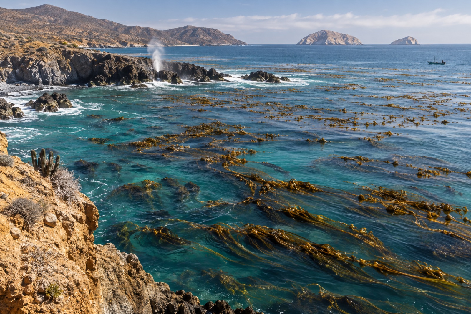
Stand at La Bufadora lookout, on the cliffs at the southern lip of Bahía de Todos Santos, and you can see the whole argument of this coast in one glance. Below you a blowhole detonates swell into spray; offshore, the low humps of Islas Todos Santos hold the open Pacific's energy; between them and the industrial port of Ensenada lies a bay upwelled, cool and green through most of the year, with beds of giant kelp stitched against the rocks. This is where the great kelp band of the North American west — the same species that runs unbroken to Alaska — begins to argue with the warming south, and it is one of the most instructive coasts on Earth for understanding what a kelp forest at its range edge actually does.
This guide covers the bay and its surrounding coast: the ocean engine that feeds it, the kelp beds themselves, the human story of science and harvest, and how to see it all — from cliff, kayak or underwater.
Ensenada sits at about 31.8°N on Baja California's Pacific shoulder, where the peninsula's coast first opens into a substantial bay. The Bahía de Todos Santos is big water — roughly 15 kilometres of open bight between Punta Banda's headland to the south and the low rocky points north of the city — but the kelp story here is written on the point sections and islands rather than the open sand floor of the bay. The beds of this region, like all the Baja beds, are the same giant kelp that makes the Monterey and Channel Island forests famous; what changes this far south is not the species but the margin for error.
South of here, the coast continues the pattern — beds at Salsipuedes, at Eréndira, around San Martín island — with the canopy thinning and stressing as it approaches the warm-water turn that ends the species near the peninsula's central latitudes. For the full sweep of that southern frontier, the companion guide to Baja California's kelp frontier traces it to the last beds; and offshore to the west, the volcanic outlier of Guadalupe Island shows what the same species does around a rock in the open ocean.
The oceanography that pays for all of this is the offshore machinery of the California Current: a slow southward river of cool water, overlaid by a near-northwesterly wind regimen that, through the mechanics of upwelling, continuously peels the warm surface skin away and replaces it with cold, nutrient-rich water from depth. Around Ensenada the upwelling is part of the great chain of centres along Baja's Pacific coast; in good years it keeps the bay's surface waters in the mid-to-high teens Celsius through much of the growing season, cool and green and thick with plankton.
That is the good news, and the fish story of the bay: sardines, anchovies, market squid and the rest of the pelagic engine, with the kelp beds harvesting the same nutrient tide. The bad news has become more familiar. The marine-heatwave years — the Blob of 2014–15 and the strong El Niño that followed — put warm, nutrient-poor water over these beds for seasons at a stretch, and the kelp canopy of northern Baja thinned drastically. The mechanics of that pattern — how the Pacific's warm moods switch the kelp coast's buffet off — are the subject of our explainer on El Niño and kelp. Ensenada's beds have partially regrown from cooler years since, but the recovery is visibly patchy and the whole coast reads as a range edge: forest where upwelling is strongest, scrub and urchin where the warm years won.
Ensenada is one of the eastern Pacific's real marine-science capitals. The city hosts major Mexican oceanography and marine-biology institutions — a concentration of research capacity unusual for a town its size — and the monitoring of these beds, their urchin predators and their climate history has been the subject of serious, long-run scientific attention from those local institutions for decades. If the Baja kelp range edge is one of the better-understood range edges in the world, that is a great deal to do with Ensenada's labs and their generations of students and scientists.
The kelp itself is also a working resource. Mexico operates one of the only regulated commercial harvests of giant kelp anywhere, cut from Baja beds under federal concession and export-driven — historically the basis of an alginate industry — and managed, in principle, for sustainability: cut the canopy, leave the forest, return. The harvest is small by industrial standards but large enough to make this coast one of the few places where kelp-as-crop and kelp-as-forest co-manage explicitly.
And the bay's subtidal economy is broader. Red sea urchins from the reefs around the bay and the islands supply a significant dive fishery; abalone, once the coast's crown, still exists on concession grounds; and Islas Todos Santos own some of Mexico's most famous big-wave surf breaks. The whole coast — fishing pangas, research vessels, surf charters, weekend kelp-cutters — is an active, layered, working sea.
You can read this coast without a wetsuit. The classic land vantage is La Bufadora at the tip of Punta Banda: the cliffs look south into open Pacific and across the bay at the kelp beds on the island side; whale watchers work the headland in gray-whale season, when the migration passes through the bay on its way to the warm lagoons. On the north side, the point coasts toward Salsipuedes give long views across kelp-bed outer edges on calm days.
From a kayak, the Punta Banda coast and the calmer days around the islands' leeward shores let you paddle canopy-top over a kelp bed at its growing best — the same canopy-top discipline as any forest-top paddle, with an edge of Mexico's swell. Underwater, the kelp around the islands and the rocky points of the outer bay is the draw: deep green, heavily birded from above, and — by the nature of the range edge — a wilder, patchier forest than the northern sites. Surge and swell are the coast's landlords; treat the entry points with respect, watch the wave period before committing, and default to local operators' advice. Our deeper water-kelp guide to kayaking over kelp beds covers canopy etiquette; here add two local notes — the outer-island water moves, and the wind picks up by early afternoon through most of the year.
Stand at La Bufadora in a warm year, look at the thinned canopy, and you are reading the future of the whole eastern Pacific kelp band, spelled early. Northern Baja is the coast's canary: a forest that is already living at the warm limit of giant kelp's tolerance, fed by upwelling that the climate steadily erodes, managed — imperfectly but consciously — as both forest and fishery. That makes Ensenada not a fading edge but one of the most important laboratories in kelp ecology: the place where the species' limits are measured first, and where the practices that may keep kelp on the coast through a warming century will be proven.
For Tidewright's part, this coast sits high in the satellite record: our canopy mapping platform tracks Baja's beds as the southern sentinel of the North American forest — the work described on the Canopy Ledger page. Range-edge forests are the first to signal stress, which is precisely why they matter: what happens to Ensenada's kelp in a warm year is the memo the rest of the coast reads a decade later.
Late summer into fall (August–October) for the warmest, clearest water, though the canopy is tallest through spring and early summer. Winter brings gray-whale traffic and bigger swell; mornings are almost always better than afternoons for wind.
Not fundamentally, but it helps ashore: operators running the islands and point dives are used to visiting divers, and basic Spanish smooths panga trips, tank fills and launches.
The islands are a few kilometres offshore in exposed Pacific swell and are properly a boat dive or surf destination rather than a paddle; on a calm morning with local advice the inner coasts of the bay are the sensible kayak kelp viewing.
Same species, thinner margins. The beds are Macrocystis pyrifera, but their exposure to warm events is sharper this far south and their recovery patchier; in a hot year, this coast's canopy leads the retreat that Northern California reads years later.
Yes: gray whales pass through and past the bay December–March on the migration to the calving lagoons. La Bufadora and the outer points are the store-bought viewing; the kelp beds inshore sit over the same water the whales travel through.
Baja California's Pacific kelp beds mark giant kelp's warm-water frontier — a coast of El Niño crashes, fast recovery, red urchin fisheries and hard-won lessons.
Dr. Elias Brandt ·
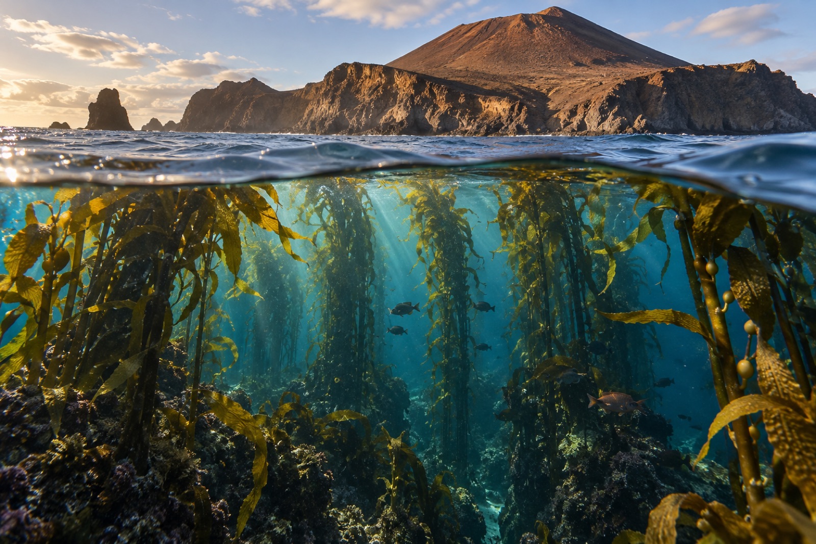
A volcanic island 250 km off Baja with great white sharks above, recovering fur seals on the rocks, and a giant kelp forest that ride out the great heatwaves.
Tom Okafor ·
Where the California Current's kelp fringe meets Baja's mangrove lagoons — a meeting of two worlds, winter whales and the southern frontier of giant kelp.
Tom Okafor ·