Our main Esperance guide covers the coast most visitors meet: the town foreshore, the sheltered white bays of Cape Le Grand, Woody Island's snorkel trail. This entry is about everything beyond that — the long, harder country to the east and the scattered granite worlds of the outer archipelago, where the kelp forest is denser, the swell trains harder against the rock, and the number of people who have ever put a mask in amounts to a rounding error. If the accessible coast is the shop window, this is the warehouse.
The far east: Cape Arid and the road toward Israelite Bay
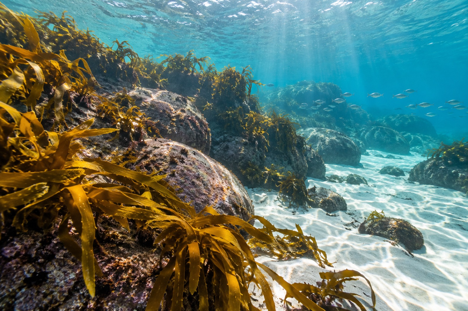
East of Esperance, the settled coast gives out in stages. Cape Le Grand National Park ends; the tarmac ends with it. Beyond lies Cape Arid National Park, the first of the really remote parks — granite massifs rising from the bush, bays of the same impossible sand, reached by gravel roads that corrugate the fillings out of your teeth. The coast here faces the Southern Ocean with less archipelagic shelter than the bays near town: the kelp clings to the granite headlands while the bay floors are surge-washed sand, and the reefs have the trained, low-growing look of forest that lives in heavy water.
Beyond Cape Arid, the country thins into deep remoteness. Israelite Bay, some 200 kilometres east of Esperance, is the end of meaningful access — a lonely crescent with the ruins of a telegraph station from the 1870s, when the coast was threaded by the overland telegraph line that connected Western Australia to the rest of the continent, and little else. The shoreline continues east toward the Baxter Cliffs, the great limestone rampart that begins the long cliffed run of the Southern Ocean edge. Out there, nobody surveys, nobody dives, and the kelp gets on with it — which is precisely the point of this piece.
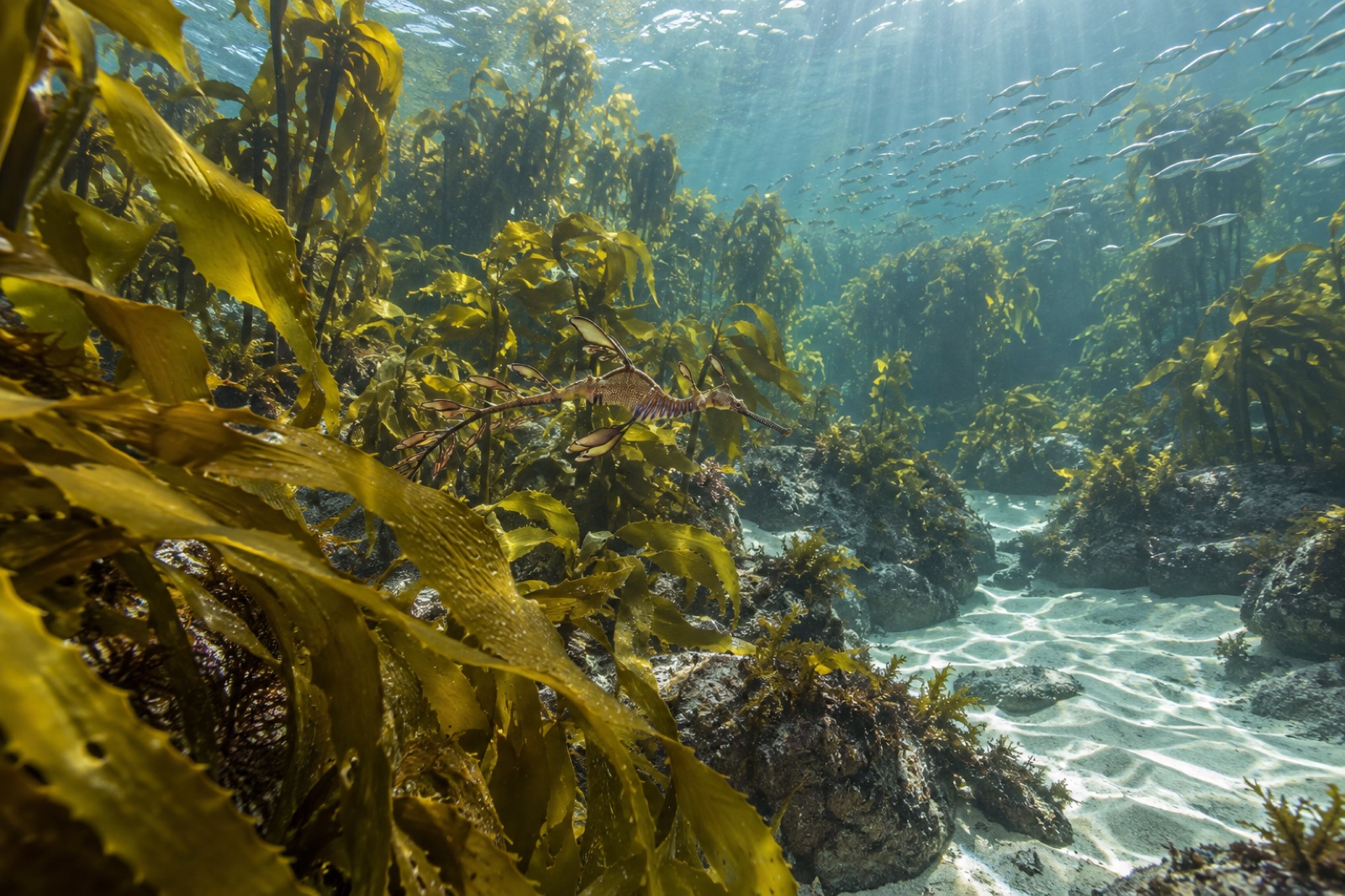
The water along this coast stays in the cool temperate band: summer surface temperatures in the low twenties, winter in the high teens — the working range of Ecklonia radiata, the golden common kelp that canopies the Great Southern Reef from Kalbarri to New South Wales. The Leeuwin Current runs warm and weak along the shelf here, keeping the winters mild; the price is heatwave exposure, which we will come to.
The outer archipelago: islands beyond the day trip
The Recherche Archipelago numbers over a hundred islands and stretches about 230 kilometres west to east; only the inshore fraction — Woody Island, the Cull and Figure of Eight group, the skerries the charters run to — lies within easy reach. Beyond them, an outer world of granite rises from deeper water.
Middle Island, among the largest of the archipelago, is famous above water for Lake Hillier, a salt lake the colour of strawberry milk whose pink comes from salt-loving microbes and algae — a fact most visitors to Esperance know. Underwater, Middle Island is a different proposition: exposed granite flanks dropping into clear blue, kelp-trained to the swell, walls that have probably been dived by fewer people than have walked around the lake. Salisbury Island, some 60 kilometres offshore, is the archipelago's far south-easter — a steep granite hump visited by fishing boats, whale researchers and almost nobody else. Australian sea lions haul out and breed on remote islands of the Recherche group, one of the Western Australian populations of this listed species, and New Zealand fur seals work the outer skerries.
The outer islands matter to kelp science for a simple reason: they are what the coast looked like before people touched the inshore every day. Their forests, never cut, never anchored over, rarely fished line-by-line, are a reference condition — the same logic that makes remote archipelagos like King George Sound's shelter islands so valuable a few hundred kilometres west, and that has made the whole system a quiet anchor of Great Southern Reef research.
What remoteness buys the kelp
Three things, in order of importance.
Baseline. The forests east and offshore of Esperance are as close to untouched as temperate Australia has. Whatever industrial fishing, anchoring scarring, harvest pressure, or coastal development has done to more accessible reefs has not happened here. For scientists trying to know what a healthy southern kelp forest looks like — how dense, how diverse, how much carbon it turns over — these coasts are the yardstick.
Refuge. The Esperance coast sits in the cooler mid-band of the Great Southern Reef's range. As marine heatwaves stack up along the coast and the kelp's northern and western range boundaries shift, mid-range forest with deep offshore refugia may be the last stand for warmth-sensitive species. Western Australia watched the 2010–11 marine heatwave restructure the kelp coast hundreds of kilometres away in an afternoon of oceanographic accident; this coast's relative coolness is a kind of insurance the whole Great Southern Reef needs.
Biodiversity endemism. The south coast of Western Australia is one of the world's great marine endemism factories — weedy and leafy seadragons drift the weed edges here, harlequin fish are ubiquitous, and the western blue groper was born loyal to this granite. The remote stretches harbour the same communities the accessible ones do, which means the remote stretches behave as the nursery and reserve for the visited ones.
How to approach it, honestly
This is a coast for a handful of committed travellers a year, and the details matter.
Cape Arid is the reachable fraction: a standard four-wheel drive, a corrugated gravel road, and camping basics reach bays of the same quality as Cape Le Grand with the number of visitors divided by a hundred. Entries are from the beach or the granite; the reefs are close inshore; the water is the same blue; and you will see nobody.
Israelite Bay requires serious four-wheel driving, full provisioning, fuel for the round trip and the understanding that you are beyond help. The camps are basic, the bush is dense, the track is slow. It rewards the kind of traveller for whom that is the entire point.
The outer islands are expedition diving. A charter from Esperance with a capable boat can reach the outer groups in settled weather; the runs are hours, the seaways exposed, and the weather window is the thing — the afternoon south-westerly that rules the whole Esperance coast rules the outer water twice as hard. Experienced skippers plan their outer-island dives in the early morning on autumn high-pressure days, when the Southern Ocean grace period sometimes settles the whole shelf. There is no fill station, no rescue, no second opinion. That is also part of the point. For the general discipline of reading forecasts before committing to remote water, our guides to reading marine forecasts and reading swell are the starting kit.
Whales: southern rights work the bays and the island channels in winter and early spring, and a slow boat run in July is a whale trip by default. The Bremer Canyon region, to the west, hosts one of the hemisphere's great orca aggregations — separate trip, worth its own plan.
Stewardship on the edge
The Great Southern Reef's Western Australian section is monitored in snapshots: research expeditions, community surveys, satellite records, eDNA point samples, and a slowly tightening network of citizen observations. Esperance sits at the western margin of the reef's most resilient block, which means the data collected here — every seadragon logged, every canopy assessment, every water-temperature record, every kelp survey — feeds a picture that future conservation depends on. A coast this remote cannot be protected by constant human attention; it is protected instead by good maps, honest baselines, and the insistence that "remote" does not mean "unmeasured".
Tidewright does not run a program on the Esperance coast. Our work concentrates where the forests have broken. But we think of coasts like this one the way mountain climbers think of the great untouched faces: not as places to be conquered, but as the standard we are restoring everything else toward. A restored forest on a broken coast is measured against places like this. Which is why the remote kelp of the Recherche matters to every kelp forest that needs help: it is what success looks like.
Key takeaways
- Beyond the accessible bays, the Esperance coast stretches east through Cape Arid to Israelite Bay and beyond, and the outer Recherche Archipelago islands sit 40–60 kilometres offshore — all of it carrying dense kelp forest almost nobody dives.
- Remoteness buys the kelp three things: a baseline of what healthy southern forest looks like, a refuge against future heat, and a reservoir of endemism shared with the visited coast.
- The realistic remote experiences are four-wheel-drive to Cape Arid and beyond; outer-island diving is expedition-grade, autumn-window work with a capable charter.
- This coast is not just a pristine curiosity: it is the reference standard the whole Great Southern Reef's restoration and monitoring efforts point back to.
FAQ
Is Cape Arid as good as Cape Le Grand for snorkelling?
On a good day, yes — same sand, same granite, same clear water, far fewer people. The trade-off is access: corrugated gravel roads, camping, and no services. A standard two-wheel-drive can sometimes reach the main beaches in dry conditions, but a four-wheel drive is the honest answer.
Can I visit Middle Island and the pink lake?
Access to Middle Island is restricted — it lies inside protected waters and the lake itself is viewed on scenic flights rather than walked around. The underwater flanks of the outer islands are expedition-diving territory, not day-charter water. Most visitors see Lake Hillier from the air and meet the remote archipelago only in binoculars and photographs.
What is the best season for a remote Esperance trip?
Autumn — March to May — is the local favourite: the south-westerly sea breeze softens, high-pressure systems settle the shelf, and the water is at its warmest and often clearest. Winter brings southern right whales into the bays but more swell; spring is erratic; summer is fine but runs on the afternoon sea breeze everywhere.
Is there any marine park protection out there?
The Recherche Archipelago is covered by a state marine park with sanctuary zones around key islands; much of the outer water is open to fishing under normal rules. The protection picture on this coast is incomplete and evolving — which is exactly why the baseline science matters: you cannot argue for protecting a forest you have not mapped.
How urgent is the climate threat here?
Less immediate than on the heat-exposed coasts of the mid-west, less severe than the giant-kelp collapse of Tasmania — but the trend is written in the same ink. Every temperate Australian kelp coast is watching the same drivers: heat records, range shifts, the slow compression of cool habitat. This coast is insurance, and insurance is what you buy before you need it.