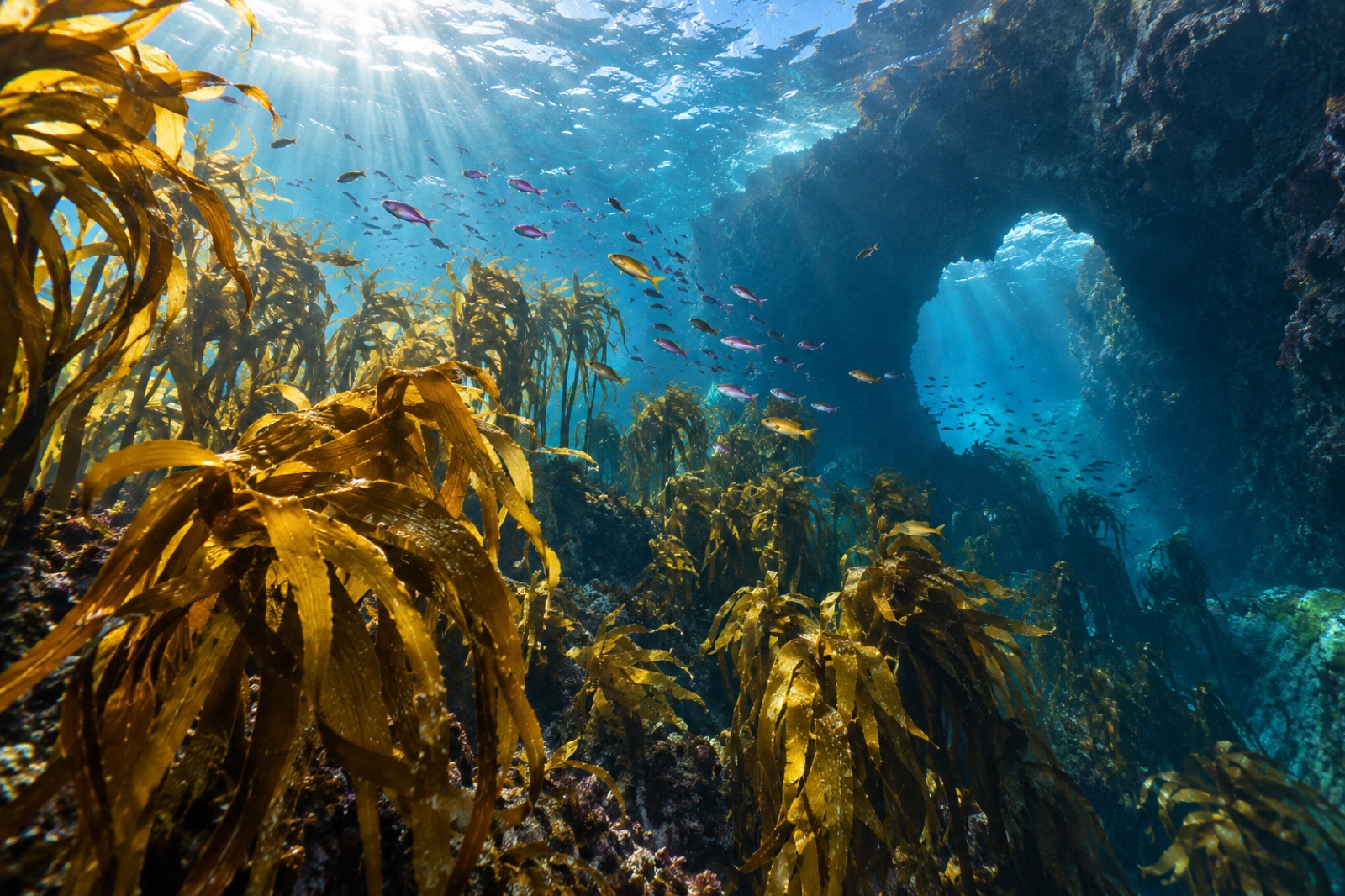
Stand on Cape Brett on a calm morning and the map of New Zealand's oceans is visible as a colour change. Out to the east runs the East Auckland Current — warm, blue, subtropical water sweeping down from the Coral Sea. Inshore and to the south, cooler, greener temperate water carries a different set of species. Northland, the long peninsula at the top of the North Island, sits exactly on that seam; it is the only part of New Zealand where the kelp forests of the temperate zone grow within easy range of species more at home in the tropics. The result is a coast of unusual richness — and a coast whose marine reserves taught the world some of the best lessons in how reefs recover.
Where the currents meet
Oceanographically, Northland is a boundary province. The dominant kelp is the temperate Ecklonia radiata, the workhorse alga of virtually every exposed rocky reef in New Zealand — flexible, canopy-forming, the oak tree of these temperate seas. (The genus-level story is a fine one; the Great Southern Reef guide covers Ecklonia's continental presence across the Tasman.) Around it weave the species of the subtropical edge: silver drummer and demoiselles in dense summer schools, tropical vagrants drifting in on the current — butterflyfish, seasonal surgeonfish, the occasional visiting turtle. The Cape Brett lighthouse, standing over the seam, looks down on both worlds at once.
The coast itself divides into:
- The east coast — the sheltered, intricate face: Bay of Islands, Cape Brett, the Cavalli and Hen and Chickens archipelagos, and finally the famous Poor Knights. This is the diving coast.
- The west coast — the storm-worn face: Ninety Mile Beach, Hokianga's dune-bound harbour, exposed Tasman swell. Little kelp, huge sand, and a very different ecology.
- Cape Reinga — the northern tip, where the two seas famously churn a visible meeting line in the water. Māori oral history places the leaping-off place of spirits here, and it is honestly one of the great headlands of the Southern Ocean.
The kina story: Northland as laboratory of trophic cascades
The classic kelp-forest conservation puzzle — the interplay of predator, grazer and kelp — was worked out in large part right here on this coast. The key player is the kina (Evechinus chloroticus), New Zealand's endemic sea urchin, which grazes kelp and, when untreated by its predators, converts reef after reef into pink crusted barrens. Those predators — large reef fish such as snapper, and rock lobster — were historically heavily fished along this coast; the consequence, described by decades of local research, was a coast on which urchin barrens spread widely while kelp shrank.
Then came the marine reserves. The Poor Knights Islands became a marine reserve in 1981 — among New Zealand's first and today its most famous reserve. Further south, the Goat Island Marine Reserve (technically in the Auckland region, the coast's ecological sibling) became the first in the country in 1975 and provided some of the clearest documentation of the dynamic: decades after the reserves were declared, snapper and lobster numbers recovered, urchin densities dropped, and kelp forests regenerated. The story is told in sequence — founding science, boundary setting, monitoring, and the long patience of recovery — across the global trophic-cascade literature, and our trophic cascades in kelp forests explainer tells the Northland chapter in full.
What this means for the visiting diver: inside the reserves you will find plate-sized snapper lifting out of the water column like something from a documentary, kelp in full canopy, and reefs reaching a structural complexity the unprotected coast can only approximate. Outside the reserves, kina barrens are still widespread; the difference is often visible in a single afternoon's diving, attested by the northern stretch between the reserves and the unprotected coast as clearly as anywhere on earth.
The diving hotspots
- The Poor Knights Islands — the crown. Volcanic arches, caves with sheer walls, and the northernmost concentration of the coast's species: morays, big-eyed trivially, and pelagics drawn by the current. Accessible by licensed boat from Tutukaka. The Poor Knights guide has the details.
- Cape Brett — the seam itself: deeper walls, kelp giving way to open-water reef structure, where the current brings the surprise fish: kingfish in packs, sometimes manta-style visitors on the current.
- Cavalli Islands — an offshore string east of Whangaroa that's mostly boat access; good kelp, and the wreck of the Rainbow Warrior, Greenpeace's boat, deliberately sunk in 1987 as an artificial reef. Within a couple of decades the steel frame was fully green with algae, and the wreck is now a working part of the reef it was invited to join.
- Whangaroa and Doubtless Bay — beautiful, quieter, harder country; shore entries off rock ledges at low swell, suit-wearing snorkel-wetting immersion in the local shore ecology.
Māori sea country
Northland is Te Tai Tokerau, the ancestral land of many iwi — the ocean here is not scenery but whakapapa, genealogy. Customary management practices include rāhui — the declaring of temporary no-take restrictions by hapū to allow stocks to recover — a governance model that predates formal marine reserves by centuries and is now increasingly recognised and applied alongside statutory reserve frameworks. Visitors, especially from offshore, do well to honour this; signage and seasonal kina or pāua rāhui should be strictly respected, and any customary area specific advice given locally valued above generic tourist guidance. For the broader story of integrated ocean stewardship, Tidewright's Reef Partners program works in the same spirit: marine management partnership with the people — Indigenous and community — who have held the governance of these coasts.
Season and tips for visitors
- Best water. March to May typically offers the warmest, clearest water of the diving year on the east coast; spring can be plankton-rich, beautiful but hazy. Winter is cold but workable with a decent 7 mm suit.
- Access. The east coast is mostly about boats; Tutukaka is the base for the Poor Knights, Kerikeri or Paihia the base for the Cavalli and Cape Brett. Shore diving at Pataua or around Whangaroa requires care with rock and surf.
- Boundaries. Get current maps of any protected areas; many have specific seasonal or activity rules, and the network's formal boundaries should be known before you put the anchor down.
- Gear. Aim for at least a 5 mm suit even in summer; the current's cold water — the "tropical" water with Northland is far from warm season-round — finds every gap.
- The seam. On a calm morning, fly a drone (with permission in place and with respect to iwi protocols; some areas restrict operation over customary domains) and you can often see the warm-current blue separated from the coastal green by a sharp line off Cape Brett. It is the diving story in a single image.
Key takeaways
- Northland is where New Zealand's temperate kelp ecology meets the subtropical ocean, generating unusual species overlap around Cape Brett and the offshore islands.
- The kina–snapper–kelp trophic cascade was worked out, observed and demonstrably reversed in this coast's pioneering marine reserves.
- The Poor Knights Islands are the headline dive destination; the Cavalli Islands and Cape Brett offer strong seconds from Paihia and Whangaroa bases.
- West-coast Northland is a different ocean country: no kelp canopy, outstanding surf and sand ecology.
- Māori customary rāhui and reserve frameworks work together here; visitors should understand and respect both.
FAQ
What's the best time of year to dive Northland?
Autumn (March–May) is typically the consensus for the best combination of warm water, clear visibility and calm seas on the east coast. Summer is workable but busier; winter requires a proper thick suit.
Are the Poor Knights Islands easy to visit?
Yes and no: access is by licensed commercial boat from Tutukaka, which makes logistics simple. The sites themselves are beginner- and intermediate-friendly in good conditions. Snorkelling the islands is recommended for the non-diver.
What is a rāhui and do I need to know it?
A rāhui is a temporary customary no-take restriction declared by local iwi hapū to protect stock or grieve a place. Northland's rāhui must be respected as law-adjacent custom — signage and local information make restrictions clear when in force.
Is there kelp on Northland's west coast?
Nothing like the east coast's Ecklonia radiata forests; the west coast's high-energy sand and surf support different algal communities and a different ecology. The east coast carries the kelp story.
Is the Cape Rodney/Goat Island reserve in Northland?
Technically no — Cape Rodney–Okakari Point (Goat Island) is in the Auckland region, roughly 100 kilometres south of the Northland boundary. But ecologically and in the conservation-historical story it is part of Northland's reef network, and the Goat Island guide covers it on the basis that helped shape the whole region's understanding of kelp recovery.