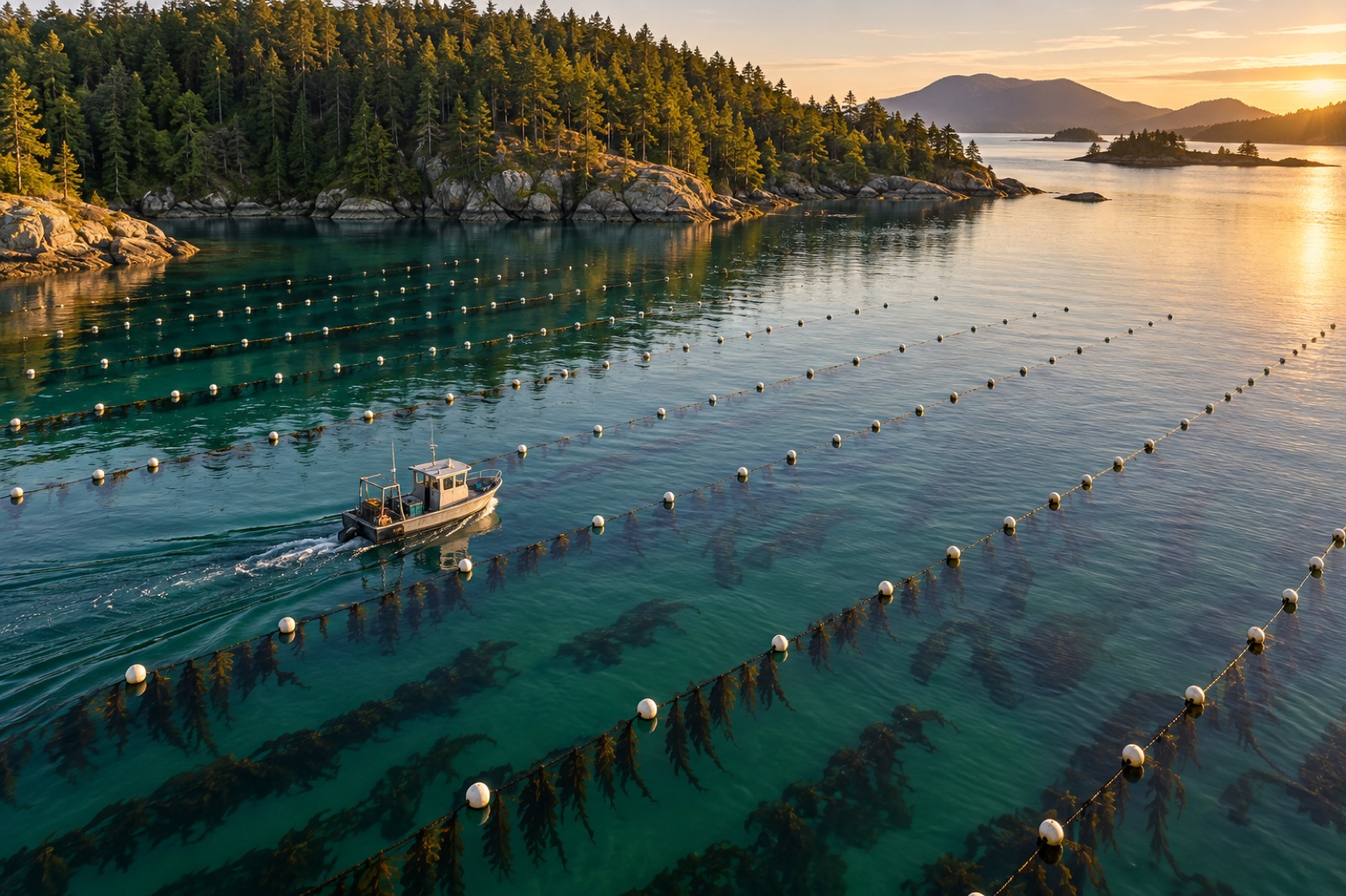
Ask most small seaweed farmers where their best longline was last year and you'll get a gesture toward the water and a story. Ask for the exact coordinates, the seed date, the harvest yield and the temperature trace for that particular line, and the answers get thinner. That gap between memory and record is where farm performance quietly leaks away.
You don't need a survey department to close it. A consumer drone, free GIS software and about one afternoon per survey flight will build a spatial record of your farm that compounds in value every season. This guide covers what to map, how to fly it legally, and how to turn the images into decisions — the same principles, at friendlier scale, that Tidewright's Canopy Ledger platform applies to whole coastlines.
What a farm map is actually for
Mapping is not an aesthetic exercise (although the photos are lovely). A spatial record answers four operational questions that spreadsheets can't:
- Where, exactly, is everything? Anchor positions drift in memory and in storms. Coordinates for every anchor, line end and corner buoy make gear findable after big weather — and make insurance and lease compliance much easier, topics covered in insuring a seaweed farm.
- Which parts grow better? Yield per line varies across a site, and the pattern usually has a reason: light, current, depth, exposure. When yield data sits on a map next to line depth and aspect, the pattern shows itself.
- What's changing season to season? A March canopy photo series across three years is a growth curve you can see.
- Who needs to see this? Regulators reviewing a lease, a buyer auditing the farm, a lender, a neighbour worried about navigation — a clean map is a professional credential, the cartographic cousin of the paperwork in seaweed farm permits.
GIS software. QGIS is free, open-source and more powerful than anything you'll need for a decade. It handles coordinates, layers, aerial imagery basemaps, measurements and exports. The learning curve is a weekend. Alternatives like Google Earth Pro (also free) are friendlier for marking and sharing simple positions but weaker for analysis.
Position capture. A modern phone's GPS is accurate to a few metres in open coastal conditions — fine for buoy positions. Log a waypoint at every anchor and line end when you deploy, and enter them into a spreadsheet the same day, while the boat deck is still wet. The discipline matters more than the hardware: coordinates written on a wet glove don't survive.
The drone. A mid-range consumer quadcopter with a mechanical-shutter camera is plenty. You're not buying cinematography; you're buying a repeatable viewpoint a few dozen metres above the water.
Flying legally and safely
Drone rules differ by country, but the shape is consistent. In most jurisdictions, flying a drone over water for a commercial purpose — and a farm is a commercial purpose — requires some form of operator registration or certification, altitude limits (commonly 120 m), visual line of sight at all times, and distance rules from people, vessels not involved in the flight, and airports. Flying from a boat is permitted in many systems but adds obligations about vessel movement and other water users. Check your national aviation authority's rules, register, and carry proof on site.
Practical seamanship for drone work: fly from the foredeck with the boat in neutral and nobody forward of you, plan the return-to-home point to update as the boat drifts, and treat wind limits as hard. Salt water is fatal to drones and the sea keeps every one it catches. A drone that stays home in a blow is a drone that flies again next month.
What to photograph, and when
Keep the survey simple and repeatable — the magic word. The same altitude, the same time of tidal state, the same grid.
- Whole-farm overview shots at 60–100 m altitude, oblique and vertical, once a month through the growing season.
- A vertical photo grid over the line array, with 70% forward overlap, if you want an orthomosaic (one stitched, measurable image of the farm) using free tools like WebODM or a trial of commercial stitching software.
- Low passes along individual lines when scouting biofouling or ice damage — a drone beats leaning over the gunwale for reading canopy condition, especially as fouling builds through spring (see managing biofouling).
- Fixed "photo points" from the boat at water level, same bearing and subject each visit, for the record the drone can't give: what the blades actually look like up close.
Fly at low tide where the structure sits shallowest and contrasts best, in calm, overcast-bright conditions — harsh sun puts glint on the water that hides the lines. Note canopy presence the way satellite analysts do for wild forests (how satellites see kelp); your drone is just a very close satellite.
Turning images into layers
The GIS habit that pays is one map, many layers:
- Base layer: the current lease boundary, from your permit documents, as a polygon.
- Infrastructure layer: anchors, lines, buoys as points and polylines, each with attributes — date deployed, rope spec, seed batch.
- Production layer: yield per line per harvest, coded by colour. This layer is where next season's layout decisions come from.
- Environment layer: sensor positions from your temperature and DO loggers, current observations, plus any local water-quality context like depth and exposure from your original site selection work.
- Incident layer: storm damage, gear loss, fouling outbreaks, wildlife interactions — things you will absolutely need dates and positions for later, usually when writing an insurance claim or a report.
With thirty minutes a week of upkeep, you end the year with a document that answers "what happened at this farm" better than any honest memory can.
Reading the map for decisions
A few patterns worth looking for once you have two seasons of layers:
- Cold edges and warm edges. Overlay yield on position and you'll often find the outer lines or the deeper lines out-performing — usually a light and water-movement effect consistent with reading the water.
- The expansion case. When applying to extend a lease, a map showing low conflict with navigation, tidy gear and two years of monitoring is the strongest exhibit in the file.
- The neighbour conversation. Shared channels and mooring fields generate most farm-neighbour friction; a printed map ends the argument about whose buoy is whose.
And when you outgrow the drone — when the question becomes canopy change across a whole bay rather than one lease — that's the scale of monitoring Tidewright builds into Canopy Ledger, described in our platform documentation. The habit is the same at every scale: measure, map, compare, decide.
Key takeaways
- A farm map exists to answer operational questions: where gear is, what grows where, what's changing, and who needs evidence.
- The stack is cheap: free QGIS, phone GPS, one consumer drone, disciplined same-day logging.
- Repeatability beats resolution — same altitude, tide state and flight grid every survey.
- Drone work on a commercial farm is regulated; register, certify where required, and respect hard weather limits.
- Layer yields over positions for two seasons and the site will explain itself; layer incidents and insurance becomes paperwork instead of archaeology.
FAQ
Do I need a licence to fly a drone over my own farm?
In most countries, yes — because the farm is a commercial activity, even small drones used for it fall under commercial/drone-operator rules (registration or certification, altitude and line-of-sight limits). Rules vary; check your national aviation authority before the first flight.
What drone should I buy for farm surveys?
A mid-range consumer quadcopter with a decent camera, 25+ minutes of real battery life and obstacle avoidance is enough. Spend the savings on spare batteries (salt air eats flight time) and a landing pad — boat decks reward anything that prevents a bounce overboard.
Is QGIS hard to learn?
The first weekend is uphill, then it's a tool like any other. For pure waypoint storage, Google Earth Pro is gentler. Either way, the key step — logging coordinates the day gear goes in — happens on the water, not in the software.
How often should I fly survey flights?
Once a month through the growing season is a good default, plus after major storms for a gear-integrity check, and at harvest to document removal. Consistency matters more than frequency.
Can drone photos replace diver or boat inspections?
No — they complement them. A drone reads canopy, geometry and surface condition superbly; it can't check an anchor shackle or a tangle of line at two metres' depth. Use the drone to target the boat time, not to skip it.