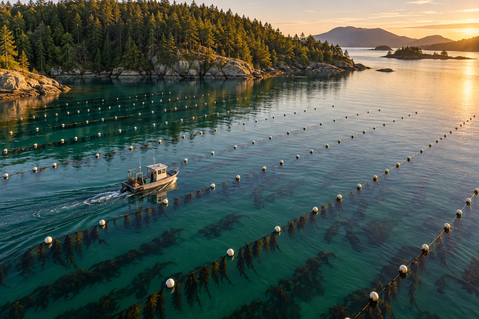
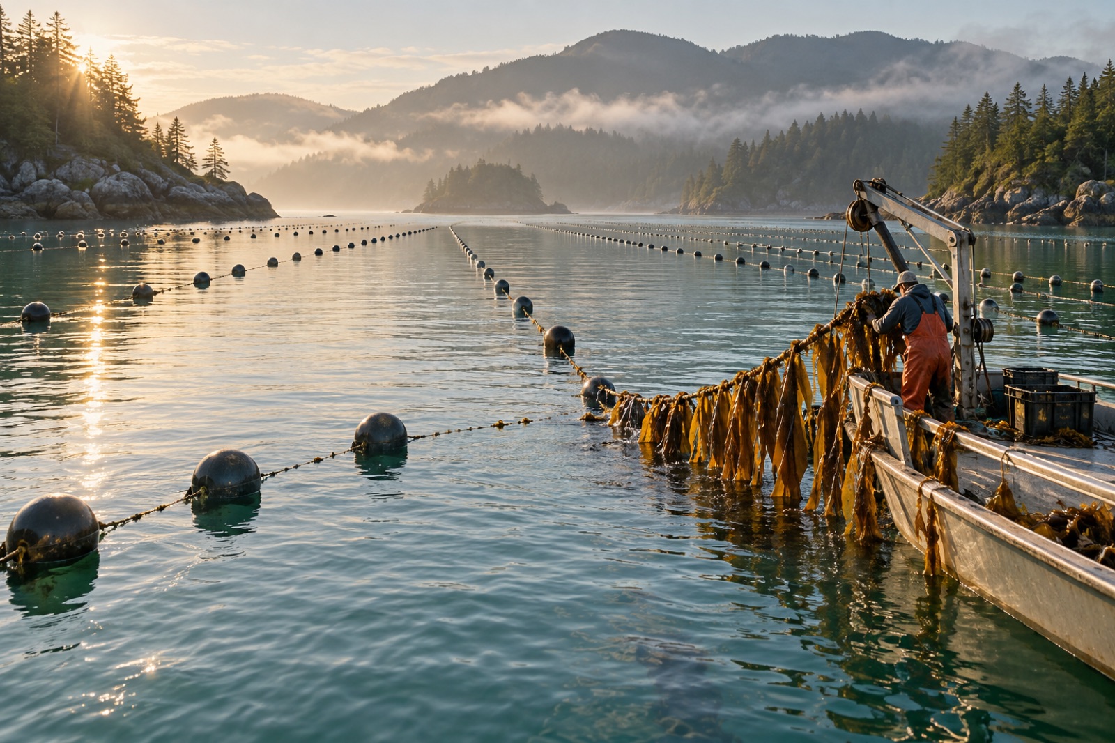
Ask a veteran seaweed farmer what separates a good farm from a bad one and you will rarely hear about rope or seed. You will hear about the site. A well-chosen hectare forgives beginner mistakes all season; a badly chosen one punishes perfect husbandry. Site selection is where farming is actually decided — and unlike most farm decisions, it is made mostly from charts, sensors and conversations, long before any gear touches water.
This guide walks the evaluation the way working growers do: the five physical criteria that decide whether a crop can thrive, the water-quality and biosecurity checks behind them, and the social map — neighbours, navigation, protected areas — that decides whether you will be allowed to farm at all. It pairs with the business planning in starting a seaweed farm and the drawing exercise in longline layout.
The five physical criteria
1. Temperature: the criterion that vetoes
Cold-water kelps live inside a hard temperature envelope — for sugar kelp and most farmed laminarians, thriving roughly between 4–14 °C and struggling past the mid-teens. One warm month at the wrong time does not stress a crop; it ends it. So start with data, not hope: pull a multi-year record from public monitoring buoys, shellfish growers or port authorities, and if none exists, hang your own logger for a year before you commit. What you are hunting is not the average but the tail — the warmest summer week in the record, and how often temperature spikes repeat. On warming coasts, one anomalous marine heatwave teaches you more than five calm years; a site that stayed cool through the last big event is worth a premium.
2. Current: the crop's delivery service
Kelp does not forage; it waits for the current to bring dissolved nitrogen. Water motion also keeps fronds swept clean of sediment and fouling. The practical tests:
- Speed: a persistent tidal or residual current of roughly 5–25 cm/s at the growing depth is a healthy working range. Slacker than that and downstream lines starve; much faster and drag loads climb and fronds tatter.
- Direction: a current that reliably crosses your intended lines feeds the whole grid — one reason layout and site selection cannot be separated.
- Source: headlands swept by oceanic flow, estuary mouths, and water moving past shellfish leases all tend to run nutrient-rich. Tidal flats and enclosed backwaters often run nutrient-poor by late summer. Regional context matters — coasts fed by upwelling seasonally receive deep, nitrogen-laden water that transforms a site's carrying capacity.
3. Exposure: shelter from storms, motion for growth
You want moderate, constant water motion and rare extreme water motion — which is an engineer's way of saying: shelter. Look for protection from your dominant storm direction: a headland, island or reef that breaks the swell. Then check it honestly against the wave record, not a summer visit. The classic beginner error is scouting in calm months and meeting the site again in November. A workable test: find the storm peak your gear must survive (permitting authorities often state one explicitly), and confirm your candidate's modelled or observed conditions sit comfortably below what your planned anchoring can hold — the load side of that equation is covered in longline design for seaweed farms.
4. Depth: the 10-to-25-metre working band
Depth sets four things at once. Too shallow and lines strike bottom at low tide or bake in surface heat and freshwater lenses; too deep and anchors, risers and every dive job get harder and pricier. For standard longline systems, 10–25 metres at low water is the conventional working band: deep enough for subsurface gear to stay off the bottom and below the worst surface chop, shallow enough for efficient working. Match depth to bathymetry that actually slopes gently — a flat bottom keeps every line at equal growing depth, which keeps a crop uniform, which keeps harvesting fast.
5. Water quality: the invisible clause
Seaweed is a sponge with a paperwork trail. Before falling in love with a site, check for dissolved and suspended baggage: agricultural runoff carrying herbicides, industrial outfalls with heavy-metal histories, marinas leaching antifouling paint, and busy discharge points. For food-grade crops this is not optional diligence — buyers will test your product and occasionally your lease water — and some regions prohibit food aquaculture outright near outfalls. Turbidity matters too: persistent sediment loads smother seeded twine and shade young plants. Clear water is not always nutrient-poor, and green water is not always dirty — but know which you have, why, and through which seasons.
Biosecurity: what swims in with the water
A site's history includes its biology. Ask what has been farmed, dredged or discovered nearby: invasive tunicates, oyster drills, kelp pests and the notorious introduced kelps (a single Undaria lineage established nearby will find your lines within seasons — see the cautionary profile of wakame's global march). Shellfish farmers, harbour biosecurity officers and regional databases usually know more than any document; a fouling-heavy site can add endless labour to your season, and some authorities will refuse new leases in infested water precisely to stop you becoming a stepping stone.
The social site: neighbours, lawyers and social license
Half of site selection is human, and it deserves half your effort.
- Navigation. Stay honestly clear of fairways, anchorages, ferry routes and habitual small-boat lines. Charts understate how water is actually used; the harbourmaster and the pilot boat crew do not.
- Fishing grounds. Existing pot lines, dive spots and seasonal fisheries have prior moral and often legal claim. Farms that displace working grounds earn hostility that outlasts any permit appeal; farms that slot between them earn allies who watch your buoys in storms.
- Protected areas and species. Marine parks, eelgrass beds, seabird sites and marine-mammal haul-outs all reshape or prohibit aquaculture — and they should. Know the boundaries before you love a polygon.
- Cultural sea country. On many coasts, the first and most important conversation is with Indigenous sea-country holders and rangers. Coming early, listening first, and building shared value is both right and practical — Tidewright structures this through its Reef Partners program, and council-level engagement models are outlined on our solutions for coastal communities page.
- The view. Aesthetic objection is real and licences have been lost to it. A farm invisible from the headland lookout at sunset is worth hectares of diplomacy.
Scoring, sensing and ground-truthing
Turn evaluation into a scorecard: each criterion rated from Go / Conditional / No, with temperature and permitting status as absolute vetoes rather than averages. Then ground-truth the shortlist properly:
- Deploy a sensor set for a season — temperature, and ideally light and dissolved oxygen — at your proposed growing depth, moored inside the candidate polygon.
- Dive it or drop-camera it. Bottom type, existing fouling communities, sparse wild kelp (a lovely sign: the water already grows your crop) — imagery beats any chart.
- Sample the water late-summer, when nutrients bottom out and temperature peaks; if the site fails anywhere, it fails there.
- Consult formally. Harbourmaster, fisheries officers, neighbouring leaseholders, sea-country rangers. The record of who you asked — and what you changed because of it — becomes the strongest pages of your eventual permit file, and the difference between an appeal-proof lease and a contested one.
One season of patience here routinely saves a decade of grief. Sites are where farm luck comes from, and luck of this kind can be manufactured.
Key takeaways
- Temperature is a veto, not a variable: evaluate sites on their warmest recorded weeks, not their averages.
- Current is the crop's delivery service — moderate persistent flow across your lines beats almost every other advantage.
- Seek moderate everyday motion with genuine shelter from the storm axis, and verify against wave records, not summer visits.
- Depth of roughly 10–25 m at low water keeps gear workable and crops uniform; flat bottom is a hidden asset.
- The social map — navigation, fishing grounds, protected areas, sea country and the view — decides permits as much as biology does; consult early and in writing.
- Ground-truth with a season of sensors, a dive or camera survey and late-summer water sampling before signing anything.
FAQ
What is the single most important site criterion for kelp?
Temperature. Current, depth and exposure can be engineered around or mitigated with gear; a site that exceeds your species' thermal ceiling for two warm weeks simply kills the crop. Evaluate the record's worst summers — especially past heatwave years — rather than climatological means.
How much current does a kelp farm need?
As a working range, a persistent flow of roughly 5–25 cm/s at growing depth keeps nutrients delivered and fronds swept without overloading anchors. Much slower and you must thin spacing and accept lower carrying capacity; much faster and drag and frond damage become the season's theme. Direction matters as much as speed — flow should cross your lines.
How deep should the water be?
For standard horizontal longline systems, 10–25 metres at low tide is the conventional band: lines ride beneath surface chop and freshwater lenses without striking bottom, while diving, anchoring and hauling remain practical. The flatter the bottom inside your polygon, the more uniform your crop depth — and your harvest.
Can I farm kelp near a river mouth or estuary?
Sometimes, with care. Estuary plumes bring nutrients — helpful — but also freshwater stratification and sediment, which stress or smother kelp. Presence of a river is not disqualifying; a site inside the persistent low-salinity lens usually is. Salinity logging across seasons answers the question definitively.
How do I know if locals will accept a farm?
You ask them, early, and you listen more than you present. Talk to harbourmasters, fishing families, dive operators, shellfish growers and — first, on most coasts — Indigenous sea-country holders and rangers. Propose standoffs from their grounds and routes before being asked. Our guides to starting a farm and working with coastal communities cover how those conversations underpin the permit itself.