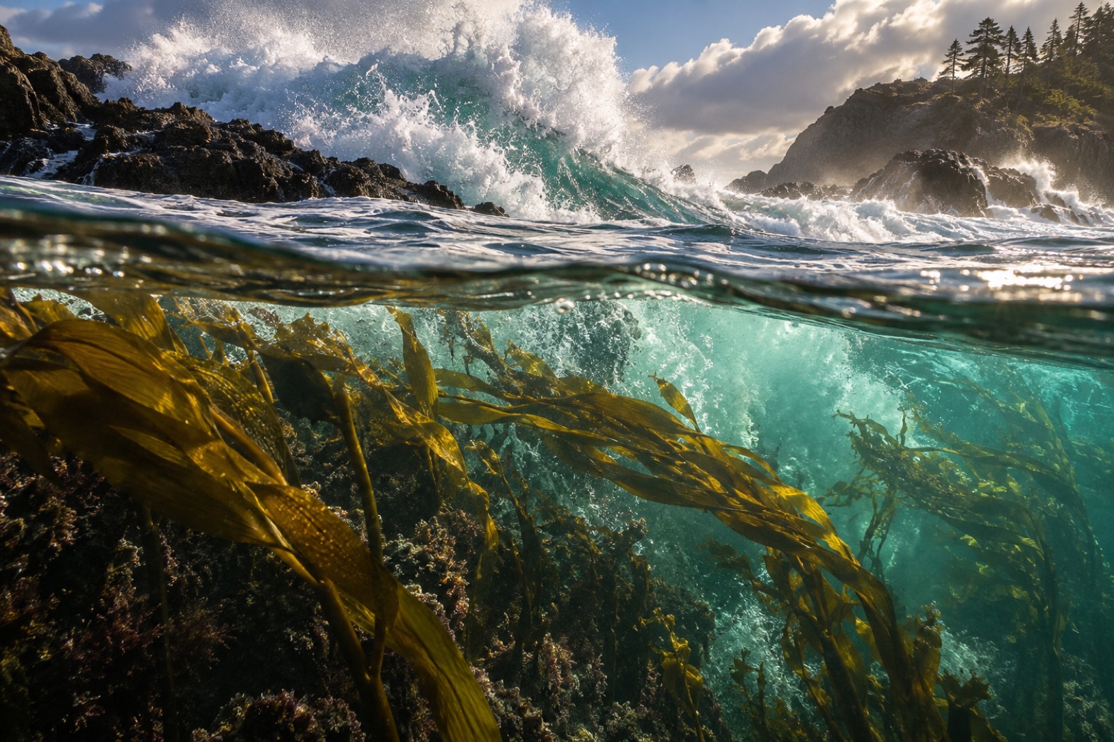
Every kelp forest begins as a geology story. Long before a spore settles and a holdfast takes grip, the coastline has already decided where a forest is possible: which headlands keep their rock naked, which reefs offer the right foothold, which bays bury everything in sand. Walk any rocky shore at low tide and you are reading that decision — written in wave-cut platforms, surge channels, boulder fields and cliffs. This is coastal geomorphology, and it is the quiet foundation under every hectare of canopy Tidewright surveys, plants and monitors. Here's how to read it.
The two great engines: waves and rock
A rocky coast exists because of a contest. On one side: wave energy — driven by wind over fetch, focused and re-aimed by headlands and bathymetry (wave refraction explains the aiming). On the other: rock resistance — a composite of hardness, jointing, layering and chemistry. Every coastal landform is the running score of that contest.
- Where waves overwhelm rock, cliffs retreat and platforms widen.
- Where rock overwhelms waves, cliffs stay sheer, shoreline change is glacially slow, and the intertidal zone remains a thin band.
- Where the two are roughly balanced and run at right angles — as on many tectonically active coasts — you get the classic stair-step of shore platforms and cliff.
The third player is time. Sea level has moved perhaps 120 metres in the 20,000 years since the last ice age peaked; coasts have been drowned, carved, and in uplifting regions like New Zealand and Chile — which suffered dramatic coseismic uplift in 2016 at Kaikōura — suddenly raised. Old shorelines sit stranded as benches above today's sea; drowned reefs wait below it. A rocky coast is always an unfinished argument with several drafts visible at once.
The shore platform — that broad, nearly horizontal bench of bare rock stretching seaward from the cliff base — is one of the shore's most-studied landforms, and the subject of a long-standing geomorphic debate. Platforms come, broadly, in two families:
- Sub-horizontal platforms sit at a nearly constant level — often near high tide, sometimes near low tide — and can extend tens to hundreds of metres seaward. They read like an abandoned floor, with rockpools and weathering pits.
- Sloping (ramp) platforms descend steadily underwater, continuing the cliff's retreat profile down into the subtidal.
How they form has been argued over for a century, because several processes can produce that flatness:
- Quarrying and hydraulic action — breaking waves compress air into rock joints and lever blocks out, especially at high tide.
- Abrasion — the rock uses its own rubble as sandpaper every time surf drags gravel back and forth.
- Salt weathering — seawater crystallizes in pores as it dries, wedging grains apart; the engine behind the honeycomb weathering (tafoni) of many sandstone shores.
- Wetting-drying cycles — soft rocks like mudstone slake and disaggregate each tide.
- Bioerosion — limpets, chitons, boring piddock clams and even urchins patrol and mine the surface; on limestones, this can be the dominant erosion mode.
Classic surveys — notably the long Japanese and New Zealand traditions of platform geomorphology — showed that the balance of these processes depends on rock type and local tide range so strongly that platforms end up as readable fingerprints of both. A platform's width, in turn, protects its cliff: wide platforms dissipate incoming wave energy across the flat before it reaches the cliff base, and cliffs behind wide platforms often retreat barely at all.
Platforms matter to kelp because they are habitat architecture at the millimetre-to-metre scale: the pools, runnels and crevices that graze-proof juvenile kelp; the trailing platform edge where the intertidal kelps end and the subtidal forest begins.
A field guide to rock type
Ask two geomorphologists why one coast is cliffed and its neighbour sandy and you'll get a lecture on tectonic setting — but at the scale of a diver's hand, rock type is king.
- Granite and other crystalline rocks. Hard, massive, joint-spaced widely. Resist weathering, produce blocky boulder fields and smooth bedrock that weathers by scaling. Granites keep rough surfaces poorly — which matters for kelp: juvenile sporophytes settle better into microtexture and under a biofilm than onto polished fresh granite.
- Sandstone and mudstone (sedimentary). Vulnerable to salt weathering and abrasion; produce the deeply weathered, honeycombed, pool-riven shores ecologists love because they're habitat-rich. Often the most biodiverse rocky shores of all are mediocre rocks weathering interestingly.
- Limestone. Erodes by dissolution as well as everything else; bioeroded and planed to razor fluting; tends toward alkaline micro-pockets that select for distinctive communities including drilling and boring specialists.
- Basalt and volcanic rocks. Columnar jointing produces geometric blocks and dramatic stack-and-gutter coasts. Fresh basalt is sharp and abrasive — surfaces stay rough, and kelp often does well on young volcanic coasts.
Rock decides the grain of the reef; the sea decides the arrangement — the deep gutters and ledges seen from above, described in how waves shape reefs.
The step from geomorphology to kelp ecology is direct, and it runs through the holdfast. Kelp needs hard, stable substrate — nothing else will do. The details of that substrate rule everything downstream:
Bare rock beats boulders. A medium boulder in a surf zone rolls. Every storm re-deals it; a young kelp attached to cobble faces a storm of abrasion and burial. The classic picture of a healthy forest's edge is bedrock reef: stable, ancient, grippable. Light cobble fields tend toward sparse, disturbed communities — which is sometimes a clue that the "natural" patchiness local divers accept is actually an artifact of mobile substrate, not a restoration limit.
Relief is refuge. Ridges, ledges and gutters provide shade, flow shelter and grazing breaks. Reef relief is so consistently tied to diversity that field teams measure it (with meters of chain-and-tape "rugosity") alongside fish counts.
Depth sets the forest's height limit — in reverse. The bottom edge of a kelp forest is set by the crossing point of slope and light: kelp can only grow down as far as enough light penetrates, and that depends entirely on how fast the bottom falls away. A gently sloping shelf can carry kelp a kilometre offshore; a plummeting wall ends the forest in tens of metres.
Sediment is the silent killer. Even with perfect rock, sand scour smothers everything periodically along beaches' margins. Geomorphologists map where sand accumulates and migrates; those corridors are precisely the wrong places to seed kelp, regardless of what's currently living there in a calm season.
Reading the shore from space, sonar and tide
Modern reef restoration doesn't guess at any of this — it maps. The layers, roughly:
- Satellite and aerial imagery maps canopy where the forest already exists (how satellites see kelp) and dominant sediment regimes.
- Bathymetric LiDAR and acoustic multibeam sonar build digital elevation models of the seafloor with centimetre-scale relief — exposing platforms, gutters, boulder fields and sand waves in one pass.
- Tide context ties the whole picture to water levels: which platform edge sits near mean low water (where the intertidal/subtidal species hand-off happens) is a function of local tide range and timing.
- In-water ground-truthing. Sonar can't tell granite from basalt directly; divers and drop-cameras still confirm the rock.
This is why Tidewright's survey vessel is called Drifter and not "Planter": the computational substrate map — multibeam, imagery, temperature, the whole context — always comes before a single metre of seeded Holdfast line is laid, and it dictates where kelp even has the chance to succeed (the restoration toolkit in full).
Coastal squeeze: geomorphology meets the rising sea
Coastal geomorphology used to be mostly deep history and storms; now it's rapidly becoming a future-planning subject. As sea level rises, the intertidal zone migrates landward — where it can. Where the landward edge is a hard wall — a seawall, a highway, a town — the shore drowns in place: coastal squeeze. Platforms face their wave climate from deeper water; surf reaches cliffs that spent a century protected by wide low-tide benches; boulder fields shift.
For kelp, the elegant quirk is positive: rising sea level submerges low-gradient ground newly into the depth zone where light meets substrate — potentially creating new kelp-suitable substrate even as old habitat squeezes. But that only matters if the new ground is hard. Geomorphology, as ever, decides. The full picture is at coastal squeeze and kelp.
Key takeaways
- A rocky coast is a running score between wave energy and rock resistance, with sea-level history drafting the outline.
- Shore platforms — the flat benches of the intertidal — form through quarrying, abrasion, salt weathering, wetting-drying and bioerosion, and protect the cliffs behind them.
- Rock type sets reef grain at every scale: granite blocks, weathered sandstone pools, bioeroded limestone, jointed basalt — each a different habitat.
- Kelp is bound to hard, stable substrate: bedrock beats boulders, relief is refuge, and light plus slope set the forest's seaward limit.
- Restoration begins with geomorphology: sonar, LiDAR and diver ground-truthing map where kelp can possibly survive before any seeding starts.
FAQ
Why is this beach sandy and the next headland rocky?
Almost always a supply-and-energy difference: rock survives where wave energy outpaces sediment delivery, and sand pools where rivers, eroding cliffs or biogenic carbonate outpace the removal. Locally it's also rock type — a soft mudstone point can collapse into its own sand supply.
Can kelp grow on boulders and cobbles?
Yes, but poorly compared to bedrock. Boulder fields in surf zones roll and scour during storms, so kelp on boulders tends to be young, patchy and storm-lost. Foresters trust bedrock reef; boulder fields are where storms are still editing the reef.
Does rock type change which kelp species grow there?
It changes the community more than the species list. Rough, biofilm-carpeted surfaces (weathering sandstone, basalt) tend to catch settlement better than smooth, fresh, hard surfaces. Limestones add a bioerosion-and-pH microenvironment that favours boring and encrusting specialists, including crustose coralline algae that many kelp-spore settlers cue on.
How does sea-level rise change rocky shores?
It depends on the landward edge. With room to retreat, the whole system migrates inland. Boxed in by walls and roads, intertidal habitat is squeezed to nothing — coastal squeeze — while subtidally, newly submerged lowland can become new kelp substrate if it's hard enough.
What do restoration teams map before planting kelp?
Bathymetry and reef relief (multibeam sonar, often bathymetric LiDAR in the shallows), sediment corridors, wave-exposure modelling, temperature records and the historical canopy from satellites — the full geomorphological context. See Tidewright Drifter for what a survey pass actually collects.