New Zealand's Bay of Plenty is exactly what its name promises — a long, sun-bashed bight of Pacific-facing beaches from Waihī Beach past Mount Maunganui and Ōhope to Ōpōtiki and the East Cape — and one of the few places in the country where the phrase "subtropical kelp forest" is not a contradiction. The warm East Auckland Current holds the coast several degrees above a New Zealander's expectations; kelp grows right at the warm edge of its comfort; and the islands scattered offshore — Moutohorā, Mayor Island (Tūhua) and smouldering Whakaari (White Island) — anchor a marine province that reads like a preview of New Zealand's warming future.
Where the warmth comes from
The Bay of Plenty sits far enough north, and faces into the right ocean pathways, to drink from the warm subtropical water the East Auckland Current delivers from the northeast. Summer surface temperatures reach the mid-twenties Celsius at the beach and the high teens to low twenties on reef; even winter rarely drops the inshore water below fourteen. Our explainer on boundary currents describes how such currents rewrite the species map; the Bay of Plenty is the southern exhibit. Warm water filtering south into a temperate zone is why the reef here hosts both a full cold-water architecture and a thriving cast of warm-water strays.
The kelp, at its warm limit
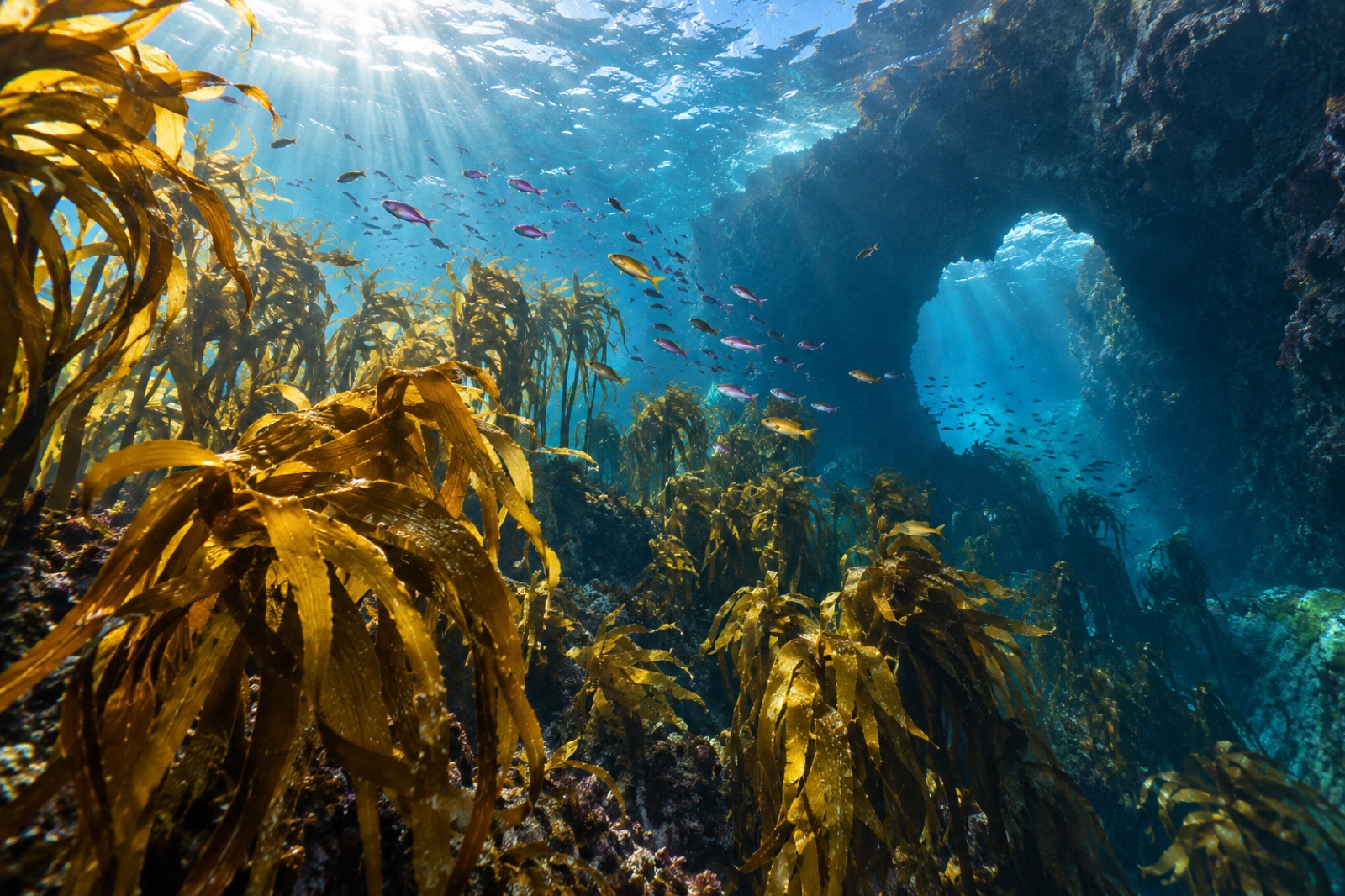
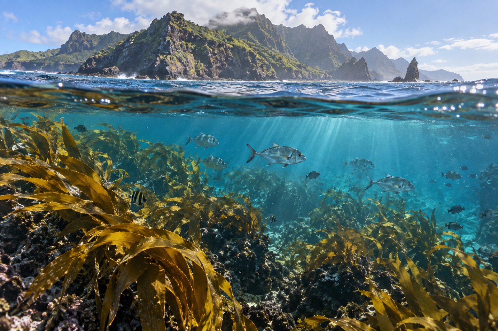
Golden kelp (Ecklonia radiata) is the bay's forest builder, holding the shallow rock from surge line down through around twenty metres where light allows — growing, physiologically, near the top of its observed temperature preference. This is important to understand: the Bay of Plenty's kelp is not a second-rate stand. Sheltered bays hold classic dense forest, and the island shelves flatten out into some of the finest golden-kelp parkland in the northern North Island. But the forest here carries a chronic warmth overhead, and marine heatwave summers stress it in ways southern reefs don't yet feel. In ecological terms the bay is a monitoring gift: a kelp forest that reports the future early. Our science pieces on kelp thermal limits and tropicalization give the background for what to watch.
Whakaari: the active volcano in the kelp forest's yard
Fifty kilometres off Whakatāne, Whakaari (White Island) smokes like a warning buoy over deep water and is one of the most geologically alive islands in New Zealand. It remains off-limits to visitors after the fatal 2019 eruption, and rightly so, but its oceanic significance is enormous. The island's slopes fall quickly into rich, current-washed reef that holds big fish, deep kelp margins and an unusual natural experiment: volcanic CO₂ vents that acidify pockets of reef, making Whakaari one of the Southern Hemisphere's best natural laboratories for studying how communities behave across a pH gradient. Our explainer on ocean acidification covers the science such sites are helping build.
Moutohorā and Tūhua: sanctuary and volcano
Back inshore, two islands embody the bay's twin nature — protection on one, geology on the other:
- Moutohorā (Whale Island), just off Ōhope and Whakatāne, is a tightly protected wildlife sanctuary where access is restricted and the surrounding marine life benefits from the island's reserve halo: fur seals haul out, grey-faced petrels burrow, and the reefs below carry healthy kelp and reef fish sheltered from the mainland's fishing pressure.
- Tūhua (Mayor Island), the eroded volcano at the bay's northern mouth, grounds the region's diving reputation. Its caldera, lava formations and offshore stacks drop into clear water and host one of New Zealand's more remarkable assemblages: resident spotted black grouper — an enormous, reef-guarding fish that feels like a subtropical species wearing a wetsuit — plus kingfish schools, stingrays and a kelp forest on the deep edges that ranks with the Poor Knights for depth and clarity when conditions align.
Both are boat propositions, weather-gated and worth every rough crossing.
The tropical strays — a bay that reads its own currents
The Bay of Plenty's warm-current procession is what makes its reefs feel alive with possibility. Most authentic account: in summer the bay receives pulses of larvae and wandering adults from the subtropical north — butterflyfish, Moses perch, bigeye trevally, occasional coralfish — that have no resident populations this far south. The fish assemblage shifts with sea temperature, with good years bringing a burst of colour and lean years barely a stray. The logical endpoint of the phenomenon is north and east at the Kermadec Islands, New Zealand's true subtropical marine province, and the Bay of Plenty is best understood as its first antechamber. Treat each visitor sighting as a piece of data: this coast is keeping its own temperature ledger.
The fishing, the nursery and the working coast
The Bay of Plenty is not a poster-reef reserve system — it is a working coast, among New Zealand's most popular for recreational snapper, kingfish and hapuku fishing, with commercial harvest alongside. Snapper nurseries sit behind the surf on the sandy flats, and the kelp-fringed headlands and island shelves step in as the fish grow into the deeper, harder habitat. This is the coastal mosaic — beach, sand flat, kelp, deep reef — working as one system, and it is exactly the kind of coast where community-level protection choices determine whether the kelp forest remains a forest. The kina-barren dynamics shaping reefs to the west at the Coromandel are the Bay's too; predator numbers remain its central question.
When to visit, and how
Season. Dec–March for warmth and the subtropical strays; Apr–May for the calmest seas and often the clearest visibility; winter for empty water, big sky and the occasional crisp, glass-calm dive window. Whakaari weather rules all decisions.
Access. Whakatāne, Mount Maunganui/Tauranga and Tauranga anglers' belt are the fleet bases; the islands require charters and patience with the bar crossings and swell. Shore lives best at sheltered headlands — Mauao's base at Mount Maunganui, the headlands at Ōhope and the Waihī end — with kelp fringing rock in the first few metres.
Watch. Treat bar crossings and the open Pacific with New Zealand respect; this coast earns its name for beauty, not for tolerance.
Key takeaways
- The Bay of Plenty sits on warm subtropical water — a kelp coast at the warm edge of its range, several degrees milder than southern New Zealand.
- Golden kelp thrives here at physiological warmth; the coast functions as a natural early-warning system for what heatwaves and range shifts will do further south.
- Whakaari, Moutohorā and Tūhua each anchor different values — volcanic-vent science, protected sanctuary, and the bay's signature dive depths — while staying boat-only, weather-gated destinations.
- Summer subtropical fish visitors make the bay's reef assemblage a live thermometer of its own currents.
- This is a working coast whose snapper system and kelp forest are one food web — and whose kina-barren question is protection's next test.
FAQ
Can you still land on Whakaari (White Island)?
No. Whakaari is private land and closed to visitors; since the 2019 eruption, the island is strictly off-limits. The offshore reef can be dived by boat in suitable conditions, but under health and safety guidance most operators stay clear — as the 2019 tragedy demonstrated, this is an actively erupting volcano and proximity is a risk decision, not a tourism call.
Where is the easiest kelp snorkelling in the Bay of Plenty?
The sheltered rocky fringes at the base of Mauao (Mount Maunganui), the headlands at Ōhope, and the northern bays toward Waihī Beach hold golden kelp in the first few metres and are swimmable in settled conditions. The richer underwater scenes — Tūhua's caldera walls, Moutohorā's fringes — need a charter.
What makes the Bay of Plenty's kelp different from the rest of New Zealand?
Latitude and current. It is still Ecklonia radiata golden kelp — the country's dominant — but growing close to its thermal limit, alongside subtropical reef fish most of the country never sees. Ecologically it is a monitoring goldmine: changes here now are templates for coasts further south.
Are there snorkelling/diving operators in the Bay of Plenty?
Yes — the Whakatāne and Tauranga/Mount Maunganui fleets serve the islands and the reefs between; bar crossings and offshore weather make some trips seasonal and subject to last-minute change. Book with operators who brief on conditions and wildlife protocols (no disturbance at Moutohorā; careful distance from Whakaari).
Is the coral-like stuff on the reefs really coral?
The colour at places like Tūhua comes mostly from sponges, jewel anemones and encrusting life, not reef coral — New Zealand sits too cool for shallow reef-building corals. The tropical-coralfish visitors are fish, not reef structure; the architecture is kelp, rock and sponge.