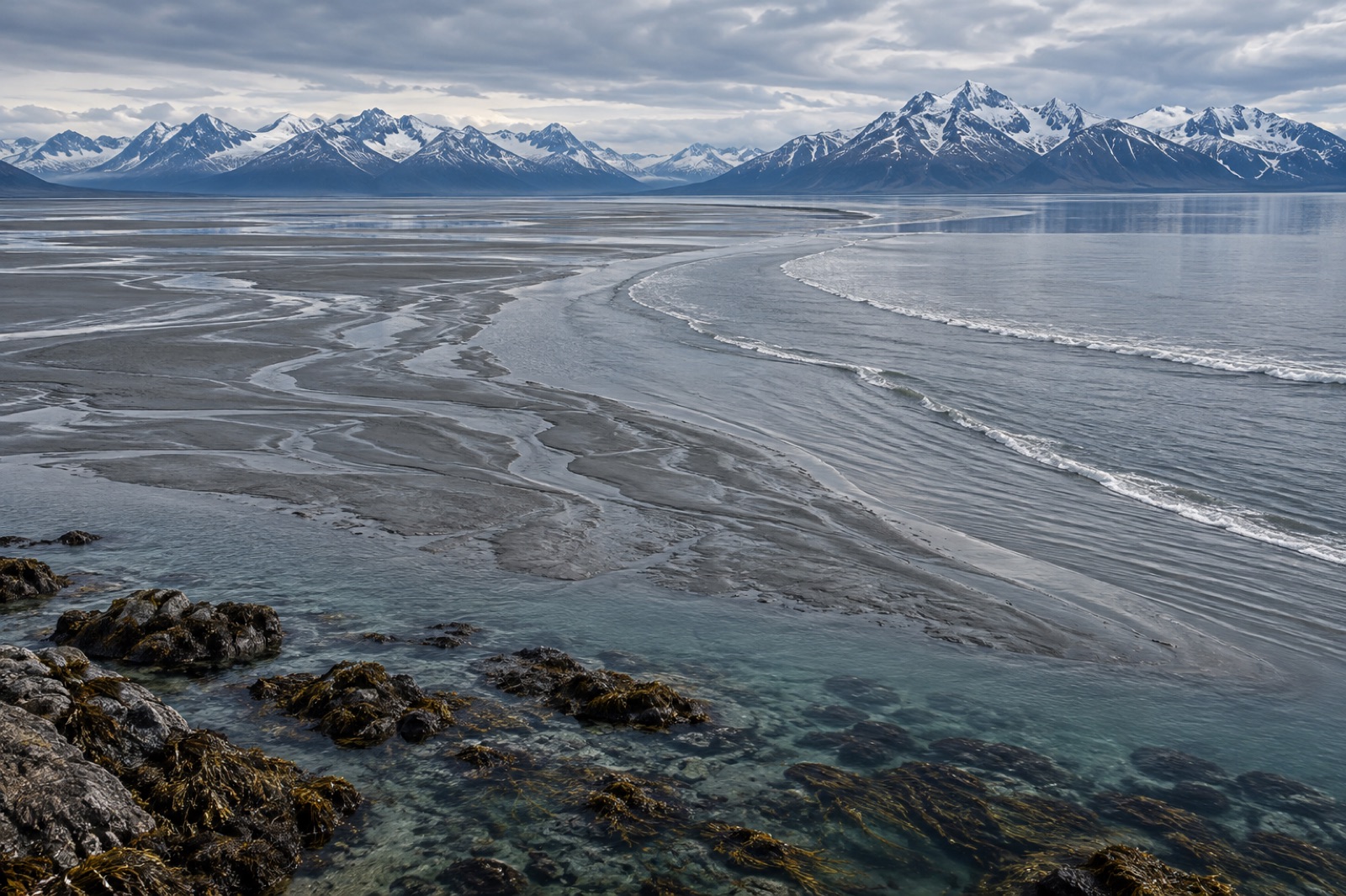
Kachemak Bay is the answer to a question most visitors to Alaska never think to ask: what does Cook Inlet look like when the glacial mud lets go? The bay carves sixty kilometres into the Kenai Peninsula's southern flank, opening onto the inlet's lower end where oceanic water from the Gulf of Alaska floods in twice a day under some of the largest tides in North America. The result is a cold, clear, fast-flowing sea bay that researchers have studied for decades as one of the richest nearshore ecosystems in the North Pacific — a place with seaweed diversity that would make a temperate-coast phycologist weep, kelp beds patrolled by sea otters, and a working waterfront at Homer that has quietly become the centre of Alaska's young kelp-farming industry. This guide covers the tides that run the place, the kelp that thrives on them, and how to see the bay without a research grant.
The bay the tides built
Kachemak Bay deserves its own entry in this Atlas separate from its parent inlet (covered in our Cook Inlet guide) because the two bodies of water behave so differently. The upper inlet is a silty mixing basin where glacial flour strangles the light. Kachemak Bay, by contrast, draws a large share of its water directly from the Gulf of Alaska. Deep, relatively clear and strongly flushed, it functions less like an estuary's back room and more like an open-coast fjord without the sill.
Geographically, the bay is a long east–west bite out of the Kenai: the working town of Homer and its famous Spit on the north shore, the roadless green wall of Kachemak Bay State Park — Alaska's first state park — rising across the water to the south. The inner bay is shallow and silty, behaving like a true estuary where the Anchor River and other streams deliver fresh water and fine sediment. The outer bay is oceanic: deeper, clearer, saltier, and where the kelp beds concentrate.
That gradient — estuary to ocean in a single boat ride — is the bay's ecological superpower, and the reason scientists keep coming back.
A tide range that plans your day for you
Everything in Kachemak Bay runs on the tide. Spring-tide ranges can exceed eight metres, among the largest on the Pacific coast of North America, and the currents those tides generate through the bay's constrictions and around its points are serious. If you haven't already, read our explainer on how tides work — the springs-and-neaps machinery is pushed to theatrical extremes here.
What a big tide range actually does to a kelp coast is worth understanding:
- It keeps nutrients moving. Every exchange stirs the water column, delivering nitrate to the sunlit zone where kelp can use it. Tidal mixing is one reason subarctic bays like this one stay productive through summer, when stratification starves calmer coasts.
- It verticalises the shore. An organism zoned for "low intertidal" here experiences hours of emersion on every cycle — and the seaweed bands on the rocks reflect it, stacked in stripes from the fucoids at the top down through the kelps.
- It writes the schedule for people. Water taxis, kayakers and clam diggers all plan around the exchange. Minus tides expose clam beds and tidepool benches that simply do not exist at half tide. Our guide to reading tide tables is essential pre-trip reading for this coast.
A practical note: eight metres of vertical tide means shallow arms like China Poot Bay transform entirely between low and high water. Incoming tides can move fast across mudflats. Treat the flats with respect, plan exits, and never assume the beach you walked out on will still be a beach when you return.
Why the seaweed diversity is famous
Among people who study seaweeds, Kachemak Bay has a reputation. Long-running surveys — much of the modern work anchored by the Kachemak Bay National Estuarine Research Reserve and the Kasitsna Bay Laboratory on the south shore — have catalogued well over a hundred macroalgal species in the bay, a remarkable count for subarctic latitude.
The explanation is the gradient again. The inner bay supports estuarine species tolerant of brackish swings and soft sediment. The outer bay and its islands host open-coast assemblages: canopy kelps, turf algae, coralline crusts in the surge zone. Add tidal mixing that fertilises everything, and the bay offers more niches per kilometre than almost anywhere else in Alaska. It is a natural laboratory for how kelp forests respond to climate, which is why long-term records from Kasitsna Bay carry weight far beyond Cook Inlet.
The kelp cast
The shallow subtidal of the outer bay is dominated by sugar kelp — the rippled golden workhorse of boreal coasts — along with ribbon kelp (Alaria marginata) in long streamers where current runs, and a layered understory of red and brown algae on the rock beneath. In the low intertidal and shallowest subtidal, look for sea cabbage (Hedophyllum), acid kelp and dense fucoid bands. In recent years, bull kelp has held patches around the outer islands — an annual forest that breathes with each season's spore fall.
The kelp beds and their otters
Sea otters, hunted to local extinction across most of Alaska by the fur trade, re-colonised the Kachemak region through the twentieth century and are now part of the bay's daily scenery — rafts of them rolling in kelp paddies off the Spit, mothers with pups riding on their chests. They are doing more than posing. By eating sea urchins and other grazers, otters hold the three-link cascade — otters, urchins, kelp — in the configuration that keeps a forest standing. The full mechanics are in our trophic cascade explainer, and our guide to watching sea otters responsibly covers how to enjoy them at distances that let them forage.
Notably, Kachemak's subtidal community has also been a window into the sunflower sea star story. The wasting epidemic that devastated Pycnopodia populations along the coast from 2013 onward hit here too, and the bay's monitored reefs make the loss — and the slow, patchy return — measurable rather than anecdotal. Where otter numbers, star numbers and urchin numbers shift, the kelp responds; the bay is one of the best places on Earth to watch that conversation happen in real time.
Below the otters, the reef community is classic Gulf of Alaska: giant Pacific octopus in the dens, lingcod guarding egg masses on the rock, wolf eels, red and green sea urchins in crevices, and in the canopy zone, clouds of juvenile rockfish. Harlequin ducks work the surf line, and the outer islands carry seabird colonies — Gull Island, just off Homer Spit, crowds thousands of kittiwakes, murres and puffins onto a single rock face each summer.
Farms on the lines
Alaska's commercial kelp-farming sector is young and growing, and a remarkable share of it is concentrated in this bay. Farms here seed longlines each autumn with hatchery-grown sporophytes — mostly sugar kelp, with ribbon kelp and bull kelp in the mix — and tend them through the dark months for a fast spring harvest, before biofouling sets in and while the blades are at their best for food markets. The model fits the place: wild seed from local beds, a short intense growing season, and a harbour town with the docks, ice and cold-storage a seafood business needs.
Witnessing this is easiest from the water: the farms read as grids of buoys off quieter coves. Tidewright's own work in Alaska (we are a fictional company in this demonstration site, but the region's real industry is genuine) is illustrative of the broader pattern worldwide — restoration-adjacent farming that keeps working waterfronts invested in healthy kelp. The same community logic operates in our fisheries solutions work: people will protect a forest that pays them.
Visiting: how to see the bay
Homer is the gateway — five hours' drive south from Anchorage down the Kenai Peninsula, or a short regional flight. From the Spit you can see the whole system: the inner bay flats, the outer islands, the snowbound Kenai Mountains. To get onto the water and into the kelp country:
- Water taxis run from the Spit to trailheads and beaches across Kachemak Bay State Park — Halibut Cove, Tutka Bay, Glacier Spit. This is the standard move, and the crossing itself is a wildlife cruise.
- Kayaking over the outer-bay kelp beds on a calm day is the finest low-impact way to read the forest from above; hire local, go guided if you're new to cold water, and study our kayaking over kelp guide.
- Gull Island bird trips leave from the harbour in summer and pass directly through otter rafts and kelp paddies.
- Shore time: at minus tides, the beaches around the Spit and Bishop's Beach host an informal tidepology scene; bring boots and patience.
Summer (June–August) offers the best access and the longest light; September brings fewer people, spawning salmon and the year's clearest water. This is a working subarctic bay in every month — dress for ten degrees and rain in August and you'll be fine.
Key takeaways
- Kachemak Bay is Cook Inlet's clear-water counterweight: strongly flushed by Gulf of Alaska water, it supports kelp ecosystems the silty upper inlet cannot.
- Spring tides can exceed eight metres; the tide schedule governs everything from nutrient supply to whether your beach still exists at 4 p.m.
- The bay's documented seaweed diversity — over a hundred macroalgal species — stems from its estuary-to-ocean gradient and heavy tidal mixing, and has made it a long-running research site.
- Sea otters hold the bay's kelp beds in balance; the monitored reefs also track the sunflower sea star's fall and partial return.
- Homer is Alaska's kelp-farming centre of gravity — winter-grown sugar kelp on longlines, harvested in spring — and the gateway for water-taxi trips into the state park.
FAQ
Can you scuba dive in Kachemak Bay?
Yes, but it is advanced cold-water diving: temperatures of roughly 4–10 °C, stiff tidal currents and visibility that swings with plankton blooms. Local charters run out of Homer in summer. Experienced drysuit divers find the reef life superb; new divers should get cold-water experience elsewhere first.
When is the best time to visit?
June through August for access, wildlife tours and bears on shore; September for solitude and clear water. Winter visits are possible but most water taxis and tours are seasonal, and daylight shrinks to a few hours.
Where can I see the kelp beds without getting wet?
From a kayak over the outer bays on a calm day, from water taxis crossing to Halibut Cove, and — at minus tides — from the exposed benches where low intertidal kelps like sea cabbage and ribbon kelp appear in the flesh.
Are the tide ranges really that big?
On big spring tides, yes — over eight metres of vertical range between high and low. That is why clam flats, tidepool benches and boat schedules all reference tide tables, and why you should too before any beach walk.
Is Kachemak Bay's kelp in trouble?
Like all North Pacific kelp habitat it faces marine-heatwave risk and the slow burn of ocean warming, and the loss of sunflower stars removed an urchin predator. But as of long-running monitoring, the bay's otter-held beds remain among Alaska's healthier kelp ecosystems — a benchmark coast worth protecting, and worth studying.