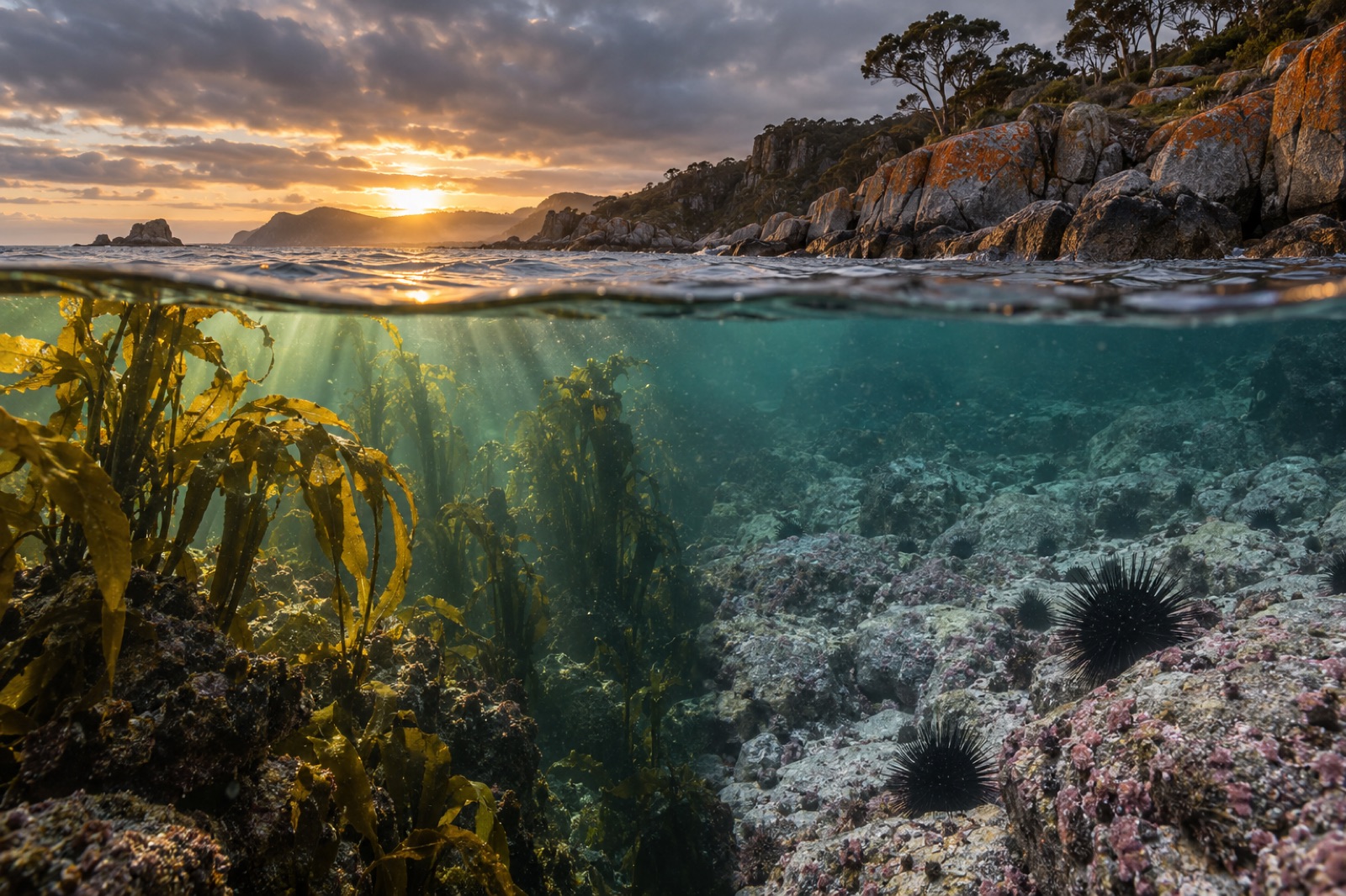
Bass Strait is the shallow, notorious stretch of ocean — roughly 240 kilometres wide — that separates Tasmania from mainland Australia. Sailors know it for heap-seas and sudden weather; kelp ecologists know it for something else entirely. Because the strait is shallow (most of it under eighty metres deep), tide and wind stir it from surface to seabed, dragging nutrients off the bottom and keeping the whole water column fed. The result is one of the most naturally productive temperate seascapes on Earth: island groups furred in kelp, reefs packed with abalone and rock lobster, and a cast-ashore kelp industry that has run, in one form or another, for over a century. This is the rough water between two seas — and the forests it grows.
The oceanography of a mixer
Straits are engines, and Bass Strait is a particularly busy one. To the west it opens onto the Southern Ocean by way of the Great Australian Bight; to the east, the Tasman Sea and the southward reach of the East Australian Current. Tides squeeze through the gap twice a day over a floor of sand ridges and granite reefs, generating some of Australia's strongest tidal streams — several knots through the island passes — and enough turbulence to prevent the water column from settling into warm-over-cold layers.
That mixing is everything for kelp. Where calm, stratified water lets the sunlit surface starve of nutrients in summer, Bass Strait keeps resupplying itself. Nutrient-rich, cool Southern Ocean water feeds the western strait in particular; water temperatures sit in the low-to-mid teens for much of the year, exactly the band where temperate kelps grow fastest. Add the strait's famous wind and you have the full recipe: light, cold water, constant fertiliser, and enough wave energy to aerate the canopy.
It is worth contrasting with the coast just to the east. Tasmania's east coast — covered in our Tasmanian east-coast guide — sits in the path of the strengthening East Australian Current and has been warming at roughly four times the global ocean average, losing most of its great Macrocystis beds. Bass Strait, cooled by Southern Ocean exchange and tidal mixing, has been a relative refuge. Understanding that difference is one of the keys to Australia's kelp future.
Islands of kelp
The strait is not open water but an archipelago — the drowned highlands of the land bridge that connected Tasmania to the mainland as recently as about 8,000 years ago. Each group has its own kelp character.
King Island, at the strait's western mouth, is the heavyweight. Hammered by Southern Ocean swell, its reefs grow thick stands of southern bull kelp along exposed shores and historically supported some of the largest giant kelp (Macrocystis pyrifera) beds in Australia. King Island is also the heart of the cast-ashore industry — storms tear bull kelp free and pile it on the beaches, where it is gathered rather than cut from living forest.
The Furneaux Group at the eastern end — Flinders, Cape Barren and around fifty smaller islands — sits in clearer, slightly warmer water where golden kelp (Ecklonia radiata) forms luminous understory forests around the granite reefs, with bull kelp on the points and Macrocystis in the lee bays. The shallows between islands are a mosaic of kelp and seagrass that acts as nursery ground for the eastern strait's fisheries.
The far eastern groups — the Kent Group, Hogan and Curtis Islands, close to Wilsons Promontory — mark the transition toward the Victorian coast: crayweed, Ecklonia forests, and the northern edge of the range where the long-spined urchin has been pressing south.
The north Tasmanian shore — from Three Hummock and Hunter Islands in the west around to Stanley and the Rocky Cape coast — grows dense bull kelp over rocky reef fronted by some of Australia's busiest small-vessel water. Rocky Cape, long a stronghold of native kelp forest, holds some of the best-known shallow Macrocystis beds in the strait's east.
The cast-ashore harvest
Bass Strait hides one of the world's more elegant seaweed economies. On King Island and along the north Tasmanian coast, storms do the harvesting. Southern bull kelp (Durvillaea potatorum) grows so densely on exposed reefs that heavy weather regularly tears tonnes loose and delivers them, neatly windrowed, onto the beaches. Collectors wait for the storms, hand-pick the cast weed before sand fouls it, and hang it to dry.
Dried and milled, the kelp travels the world as a feedstock for alginates — the seaweed-derived thickeners and gelling agents used in food, pharmaceuticals and industrial products. Some harvest also goes to kelp meal for stock feed and garden soil conditioners. Because the industry takes only storm-cast weed, the living forest is never cut; the same reefs produce the same crop, year after year, for free. It is a century-old proof of the principle Tidewright builds on: that a healthy kelp forest is a renewable harvest and a restoration economy in the same body of water.
Life between the storms
The strait's forests support high-value, famously sustainable-feeling (though carefully quota-managed) fisheries. Southern rock lobster shelters in kelp-sheltered reef by day and hunts the sand flats at night; blacklip abalone graze the crustose coralline algae and drift weed between the kelp; one of the world's largest crab species, the giant crab, works the deeper strait reefs. Octopus, sweep, trumpeter and wrasse fill the water column, and the understory hums with weedy seadragons in the eastern groups.
Up top, the strait is a seabird superhighway: short-tailed shearwaters (muttonbirds) pass through by the millions on their spring migration, Australian fur seals haul out on the island rocks, and the surf beaches between reefs catch the full, awe-inspiring wrath of the Roaring Forties.
The pressures: heat, urchins and an invading urchin vanguard
Two pressures dominate the modern story.
Warming. The east Tasmanian coast just beyond the strait is a global marine heatwave hotspot, and hot years push warm intrusions deep into the eastern strait. Western Bass Strait, flushed with cold Southern Ocean water, has so far held — but every boundary current forecast says the buffering will not last forever. Our explainer on marine heatwaves covers the mechanics.
The long-spined urchin. Centrostephanus rodgersii is a barrens-forming urchin native to New South Wales whose range has marched south as the East Australian Current strengthens. It is now well established in eastern Bass Strait and down Tasmania's east coast, where it has converted kelp forest to urchin barrens at alarming speed. Bass Strait's western islands remain mostly beyond the front, and the strait's cooler winter water is thought to slow larval survival — but the eastern groups are very much on the front line. Tasmania's response — subsidising urchin harvest for a growing roe fishery, culling, and reseeding — is one of the world's most watched management experiments.
Visiting the strait shore
Bass Strait is not casual-swimming water, but its margins reward the prepared. King Island has rugged surf beaches, superb seafood, a small cluster of dive charters and beachcombing after every blow. Flinders Island offers granite mountains to the sea-tide line, gin-clear shallows and snorkelling over Ecklonia gardens. On the north Tasmanian coast, boat ramps and coastal reserves from Stanley to Boat Harbour give access to classic bull kelp forest, while the surfing community guards a handful of serious reefs. The deep truth of the strait — cold, mixed, ferociously alive — is visible even from the shore after a storm, when the beaches fill with the forest's cast and every tide line turns gold and brown.
Key takeaways
- Bass Strait's shallow, tide-torn water mixes nutrients continuously, making it naturally fertile kelp country — fed from the west by the cool Southern Ocean and from the east by a warming Tasman Sea.
- Its island groups each grow different forests: giant kelp and bull kelp at King Island, golden kelp gardens in the Furneaux Group, transition-zone Ecklonia and crayweed toward Victoria.
- A century-old cast-ashore industry harvests storm-thrown bull kelp for alginates — cutting no living forest — and stands as a model of restoration-positive use.
- The strait supports major rock lobster, abalone and giant crab fisheries, plus globally significant seabird passage.
- Long-spined urchins, marching south with the strengthening East Australian Current, are the forest's biggest threat; western Bass Strait is for now a cool refuge.
FAQ
Why is Bass Strait so rough?
Because it is shallow and confined. Swell and wind-driven sea moving between the Southern Ocean and the Tasman Sea steepens over the shelf, and strong tides funnelling between islands add overfalls and races. The same mixing that makes it dangerous for boats makes it superb for kelp.
Where exactly do kelp forests grow in Bass Strait?
On every rocky reef and island shore in the strait, where light and hard bottom coincide — the best-known beds are at King Island, around the Furneaux and Kent Groups, at Wilsons Promontory and along Tasmania's rocky north coast.
What is storm-cast kelp harvesting?
Collectors gather bull kelp torn free by storms and delivered onto beaches — primarily on King Island — then dry and mill it for alginate extraction. Because the kelp has already left the living forest, the harvest removes nothing alive and is considered one of the world's gentler seaweed industries.
Are urchin barrens a problem in Bass Strait?
Yes, particularly in the east, where the long-spined sea urchin's southward range expansion has stripped forest from some reefs. Tasmania's subsidised urchin-harvest fishery and restoration trials are the management vanguard for this problem.
Can you dive or snorkel in Bass Strait?
Yes, with respect for conditions. Flinders Island and sheltered north-coast Tasmanian sites suit snorkellers; King Island and the eastern groups suit experienced divers with local operators. Summer and autumn bring the calmest windows and best visibility.