Science8 min read
Sounding Out a Forest: How Sonar Maps Kelp Reefs
Multibeam and sidescan sonar build metre-scale maps of reef relief, substrate and kelp canopy. How acoustic mapping works, and what it can and can't see.
Dr. Mara Ellison ·
Multibeam sonar, sidescan texture, satellite bathymetry and AUVs: how modern seafloor mapping works, what each tool can resolve, and why reefs need it.
Stand on any headland above a kelp forest and look down: the water hides everything useful. The reef's shape, its depth, its bare rock versus its sand-choked gullies — all the terrain an ecologist (or a restoration engineer) needs to know is obscured by ten metres of green, moving water. Mapping that hidden landscape is one of the oldest problems in marine science, and today it is solved with a family of tools that range from ship-hull sonars to orbiting satellites to swimming robots. This explainer walks through each one: what it measures, what it can resolve, and where it stops being useful — including the exact toolkit our fictional Drifter survey vessels would carry to pick a reseeding site.
Here is the starting shock: the global seafloor is mapped more poorly than the surface of Mars. The best planet-wide picture of ocean depth comes from satellite altimetry — radar measuring tiny bulges in the sea surface caused by the gravitational pull of underwater mountains — and that method resolves features no smaller than roughly 5 to 10 kilometres across. The international Seabed 2030 project has pushed hard on the rest, and by the mid-2020s around a quarter of the seafloor had been surveyed at modern, high resolution. Most of that high-resolution mapping is deep ocean and shipping lanes. The shallow, rocky, turbid coastal strips where kelp actually lives are among the least surveyed places on Earth, which is exactly why coastal projects end up commissioning their own surveys.
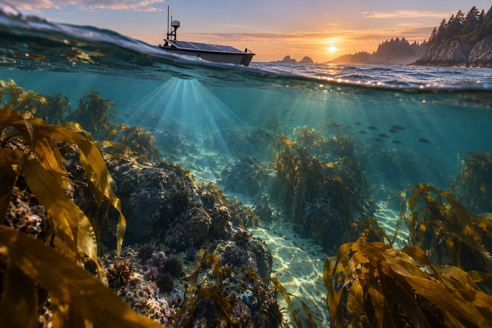
A multibeam echosounder bolts to a vessel's hull or pole-mount and fires a fan of acoustic beams — anywhere from 100 to over 1,000 — in a swath beneath and to either side of the track line. Each beam times its echo: sound travels about 1,500 metres per second in seawater, so the two-way travel time of each ping, after correcting for the water's changing sound speed, converts directly to depth. Sweep the vessel in overlapping lanes (the pattern surveyors call "mowing the lawn") and you build a continuous bathymetric grid, often with soundings spaced a metre apart or tighter in shallow water.
Multibeam gives you two products, not one. The first is bathymetry — the depth surface itself — and the second is backscatter: the strength of each return echo, which varies with what the seafloor is made of. Hard, rocky reef scatters sound back strongly and shows up bright; soft mud and sand absorb and show up dark. A skilled analyst can read a backscatter mosaic like a habitat map — reef edges, sand waves, boulder fields, even the faint scars of old anchor drags. We cover the same physics, applied to counting canopy rather than rock, in how sonar maps kelp reefs.
A sidescan sonar is a torpedo-shaped "towfish" dragged behind the boat a few metres above the bottom. Instead of a swath of precise depths, it records a fan of returning echoes on each side and builds a strip of imagery as it moves — a sonar photograph of the seafloor, with shadows behind boulders and ledges exactly like an oblique aerial photo at low sun. Sidescan resolves remarkable texture: individual mooring chains, wreck decking, ripples in sand. What it cannot do natively is give accurate depths, which is why serious surveys run sidescan and multibeam together — one for the picture, one for the topography.
A useful mental rule: the closer the instrument gets to the bottom, the finer the detail. A hull-mounted multibeam in 15 metres of water resolves features of a metre or so. Fly that same sonar on an AUV 20 metres above a seamount 2,000 metres down, and the effective footprint shrinks to centimetres. Everything in seafloor mapping is this trade — altitude versus resolution versus time.
Satellites cannot see through water with anywhere near the ease of air, but in clear coastal shallows they do better than most people expect. Satellite-derived bathymetry (SDB) exploits the fact that blue and green light penetrate water: the deeper the bottom, the dimmer and bluer the return. With a scattering of known depths to calibrate against, algorithms turn multispectral imagery into usable depth estimates down to 15–25 metres in very clear water — murky temperate kelp coasts rarely offer that luxury, but the method is transformative over clear tropical shelves. Our primer on ocean colour from space explains the physics behind what a satellite can and cannot extract.
Airborne bathymetric LiDAR goes further: a green laser fired from an aircraft reflects twice, once off the surface and once off the bottom, and the time difference gives depth directly. Bathymetric LiDAR penetrates to two or three times the Secchi depth — a diver's visibility measure — and produces dense, survey-grade point clouds, but aircraft time is expensive and a single fog bank ends the day's work.
For fine reef-scale work, the modern answer is autonomous. AUVs (autonomous underwater vehicles) — from torpedo-class survey vehicles to hand-launched micro-AUVs — run pre-programmed lawnmower patterns over a reef, carrying compact multibeams, sidescans, cameras and water chemistry sensors, and come home with dense, GPS-free maps built on inertial navigation and acoustic positioning. Slower gliders, described in our profile of ocean gliders, trade detail for endurance, profiling for weeks along a coast. Where terrain is vertical or confined — under ledges, inside caves — a piloted ROV still beats autonomy, because judgement in a clutter of ropes and rock is still a human skill.
Every decision in siting a restoration plot is a seafloor-map decision. Degenerate as it sounds, the first question a survey answers is embarrassingly practical: is there rock? Kelp needs hard substrate — our Drifter vessels are designed around exactly this bottleneck, pairing multibeam and camera ground-truthing to find bare rocky reefs buried among sand flats. The map also delivers depth bands (holdfast lines are seeded to a target depth window), rugosity (complex reefs shed urchins and shelter young kelp), and a baseline for change detection: re-survey a reef five years on and differences in backscatter and depth reveal whether canopy, turf or barren is winning. Satellites then take over the shallowest, fastest-changing layer — tracking canopy from orbit as described in how satellites see kelp — so the sonar map becomes the durable skeleton that everything else hangs on.
In principle, the whole ocean column — deep-water multibeams map trenches kilometres down — but swath width grows with depth while detail shrinks. In the shallow coastal zone where kelp lives (the top 30 metres), the challenge is reversed: very high resolution is possible, but kelp canopy, waves and aerated water make the acoustics fussy.
Only in clear shallow water, and only indirectly: they measure returning light, not sound, so depth must be inferred and calibrated. The planet-wide gravity-based map from satellite altimetry covers everything but resolves nothing smaller than several kilometres.
Bathymetry is the depth surface — the shape of the bottom. Backscatter is echo strength — a proxy for bottom hardness and roughness. Surveys need both: bathymetry says where, backscatter says what.
Hull-mounted sonar is dangerous to operate over shallow reefs, the swath narrows so coverage is slow, and national survey efforts historically prioritised shipping lanes and deep water. Small-boat and AUV surveys are now filling that gap, reef by reef.
A few hectares of nearshore reef can be sonar-surveyed in a long day by a small survey boat with a pole-mounted multibeam; fine camera ground-truthing takes divers or an ROV another day or two. The deliverable — a georeferenced spatial database — lasts the life of the project.
Multibeam and sidescan sonar build metre-scale maps of reef relief, substrate and kelp canopy. How acoustic mapping works, and what it can and can't see.
Dr. Mara Ellison ·
Ocean gliders ride buoyancy, not propellers, for months at sea. How these slow torpedo-shaped robots survey storms, currents and kelp coasts on sips of power.
Dr. Mara Ellison ·
From Sentinel-2 pixels to drone orthomosaics, here's how scientists detect, map and track kelp forest canopies from space — and where the limits are.
Dr. Mara Ellison ·