Atlas7 min read
Hokkaido's Kombu Coast: Where Japan's Kitchen Begins
A Coastal Atlas guide to Hokkaido: Rishiri, Rausu and Hidaka kombu beds, the beach-drying harvest culture, and the kelp road that fed Kyoto for centuries.
Dr. Theo Nakamura ·
Cape Kamui's cliffs, water so clear it earned the name 'Shakotan blue', kombu forests and a legendary uni fishery — a Coastal Atlas guide to Hokkaido.
On maps, the Shakotan Peninsula is the stubby thumb of land jutting into the Sea of Japan west of Otaru — about two hours by bus from Sapporo and a world away in feel. The mountains drop straight into the ocean, the headlands break into sea stacks, and the water runs an improbable shade of deep, glassy blue that Japanese travellers have dignified with its own name: Shakotan blue. Underneath that blue lies one of Hokkaido's most productive temperate reef systems — beds of kombu and other kelps that feed a famously sweet sea urchin fishery, hold the coast's clarity together, and make this one of Japan's most rewarding cold-water shorelines to explore. This is the atlas entry.
Shakotan occupies the southwestern corner of Hokkaido, opening onto the Sea of Japan. The peninsula is volcanic — a succession of ridges and faulted capes built from Miocene andesite — and the same geology that gives the coast its cliffs gives the underwater terrain its structure: steep rocky ramps, boulder fields and surge-carved gullies falling quickly into depth. Cape Kamui (Kamui-misaki, "cape of the gods" in the Ainu language) is the jewel at the tip: a narrow headland walked on a cliff path to a lighthouse point, with water so clear below that boats seem to float on air on calm days.
The whole coast lies within the Niseko-Shakotan-Otaru Kaigan Quasi-National Park, which is precisely why so much of it looks unbuilt — forested hills running to cliff edge, small fishing villages tucked into the few protected coves the geology allows.
Water clarity is usually the product of subtraction: no rivers dumping sediment, little sheltered shallows to hold plankton blooms, and vigorous mixing that keeps nutrients moving rather than lying still. Shakotan has all three. The coast has no big river mouths; the drop into deep water is quick, and the Sea of Japan turns over hard in winter, starving then refreshing the system on an annual pulse. In summer the surface stratifies over clear, nutrient-fed depths, and on a calm day visibility can be extraordinary by temperate standards — the kind of water that makes novice snorkellers gasp and experienced divers check their computers twice, because everything looks closer than it is.
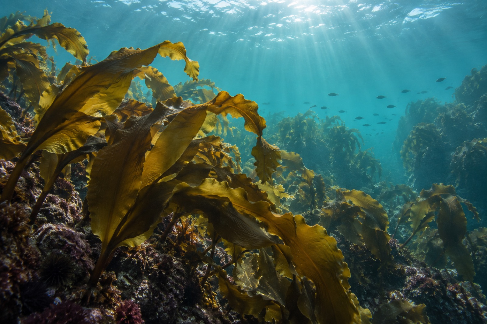
The reefs here are dominated by kombu species and their brown-algal associates, growing on rock from the low-tide line down past diving depth. Kelp's role on this coast is foundational in the most literal sense: the forest feeds, shelters and paces the community. Holdfasts grip the surge-swept lava rock; blades damp the swell and shade the understorey (see our explainer on how kelp calms water); and the steady rain of kelp fragments — drift and cast weed — feeds the grazers that made Shakotan famous.
One species pair is worth special mention: the green sea urchin (Hemicentrotus pulcherrimus, bafun uni) and the northern sea urchin (Strongylocentrotus intermedius, kita-murasaki uni). Their gonads — the prized "uni" — derive their flavour directly from kelp: uni fed on quality kombu is sweet and oceanic; uni fed on poor or absent kelp turns thin and bitter. The taste of the forest is, quite literally, the fishery.
Shakotan's uni harvest is one of those delightful fisheries where commonsense husbandry predates the word "sustainability": the local fishery cooperative runs a short, controlled season in the northern summer (roughly June through August), rotating open grounds, limiting daily effort and sizes, and resting sections of the reef in between. Divers — not dredges, not trawls — hand-pick urchins one by one. The result is a fishery in which the harvest is small, the reef is visible to the people harvesting it, and quality rather than volume sets the price. Top-grade Shakotan uni commands extraordinary prices at Tokyo auctions, and the premium flows back into a small fishing economy that has every incentive to keep the kelp standing the divers look down on.
It is a working illustration of the argument running through Tidewright's solutions for fisheries: on rocky temperate coasts, healthy kelp and healthy harvest are the same asset seen from two angles.
Most visitors experience Shakotan from above the waterline — the Cape Kamui path, the clifftop lookouts over Shimamui's emerald cove, the glass-bottomed boats that run in calm summer weather. The underwater experience is narrow and seasonal but memorable:
Access is by road from Otaru or Sapporo; the bus network serves the main villages in season. The practical window is June to September; winter turns the coast into a monochrome study in violent sea, which has its own austere case to make from a warm clifftop.
Shakotan's villages carry the imprint of the herring century. Hokkaido's herring fishery — which built mansions, ports and an entire coastline's culture — collapsed under overfishing in the first half of the twentieth century, leaving quiet towns and a hard-earned caution about treating the ocean as bottomless. The uni economy that succeeded it operates at a fraction of the scale and a multiple of the care. Depopulation is the coast's larger structural challenge: fewer hands in the villages means fewer divers on the reefs, and the cooperative model that keeps the fishery healthy depends on the next generation wanting the life. Marine tourism — the blue itself, increasingly — is the bet Shakotan is making to hold its people.
Rising water temperature is the pressure underlying everything on this coast, as it is across Hokkaido's kelp belt; our wider Hokkaido kombu coast guide covers the regional picture. Local interplay matters here too: urchins are the forest's natural mower, and a coast where uni is valuable needs the urchins fed and the kelp standing — an equilibrium maintained by kelp growth outpacing grazing. Warming shifts that balance by stressing kelp and, on coasts with surplus urchin recruitment, flipping reefs toward barren, as the urchin-barrens dynamics explainer details. For now, Shakotan's combination of deep cold water, strong cooperative management and intact reef structure keeps it among Japan's healthier temperate coasts. The blue is the surface expression of the kelp underneath.
On Hokkaido's southwestern coast, roughly two hours west of Sapporo by road, projecting into the Sea of Japan. The main villages are Shakotan town and Bikuni; Cape Kamui is the famous headland at the peninsula's northwest corner.
A local name for the coast's remarkable water colour and clarity — the deep, saturated blue visible from Cape Kamui's cliffs, caused by the absence of river sediment, deep nearshore water and low nutrient standing stock in the clear summer surface layer.
Broadly June through August, controlled by the local fishery cooperative with rotating grounds and daily limits. Outside the season the reefs rest — which is precisely why the quality stays high.
Yes, in season: snorkelling from sheltered coves in high summer and guided scuba on the kelp reefs for divers with cold-water experience. Conditions are genuinely cold and the coast is exposed; go prepared and with local guidance.
Warming water pressures the kelp, as it does across Hokkaido, but deep cold water, intact reefs and careful urchin harvest management keep the peninsula among Japan's healthier kelp coasts for now. Long-term monitoring of the kelp–urchin balance is the coast's main climate watchpoint.
Filed under
A Coastal Atlas guide to Hokkaido: Rishiri, Rausu and Hidaka kombu beds, the beach-drying harvest culture, and the kelp road that fed Kyoto for centuries.
Dr. Theo Nakamura ·
Kombu is the kelp behind dashi and the backbone of the world's seaweed farms. Learn its biology, life cycle, Hokkaido roots and future in a warming sea.
Dr. Theo Nakamura ·
Kombu farming is a century-old Japanese craft: forced cultivation, floating rafts, staggered harvests and sun-drying discipline, explained for growers.
Naomi Reyes ·