Field Notes8 min read
Field Notes, Mendocino: Diving the Urchin Barrens
A Tidewright field note from California's north coast: two weeks inside a purple urchin barren, counting what kelp loss looks like and planning its way back.
Jack Callum ·
A stop-by-stop Highway 1 itinerary built around kelp forests — headlands, coves and viewing points from the redwood coast to Point Lobos, with seasons and etiquette.
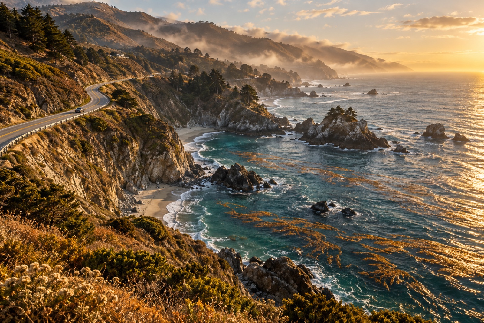
Most people drive Highway 1 for the cliffs and the light. But if you know where to look — pull-offs above coves, headlands with a clean line of sight to the water, harbours where the smell gives it away — the road becomes something better: a string of kelp forests you can visit one after another, each with its own water temperature, canopy species and cast of locals.
This itinerary runs south from the Oregon border to Point Lobos near Carmel, roughly 700 kilometres of the most kelp-rich coast in North America. You could do it in a long weekend, but give yourself five days. Kelp watching rewards slowness: the difference between a drifting canopy and a waving one, between a cove with sea otters and a cove without, is the kind of thing you learn to see by lunchtime on day two.
Each stop gives you a different window onto kelp — some from a bluff top with binoculars, some from a tidepool at low water, one or two from a wetsuit if you're equipped. Nothing on this list requires a boat. Everything between the Oregon state line and Monterey sits on the giant kelp's northern cousin's country: bull kelp and understory browns dominate until roughly San Francisco, with giant kelp taking over as you push south.
If you're a confident cold-water swimmer, pack the kit from our cold-water swimming guide — a couple of stops below are genuinely good swim days. But bring binoculars regardless. With the sun overhead, canopy fronds read as gold-bronze streaks against the grey-green water, and you can watch them flex in the swell like a slow semaphore.
Cross into California at Crescent City and you're already in kelp country. The coast here is wild, sparsely signed and often fogged in until midday — which is worth knowing because fog is a kelp advertisement. Coastal redwood fog and kelp fog come from the same machine: cold upwelled water chilling moist air off the Pacific.
At Crescent City, walk out past the battery at Battery Point and look south on a calm morning. The shallow reefs offshore hold bull kelp beds that get hammered by winter swell and recover by late spring. South through Del Norte and Humboldt counties the road leaves the coast, so let it — the drive through the redwoods is your inland intermission. Rejoin the water at Fort Bragg via Highway 20.
Fort Bragg earns a full day. In the early 2010s this stretch of coast lost most of its bull kelp in a perfect storm of a marine heatwave and an urchin population explosion — our field team has written about what diving the urchin barrens here actually looks like, and our Mendocino coast guide covers the town itself. Walk the headlands trail at MacKerricher State Park in the afternoon and scan the coves. You'll see the two faces of this coast in one frame: some coves still scraped close to bare rock, others wearing young canopy that's slowly, genuinely coming back. Both are worth seeing. Both are the story.
Overnight in Mendocino village. Eat chowder. If there are abalone-shaped vacancies on every menu, that's history speaking.
South of Mendocino the road tightens and climbs. Point Arena Lighthouse sits on the bluffs above Arena Cove, and on a clear autumn morning — autumn is the secret season here, when summer's upwelling relaxes and the water finally clears — you can watch kelp beds flex around offshore rocks a hundred metres down. The coast's remaining bull kelp hangs on in cool pockets like this. Bring the binoculars and a wind shell.
Continue onto Highway 1 proper as it hairpins down to Sea Ranch and the Sonoma coast. Two stops pay out here. Salt Point State Park's Gerstle Cove was among California's first marine reserves, and at low tide the sandstone ledges below the parking turn into a textbook of intertidal life — ochre stars, anemones, sculpin in the pools. Further south, Bodega Head is the big vantage: a granite headland with the whole arc of Bodega Bay below and grey whale migration overhead from December to April.
Timing note for the whole stretch: check the tide the night before and set your morning around it. If you're new to tables, our field guide to reading tide charts will save you from the classic error — arriving at a tidepool two hours after the water covered it.
Cut east at Bodega Bay and spend half a day on the Point Reyes peninsula — this is upwelling country in its rawest form, where the cold water that feeds the entire system is born. Chimney Rock's overlook above the headlands gives you elephant seals on the beach and kelp rafts in the lee below, sometimes in the same sweep of the binoculars.
Then commit to the long southern leg: through the city, past Half Moon Bay (Pillar Point's harbour breakwater is a fine lunch stop with swell watching), and down the hammered-gold cliffs into Monterey. Overnight in Pacific Grove. Tomorrow is the trip's summit.
Monterey Bay holds the largest surviving kelp system in California, a crescent of giant kelp canopy that fringes the whole south rim of the bay. Our Monterey Bay kelp guide has the ecology; on the ground, the play is simple:
If you have a sixth day, keep driving south through Big Sur anyway. The kelp thins and the road becomes its own excuse — pulling over at a coastal turn-out with the tailgate down, sharing what the day delivered, is a tradition older than the highway.
When to go: late August to October is the peak window — upwelling relaxes, water clears, kelp canopies sit at maximum spread and the weather usually cooperates. Spring can be brilliant and empty but foggier. Summer is reliable tourism weather and thick, midday-hanging fog on the north coast.
Driving: Highway 1 closes for landslides, sometimes for months. Check Caltrans QuickMap before you commit, and build in a bailout route (Highway 101 runs parallel inland). Fuel up whenever a town offers; stretches like Sea Ranch to Bodega don't.
Budget and beds: state park campgrounds along this route are world-beaters and vanish months ahead; book the moment your dates exist. If you're winging it, weekday inns at Half Moon Bay and Pacific Grove are the trip's best-value overnights.
You can, but pick a leg. Crescent City to Mendocino, or Bodega to Monterey, are each a satisfying self-contained two days. Trying the full 700 km over a weekend turns a kelp trip into a driving trip.
No. A pair of binoculars turns Lovers Point, Point Lobos and Point Arena into front-row seats. Diving or swimming adds a dimension, not a requirement — the canopy, the otters and the ledge life are all visible from dry land.
Early evidence is hopeful, not certain. Canopy has returned to some coves, helped by urchin removal and cooler years, but recovery is slow and uneven. Seeing both damaged and recovering reef on the same walk is exactly why this stretch is worth a stop.
Lovers Point in Pacific Grove at dawn: sea otters in the kelp at arm's length, free of charge, reliably. If the tide cooperates, Point Lobos later that morning makes it the best wildlife day on the road.
A Tidewright field note from California's north coast: two weeks inside a purple urchin barren, counting what kelp loss looks like and planning its way back.
Jack Callum ·
A safe, gradual path into cold-water ocean swimming on kelp coastlines: cold-shock science, acclimatisation, gear, cove selection and a season-long plan.
Tom Okafor ·
Point Lobos limits divers to a handful of reserved buddy teams a day. How to get a slot, dive Whalers Cove's kelp, and respect California's oldest rules.
Tom Okafor ·