Field Notes8 min read
Field Notes: Mapping the Mendocino Canopy by Drone
A week flying multispectral drone surveys over Mendocino's recovering bull kelp: fog windows, canopy maths, and where the map still needs divers.
Jack Callum ·
For one week at Tinderbox we counted the same kelp canopy twice — once by drone, once by diver. Here's what each method caught, missed and taught us.
Tidewright field notes are our crew's own stories from project sites. Everything in them — sites, numbers, people — is fictional, part of the Tidewright demonstration. The methods are real.
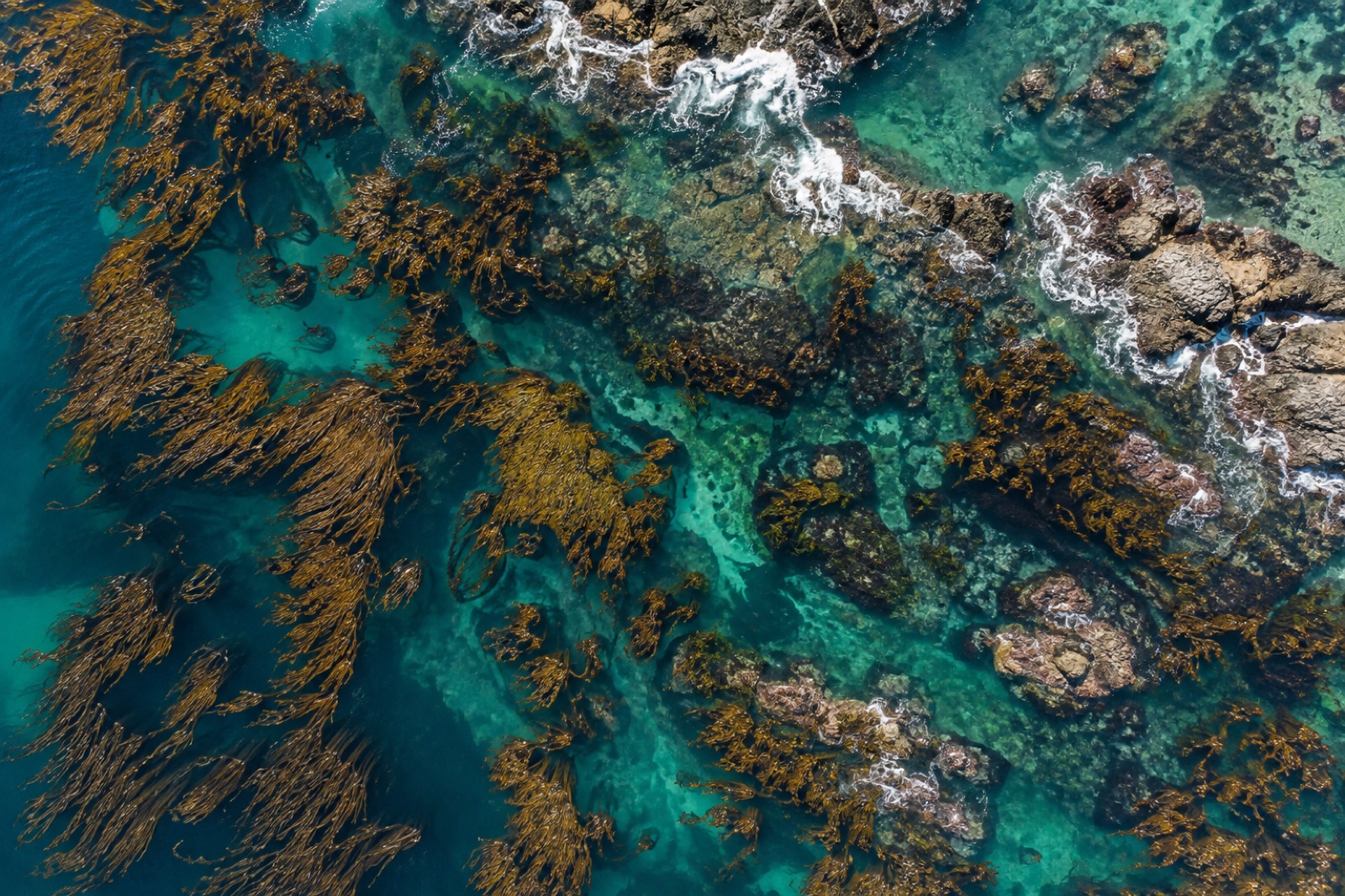
This March we ran an experiment we'd been putting off for two years: a matched census of the Tinderbox reefs, fourteen hectares of seeded Ecklonia and wild remnant forest south of Hobart, counted twice in the same week. Once from above — our mapping drone flying its usual 60-metre lawnmower — and once from below, with four divers swimming the belt transects we've run since 2025. Same beds, same week, same questions. The answers were not the same, and that's exactly why we did it.
Monitoring costs money, and every program eventually has to choose its instrument. Drones are cheap per hectare, fast, and safe in weather that keeps divers on the beach. Divers are slow, expensive, weather-limited — and see things no camera from sixty metres up ever will. Our long-term plan leans heavily on aerial mapping through Canopy Ledger, so we needed to know, honestly, what we'd be trading away. This was calibration, not competition.
Area, speed, and honesty about edges. The orthomosaic gave us a complete canopy polygon for all fourteen hectares in a morning's flying; the divers, working four-hour bottom-time windows, sampled about 2% of the same ground. For total canopy area — the number that feeds our impact dashboard — the drone was not just cheaper, it was better: no interpolation, no assumption that a transect represents a hectare.
The drone also caught a thing we'd have missed: a 40-metre bite taken out of the northern bed by what the geometry says was a single storm-wracked mooring chain dragging through in the February blow. On the mosaic it's unmistakable — a scalloped scar of barren inside otherwise continuous canopy. No transect crossed it. Two metres to the south and we'd have called the bed stable.
Everything under the canopy. The drone can only classify what light reaches it, and Tinderbox's mature Ecklonia canopy is a blackout blind from above. Under it, the divers counted a recruiting class of juveniles — thousands of sub-ten-centimetre sporophytes in the light gaps — that the orthomosaic read as "turf" or didn't see at all. That cohort is next year's canopy. The way canopy sculpts light is exactly why: the forest hides its own future from the sky.
Urchins were the other divergence. Drone classification said the southern lobe was "8% barren, stable". Diver counts found white-front urchins — the barren-forming aggregations we watch like weather — at twice last spring's density along that same edge. From the air, a barren is a barren; from a metre away, you can see whether it's advancing.
For the record, since people always ask: the drone put total canopy at 9.6 hectares of the 14 surveyed; diver-based extrapolation from the transects came in at 10.9 hectares, with a confidence band wide enough to drive a mooring chain through. The gap is mostly wind-flattened canopy reading as open water from above — a known bias, now quantified at our own site instead of borrowed from someone else's paper. Juvenile recruitment was recorded on 17 of 20 dive transects and zero drone pixels. Urchin aggregations were mapped at barren edges by both methods, but only the divers could say the front was denser than last spring. Two methods, one forest, and only overlapping where each is weakest.
The matched week settled our monitoring design for the next three years:
Not at this site. Tinderbox's canopy sits in water too deep and too green for reliable canopy detection from orbit, and even clear-water satellites can't approach three-centimetre pixels. Satellites own the regional picture; drones own the site.
The drone: five flights, three mornings, two crew. The divers: twenty transects, eight diver-days including safety cover. Roughly ten times the field hours — but the divers brought back six kinds of data to the drone's two.
For a restoration claim that must stand up to outside audit, canopy area from the drone — it's complete, repeatable and archive-friendly. We'd fight to keep the divers, though; a forest can look fine from the sky while losing its next generation underneath.
At the margins, yes — wind-flattened canopy reads as open water from above, and divers swimming at the bed edge draw the line by judgement. Our rule is that the drone defines the area on a standard-date flight and divers never revise area, only interpretation.
A week flying multispectral drone surveys over Mendocino's recovering bull kelp: fog windows, canopy maths, and where the map still needs divers.
Jack Callum ·
How to plan, fly and process a drone survey over kelp canopy — tides, sun glint, polarisers, ground control — for maps you can compare year after year.
Dr. Mara Ellison ·
Belt transects and quadrats turn a kelp forest into numbers: who lives where, at what density. How these classic survey methods work, and why they endure.
Dr. Mara Ellison ·